Along Rte. 23A to Palenville
Gauge Conditions
Runnable: 2,740.0 – 30,000.0 CFS
The minimum is based on Squires' book; the max is a rough guess, based on historical flows. If you have better beta, please add a comment.
Data from American Whitewater & USGS
Run Map
Description
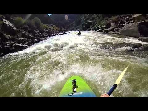
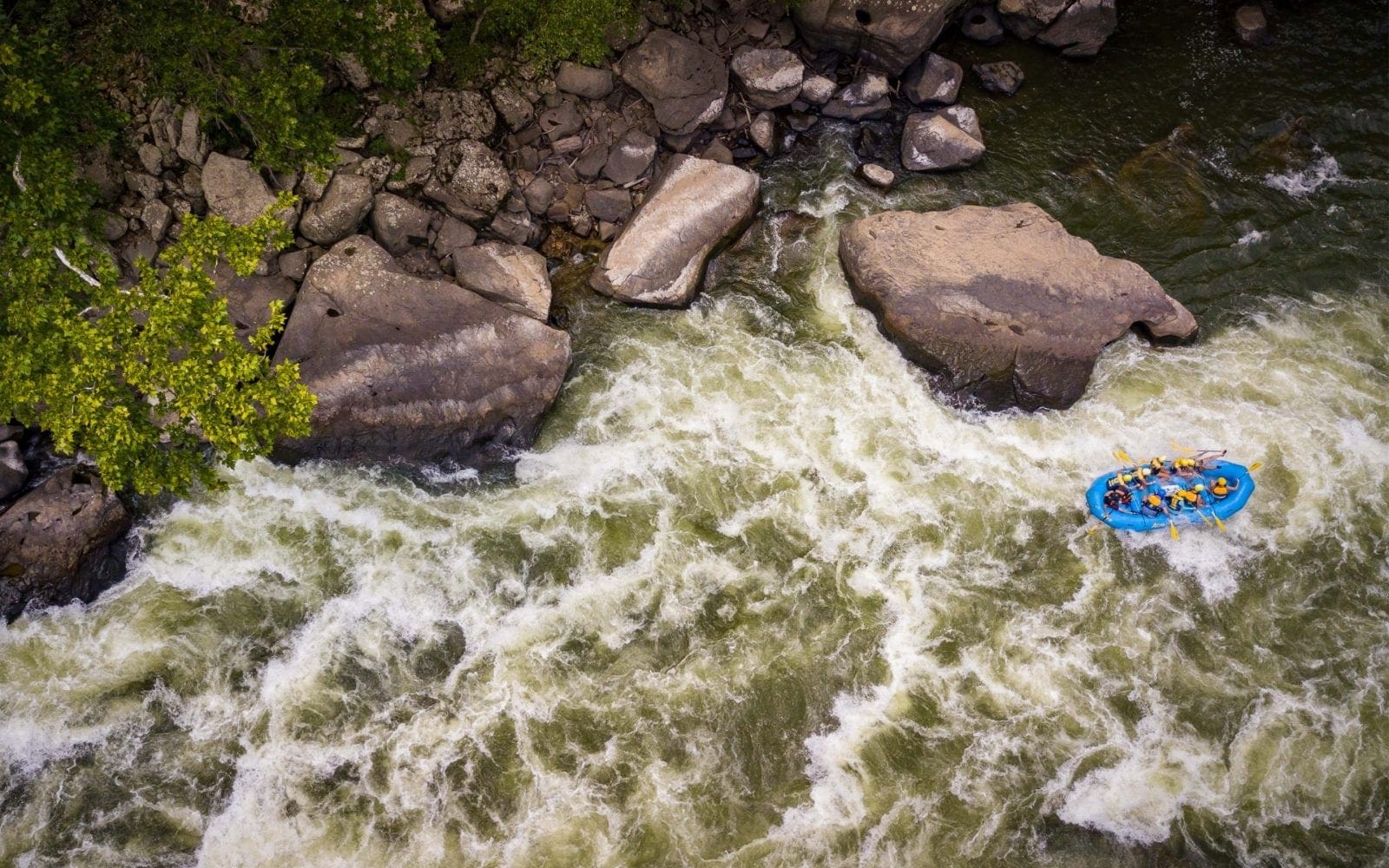
Kaaterskill Creek is the crown jewel of Catskill creek boating. It has everything an expert paddler could hope for: read and run boulder gardens, several waterfalls, a tight gorge with overhanging walls and a couple of optional rapids for "big dogs" who don't mind potentially terminal consequences for a blown line.
We've always put in at the pull out on the left (as you drive upstream along 23) before the hairpin turn and Kaaterskill Falls, a tourist attaction, which is on a tributary of the Kaaterskill. There is potentially another mile or two of difficult whitewater further upstream of the standard three mile run, if you're willing to explore and the water level is right. The gradient for this upper section, which begins below Haines Falls, looks to be about 280 feet/mile. The standard run can be described in three parts, each about a mile in length.
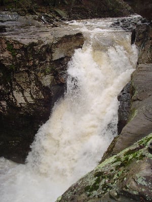
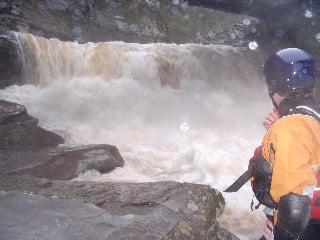
To run the first part, you'll need to park at the aforementioned pull out and bushwhack you're way down to the creek. From there, you'll have consistent maneuvering through read-and-run Class IV boulder gardens. There is some wood to be weary of and you'll want to be on the look out for Fawn's Leap, a 25 footer that several very good boaters I know have passed on. After Fawn's Leap, there is a great boulder garden rapid that culminates in an 8 foot boof on the left. After the boof, there is about twenty feet of fast moving flat water before Red Rock Falls. Get out on the right and have a look at this sliding waterfall. It is probably the easiest of the three "big" drops, but the landing is very shallow, and it should be reserved for those who have rubber spines and/or very good health insurance. Walk on the right, under the bridge, but be careful not to stub your toe on some of the rusty rebar that blends in so well with the red rock.
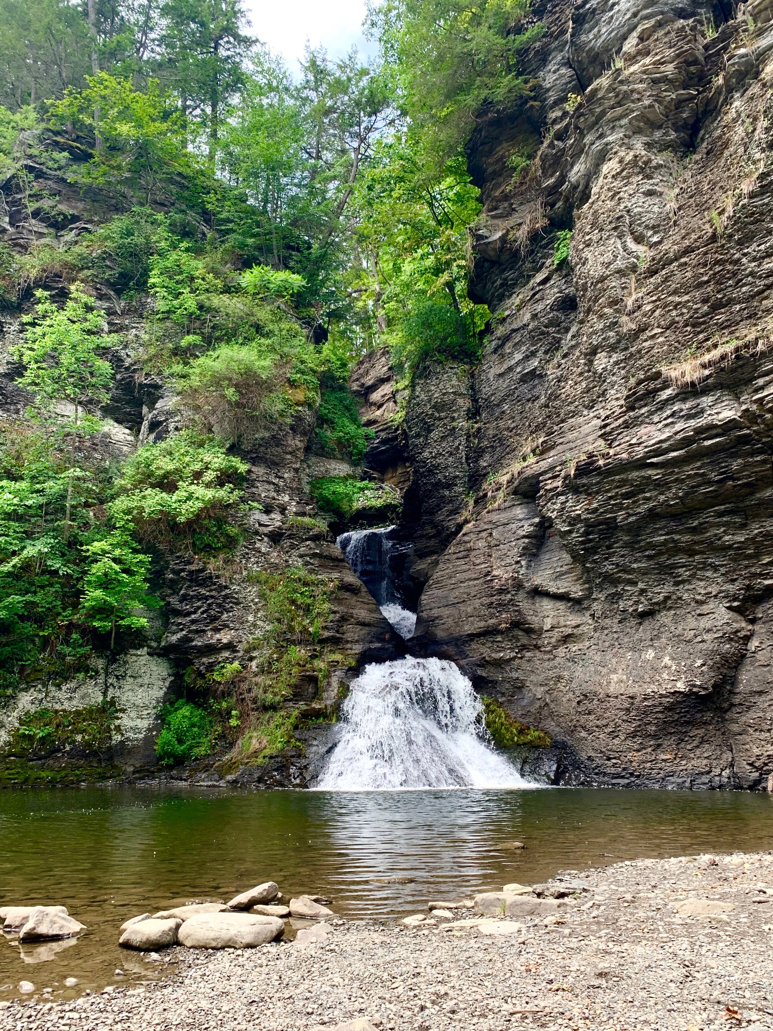
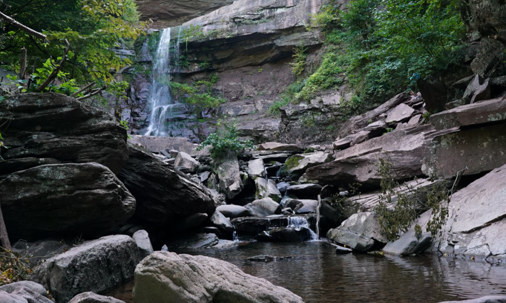
Upon re-entering the river you will shortly enter the gorge, the second part of the run, and the most beautiful. The road disappears pretty quickly and several waterfalls cascade into the creek, creating the illusion that civilization is a lot farther away than it is. Here the boating isn't as continuous as above and the drops are more distinct. Three deserve mentioning:
1) Atom Bomb Falls: In his book, Dennis Squires calls this the most horrific undercut in the state of New York. I don't know about that, but it is a big drop and it feeds right into an undercut (according to Dennis there is new wood in the undercut as well), so we've always walked it.
2) There is a relatively benign looking rapid that has pin potential, especially at low water. The hazards are obvious so long as you do not float into it unwary. A clean line opens up with more water, but if you are unsure of the line at low flows, a very dainty portage is necessary on a narrow path along the cliff walls twenty feet above river level. Watch your step.
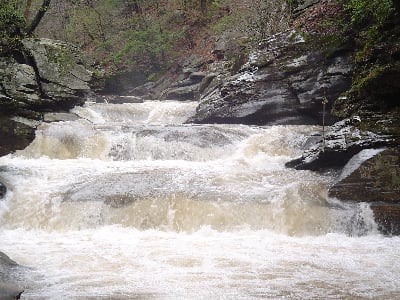
3) The last rapid in the gorge is a classic triple drop. The last hole could be terminal at high water and would be very difficult to portage. At lower levels though, it is not too bad, and the three ledges are fun boofs. The view back upstream of the triple drop framed by the grotto-like walls of the gorge is more reminiscent of a tropical paradise than a roadside creek run in the Catskills. But just downstream, a bridge comes into view and the gorge section is over.
Get out here if the water is low. The creek changes character dramatically here. It widens and takes on a pool drop character. There are maybe eight drops from here on down to the takeout. The first one is the most challenging. Get out on the left and inspect the twisting, narrow slot. We've always passed on the top move and just run the bottom ledge. There may be a line on the right that opens up with more water instead. The drops that follow will vary depending on water level, but they are all in the IV-V range. When you get to the takeout bridge, run the last 15 footer backwards, forwards, upside down or whatever, and then climb back up and do it again.
A quick word on difficulty: This is a fairly continuous creek with several significant hazards even if all the Class V drops are portaged. For a safe, controlled run, you should have Class V skills. This is not huck and tuck boating. I would say it's a step up from other creeks in the area I've run such as Fall Creek, Raymondskill, Beerkill, and more challenging in overall difficulty than Adirondack classics such as the Bottom Moose, the Raquette, and the Beaver. Putting in below Red Rock Falls would definitely make for a more manageable day for a Class IV paddler with a good guide at favorable water levels, but please use discretion.
I will try to get some pics up this spring. If anyone has any, please post them here. Enjoy.
Catskills Area Reaches
Basic CreekBatavia Kill Bear Kill
Beaver Kill (Delaware Trib)Beaver Kill (Hudson Trib) Beer Kill
Beer Kill, W. BranchBowery Creek Bush Kill
Callicoon Creek, E. BranchCallicoon Creek, N. Branch Catskill Creek (1.)
Catskill Creek (2.)Catskill Creek (4.) Claverack Creek
Coxing KillDelaware Delaware, E. Branch
Delaware, W. BranchLittle Delaware Dry Brook
East KillEsopus Creek (1) Esopus Creek (2)
Esopus Creek (3)Esopus Creek (4) Esopus Creek (5)
Hannacrois CreekKaaterskill Creek (1.) Kaaterskill Creek (2.)
Kinderhook Creek (3.)Kiskatom Creek Mombaccus Creek
Mill BrookNeversink (1.) Neversink, E. Branch
Neversink, W. BranchPeters Kill Platte Kill
Plattekill CreekPotic Creek Roeliff Jansen Kill (1)
Roeliff Jansen Kill (2)Rochester Creek Rondout Creek (1)
Rondout Creek (2)Rondout Creek (3) Sandburg Creek
Saw Kill (1)Saw Kill (2) Saw Kill (3)
Schoharie Creek (1.)Schoharie Creek (2.) Shingle Kill Creek
Squirmer CreekStony Clove Creek Ten Mile Creek
Thorp CreekTremper Kill Wallkill
West KillWoodland Creek Vly Creek
Google Map of New York Whitewater
New York Whitewater Paddlers Facebook Group
Rapids in this Run (4)
Waterfalls (4)
Hazards & Portages (2)
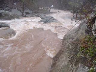
Caution: The following locations may require scouting or portaging. Always check current conditions.
Difficulty
Class V
Length
4.5 mi
Gradient
205 ft/mi
max 256
Rapids
4
2 Portages
Access Points
Difficulty Classes
I Easy
II Novice
III Intermediate
IV Advanced
V Expert/Extreme
VI Unrunnable
Current Conditions
5-Day Forecast
Whitewater data from
American Whitewater
American Whitewater