B) Banning State Park to Sandstone (2.8 or 4.3 miles)
Gauge Conditions
Runnable: 400.0 – 4,000.0 CFS
Reasonable beginner flow.
Data from American Whitewater & USGS
Run Map
Run Time Estimate
Select put-in and take-out to estimate time.
Plan This Trip
See wind-adjusted speed maps, forecast planning, and detailed time estimates.
Sign in to generate an AI timing estimate for this run.
Whitewater timing varies with scouting, portages, and group pace. Use as a planning baseline.
Description
Quick Facts:
Location: Sandstone, MN, about 82 miles N of Minneapolis/St.Paul, 56 miles SW of Duluth.
Shuttle Length: 7.4 miles. (See details in "Directions" Tab.)
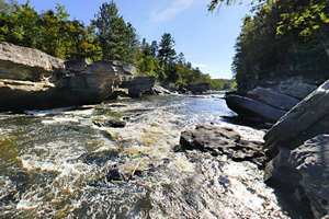
Character: Bedrock riverbed creates wonderful waves and holes. The rivername is appropriate as there are areas with various sized 'kettles' scoured out in the bedrock.
Drainage: 868 sq.mi. (at gauge site 2 miles downstream of take-out).
Put-in is approximately 1000' elevation.
Take-out is approximately 960' elevation.
Thus total elevation change is approximately 40'.
General Overview
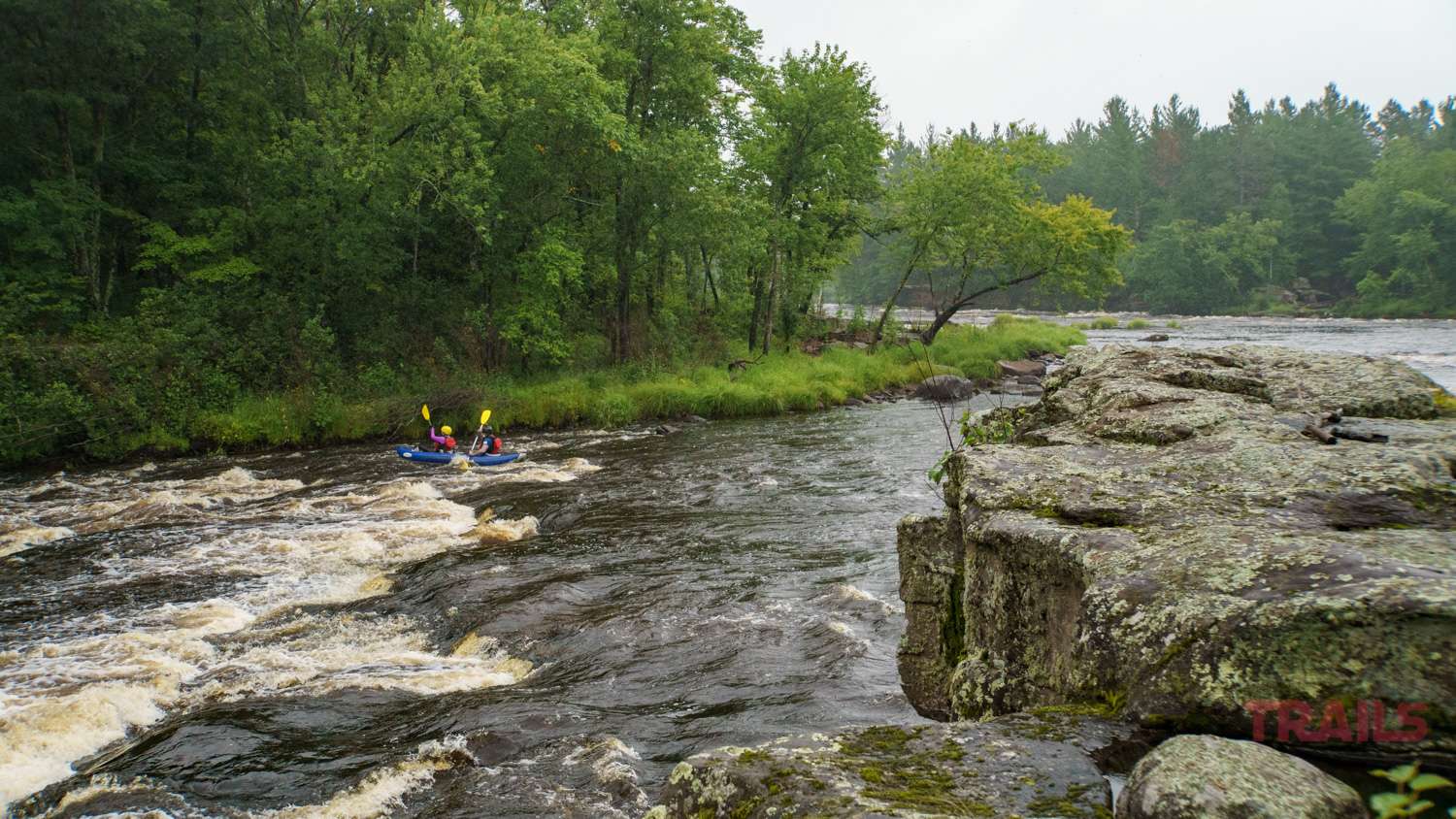
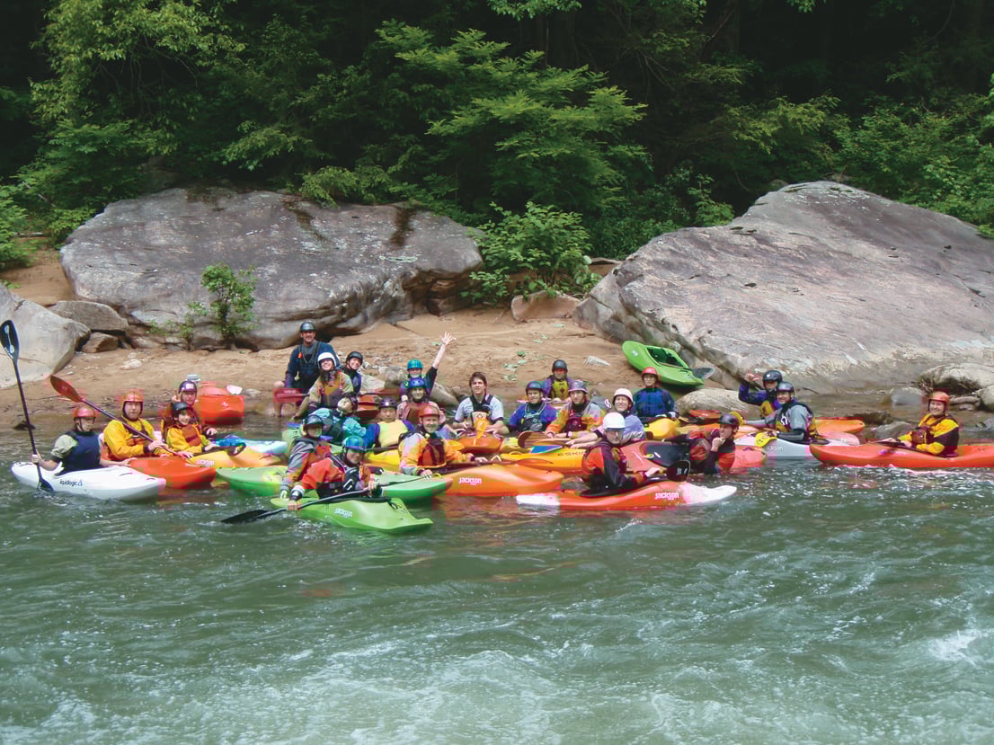
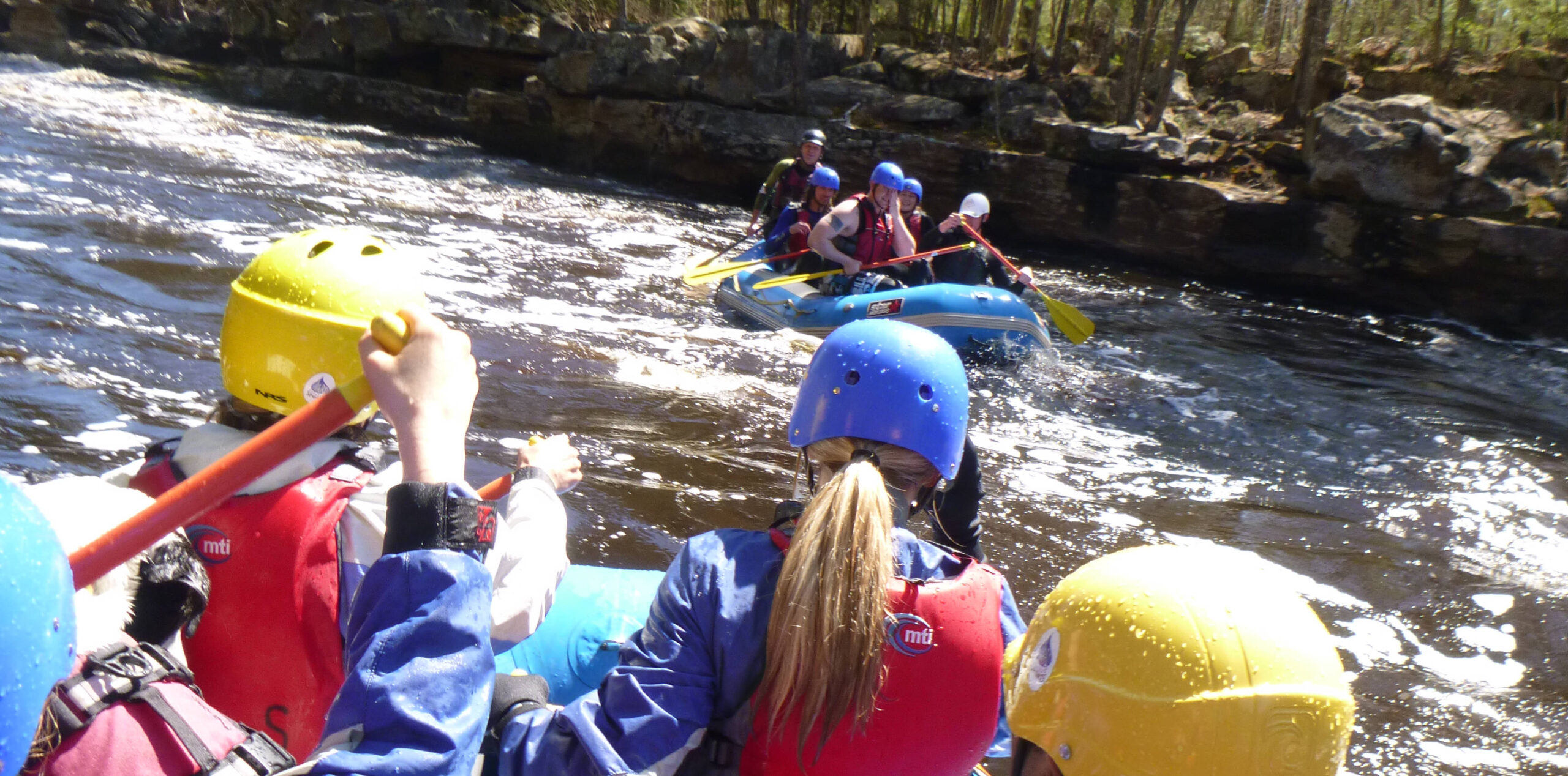
A popular playboating reach, with a few good surfing waves and holes. Caution should be exercised due to shallowness at most levels, and the existence of undercuts.
Put-in as listed is a roadside public access at the Hwy.23 bridge. However, the run from from there begins with 1.5 miles of flatwater paddling. Therefore, many (most) boaters opt to pay a park entrance fee at Banning State Park, to drive to a launch site which puts you in the river immediately above the first drop sequence, resulting in a run of 2.8 miles. Total elevation change is so little effected (no appreciable gradient loss in the 1.5 miles of flatwater), so overall gradient comes up to 14 fpm.
The first major rapids on this reach is _Blueberry Slide_. Two steeper pitches create a couple good holes and standing waves, including _Shoulder Hole_, _Teachers_ and _Teacher's Pet_. Next up is _Mother's Delight_, and _Dragon's Tooth_, where the river rushes through steep boulder-bed rapids into a short, narrow canyon with sandstone walls which are severely undercut. This should not cause any problems under 1000cfs. In high water, large waves and holes may form here.
Caution: Holes in both parts of this dells tend to feed paddlers into the undercut right wall. Stay well to the left (at high water) to avoid this fate.
This is followed by a series of boulder-bed rapids, _Little Banning Rapids_, which fill the next half mile.
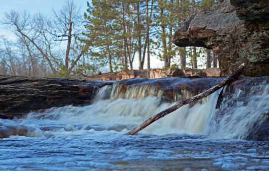
Passing the ruins of the town of Banning, you reach _Hell's Gate_, a long, boulder-bed rapids leading to the end of the Dalles. At levels up to about 1000cfs (more-or-less, depending on your tastes), this offers some of the best play on the river, with _generally_ enough push and depth for surf and squirt maneuvers. Shortly downstream, Wolf Creek enters from the right. A waterfall (about 10-15') may be found shortly upstream on this side-creek. If you are here during peak runoff or after a good rain, carry a ways up this creek to have a fun flush with a great almost goof-proof whoopie at the end. About a mile of flatwater paddling will bring you to _Quarry Rapids_, a broken-down dam/rubble-field, class II with sharp boulders churning the flow. A wide smooth wave normally forms at the top of this drop. Bottom left of the drop (at higher levels) tends to form a somewhat sticky looking hole, while the right is a fine flush into great swirls in the pool below.
This is the end of the usual run.
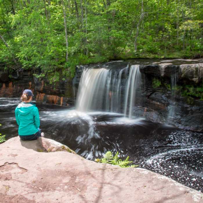
However, a mile-and-a-half further downstream lies _Big Spring Falls_. (Some of the local boaters refer to it as _Triple Drop_, in reference to there being up to three separate falls ( _across_ the width of the river) to take your pick from when deciding to run this area.) At times of high flow, a far-right channel provides a fun 'bypass' route. An island splits the main channel. The right side cascades over a waterfall, with a steep, fast 'tongue' alongside the island. At the base of this tongue, a hole forms, which changes greatly at different water levels. By some reports, it has been a sweet, friendly surf at levels around 2500-3000cfs, but sticky and nasty between 2000-2500. The leftmost channel of the river drops over a ledge and twists through boulder-filled ledges. Again, there are some bad undercuts, so caution is advised for any who venture down here.
Not far below, _Sandstone Rapids_ and three additional boulder-bed rapids are encountered. A few more low grade rapids follow before the gradient peters out.
Google Maps has excellent resolution aerials of this reach. We highly recommend going to the "Map" tab, clicking 'Satellite', double clicking near (not on, but near) the put-in location icon, zooming to the maximum resolution (without losing image), and doing a 'virtual tour' to 'walk' down the reach.
A great helmet-cam video of the run (including Wolf Creek Falls), courtesy 'MnktoDave' and YouTube:
Rapids in this Run (1)
Waterfalls (2)
Difficulty
Class II-III(IV)
Length
4.3 mi
Gradient
9 ft/mi
Rapids
1
Access Points
Difficulty Classes
I Easy
II Novice
III Intermediate
IV Advanced
V Expert/Extreme
VI Unrunnable
Current Conditions
5-Day Forecast
Whitewater data from
American Whitewater
American Whitewater