Bear Brook to Long Pond Road (Gulf Hagas)
Linked via: Nhdplus discovery 90% confidence Synced 5mo ago
Gauge Conditions
Runnable: 200.0 – 800.0 CFS
Data from American Whitewater & USGS
Run Map
Run Time Estimate
Select put-in and take-out to estimate time.
Unlock Advanced Trip Planning
See wind-adjusted speed maps, forecast planning, and detailed time estimates.
Sign in to generate an AI timing estimate for this run.
Whitewater timing varies with scouting, portages, and group pace. Use as a planning baseline.
Description
Tom McKee shared:
Here's a description of the run that I wrote for someone recently that might want to be included on the website: Gulf Hagas is the best whitewater run in Maine and, now that I live in Colorado, a creek that I miss dearly.
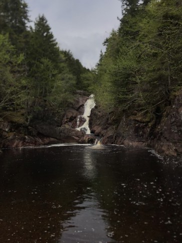
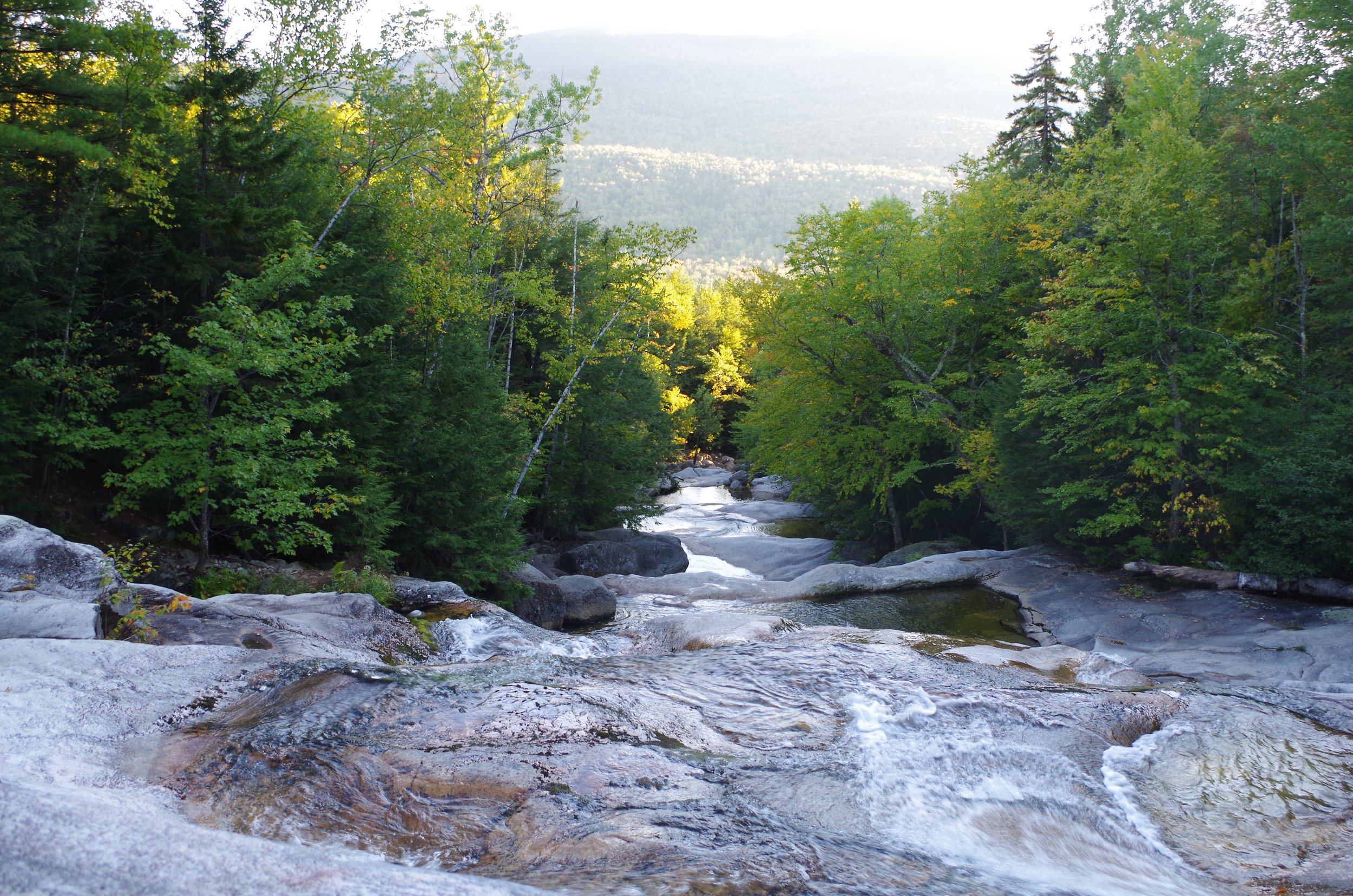
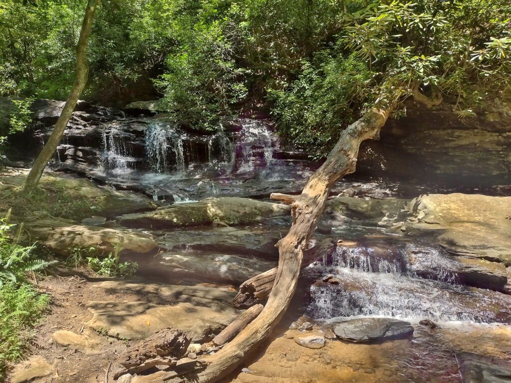
The general gist of the run is this: Overall, the river is solid class V. Your first mile is moving flatwater. Your next 1/4 mile is 4 easy ledges ranging from 6 to 18'. After that, the rest of the run (2 miles-ish) is very gorged out with very few opportunities for escape if something goes wrong. Everything is scoutable (with a little effort). So the first mile is nothing. Put in at the bridge (where the upper trail to the waterfalls starts) and float for a while. Watch for moose and other wildlife. After that, though, the character of the river changes.
First off, you have two options: 1) Keep going straight and paddle over Stair Falls, a bony triple-ledged sort of thing that is kinda fun (class III+), or 2) take a right into a tiny channel that lets you paddle over a 6-footer (my personal choice, class IV). If you miss the right, no big deal, hit it up next time. After that, the two channels meet and the run is now the same.
Next you have another easy river-wide ledge (6 foot-ish) that can be run middle or far right (class IV at best).
Next is Faceplant, an easy 10' boof, very fun (middle).
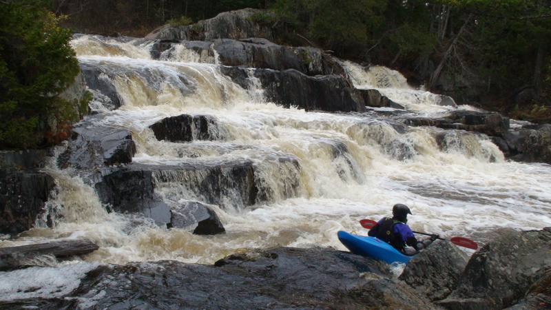
Right after that is Billings (4+), an 18' waterfall (boof middle, boof right, or slide left).
Okay, that's the first 1/4 mile of whitewater. Freaked out? Just get out before Billings on river left (I think it's possible) and hike back upstream on the trail on river left back to the car.
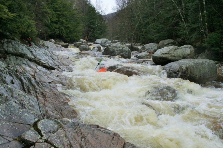
So the run has been quite open up to this point. Often you can see people hiking or hard-core folks finishing the AT. Right after this moment, though, things change significantly. From here on out the gorge walls will rise vertically 100+ feet and instead of ledges you will generally have hard rapids, depending on level, and you are very committed. Lower water means greater pin potential and higher flows mean some burly holes.
I won't get too much into the rapids but right off the bat you should know that there is one drop (Amok,a.k.a. Wedge, 5+) that is regularly portaged on the right due to the sieve at the end. Everything else is good to go, including Turnstile (class-III move with class-V consequences), Buttermilk (sweet 15' ledge), and Jaws (narrow, twisty, long class-V drop). The rapids are around every corner and VERY fun. There's tons of stuff in this 2 or 3 miles or so. Pretty much the action doesn't end until the takeout (right where you'd cross the river on foot if you were a hiker heading upstream).
If you have decent class-V skills you should be fine. The bottom limit level is probably -4" (which would suck) and the top is, well, BIG (I've run it at 19" with huge waterfalls cascading into the gorge from both sides and it was SWEET!) At super high water, Faceplant (usually one of the easiest/most fun rapids on the run), gets unrunnable.
The gauge is the concrete abutment at the base of the put-in bridge (ignore the spray-painted gauge). Even with the abutment is 0". Usually the last two weeks of April to the first week of May are pretty good to go. In the fall, 2 to 3" of rain will do it too. Just watch the Piscatiquis gauge at Blanchard. I can't remember the exact correlation but I figure if a good rainstorm brings it up to 1000 and rising, Gulf Hagas will be good. Also, I think there are gauges downstream on the Pleasant (Gulf Hagas' real name) that might help. You can always call the guys at the Ski Rack in Bangor and they can tell you a ton. If you're just getting started creeking in the area be sure to check out Sandy Stream (near Kingsfield, easy class V with fun ledges, wide open), the East Branch of the Piscatiquis (Shirley Mills to Blanchard, pretty straightforward, but with two big drops--portageable), and Smalls Falls (park and huck on the way to Rangley). Enjoy! -Tom McKee
Rapids in this Run (1)
Difficulty
Class V
Length
4.7 mi
Gradient
110 ft/mi
Rapids
1
Access Points
Shuttle Info
Source for the following text, and for the gage description: Greg and Sue Hanlon's [Steep Creeks of New England](http://www.amazon.com/exec/obidos/ASIN/1889787051/americanwhite-20), which has more info on this run. Text used with permission.
**Directions:** To takeout: from Brownville Junction, follow Rte. 11 North about 5 miles. Hang a left at the sign for Katahdin Ironworks onto a paved road which quickly becomes dirt. Follow about 6 miles to a rope gate at the remains of the Katahdin Ironworks. The Gulf Hagas, though on public land, is only accessible by private roads managed by Katahdin Iron Works/Mary-Jo Inc., who charge a toll to use their "usually dilapidated" dirt roads. In 1999, the toll was $4 for Maine residents and $7 for out-of-staters. Cough up the toll and head 6.5 miles to the dirt parking area, the takeout, on the right where a short trail leads down to the river.
From Greenville Center: take a right on Pleasant St., which turns into East Road before passing the airport. After the airport, the road turns to dirt and crosses Big Wilson Stream. You'll soon arrive at a rope gate with a trailer on the left. Here you get to cough up your cash as described above. Continue through the gate until reaching a T-intersection. Bang a right at this intersection and head 4.5 miles to the takeout parking area on the left.
To get to the putin, continue up the same road 5.5 miles. The road will bend slightly to the right before crossing the river at a small one-lane bridge (the gage bridge). Here's the putin.
Difficulty Classes
I Easy
II Novice
III Intermediate
IV Advanced
V Expert/Extreme
VI Unrunnable
Current Conditions
5-Day Forecast
Whitewater data from
American Whitewater
American Whitewater