Bellefonte to Milesburg
Gauge Conditions
Runnable: 4.0 – 6.0 FT
Data from American Whitewater & USGS
Run Map
Run Time Estimate
Select put-in and take-out to estimate time.
Plan This Trip
See wind-adjusted speed maps, forecast planning, and detailed time estimates.
Sign in to generate an AI timing estimate for this run.
Whitewater timing varies with scouting, portages, and group pace. Use as a planning baseline.
Description
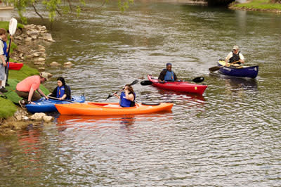
For a year-round paddling experience close to State College, you cannot beat Spring Creek. The first thing to note is that the stream is spring fed, which means the level is almost always good for paddling, even when the area experiences a drought. The run from Tussey Mountain Outfitters (TMO) to Bald Eagle Creek in Milesburg is a 2-mile paddle, therefore the shuttle is a quick 10 minutes along Rt. 144; very convenient for an evening paddles after work. Next, at the beginning of this run is Sunnyside Paddle Park, an official Olympic Slalom Training site where whitewater slalom gates are hung throughout the year. There are numerous rock weirs for training and eddy hopping. Additionally, there are some good surf/play spots along that stretch of creek:
1. at the bottom section of the Sunnyside Paddle Park
2. McWave/McHole, just upstream from McCoy’s Access
3. at the top of the last stretch of rapids into Milesburg, about 100 yards below the Community Park bridge
Rapids in this Run (1)
Playspots (1)
Difficulty
Class I-II
Length
2.2 mi
Gradient
18 ft/mi
Rapids
1
Access Points
Difficulty Classes
I Easy
II Novice
III Intermediate
IV Advanced
V Expert/Extreme
VI Unrunnable
Current Conditions
5-Day Forecast
Whitewater data from
American Whitewater
American Whitewater