Bennett Corner to Whittier
Gauge Conditions
Runnable: 4.8 – 6.6 FT
Data from American Whitewater & USGS
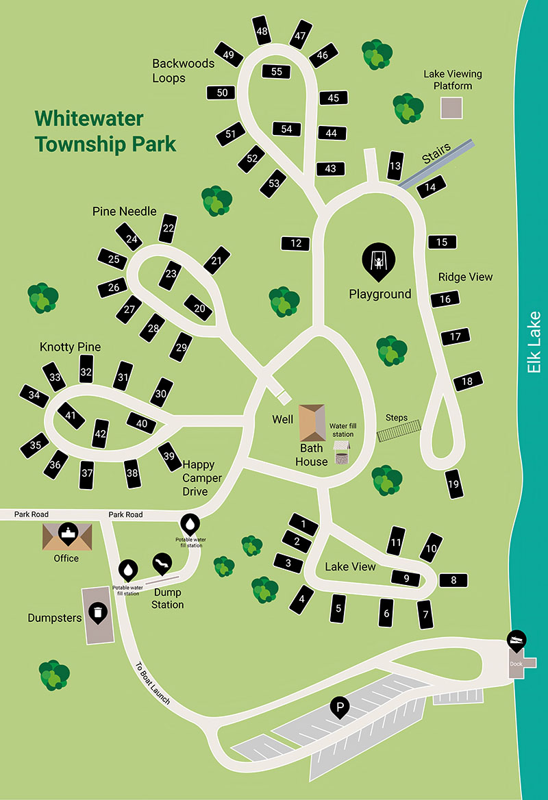
Run Map
Run Time Estimate
Select put-in and take-out to estimate time.
Plan This Trip
See wind-adjusted speed maps, forecast planning, and detailed time estimates.
Sign in to generate an AI timing estimate for this run.
Whitewater timing varies with scouting, portages, and group pace. Use as a planning baseline.
Description
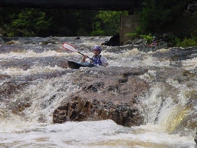
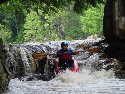
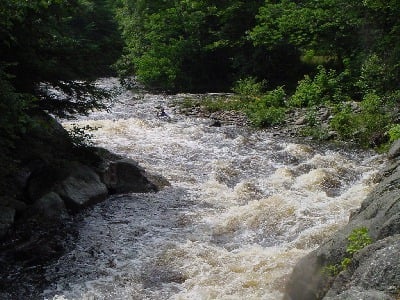
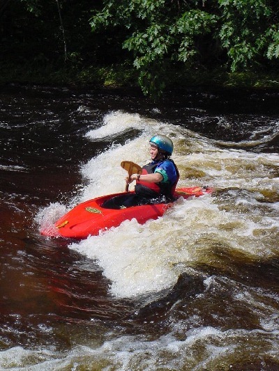
At the put in the Bearcamp is quickwater with a sandy bottom. Between here and where NH rt 25 comes into view the river contains a couple of easy class II rapids. Once NH rt 25 comes into view the action picks up. Cold Brook rapid (class III+) starts about 50 yards above a bridge. Cold Brook enters on the right just above the bridge. The section just past the bridge is the toughest. Below Cold Brook rapid the river splits around an island. The right channel goes through a small narrow gorge with 20' vertical walls. A relatively easy rapid leads to a sharp vertical drop of about 5' to 6' depending on water levels. The left channel is easier but does not always have enough water to run without scratching. Below the Gorge is a short flatwater section leading up to a delapitating concrete dam. This dam is usually protaged but can be run in a break on the far right or far left through a steep sluice. Scout this should you decide to run it since logs and other debris often clog the line. This dam is slated to be removed by the New Hampshire Department of Environmental Services sometime in 2003. The rest of the river contains a couple mostly class II-III the last one just above the takeout being the toughest and longest.
### Technical info
```
Put in elevation........580'
Take out elevation......455'
Total drop..............125'
Average drop/mile.......36'
Distance................3.5 miles
River width average.....50'
1st mile drop...........15'
2nd mile drop...........55'
3rd mile drop...........35'
3.5 mile drop...........20' (40' average)
River geology...........granite ledge, small boulders
River water quality.....Good to excellent, clarity excellent.
Scenery.................A mix of wooded isolated scenery to small town
with small homes and camps. Old concrete dam.
Wildlife................Deer, hawks, merganzers.
```
## Bearcamp dam removal
Dam removal ceremony at the Bearcamp dam Tamworth NH on September 10,
2003.
About a dozen paddlers from MVP, MWVP, and AMC showed up at the dam
removal ceremonies for the Bearcamp dam located on the Bearcamp river
in Tamworth NH. Work has started on removal of the dam. Estimates
for completion are about 8 weeks.
Located at the mid point of the Bearcamp river run the dam was
occasionally unrunable because of woody debris. Paddlers used to run
the river left or right sluice depending on debris. The mid section
of the dam continued to collect logs and other debris causing concern
with state and federal agencies over the potential for disaster
should the blockage suddenly let go during a high water event.
New Hampshire is leading the way with an active river restoration
program that includes removal of old unused dams. This is the third
such dam of notable size to be removed. The other two were taken out
of the Ashuelot river last year.
The dam consists of eight 20-foot high concrete piers with a
foundation resting on bedrock, and is approximately 230 feet long.
The concrete will be removed and recycled at a New Highway department
facility; the wood will be brought to a stump dump. All rebar and
unnatural material will be removed.
Fish and wildlife are looking forward to the return of landlock
salmon to the upper reaches of the Bearcamp. Paddlers are looking
forward to paddling a restored stretch of river. The town of
Tamworth can feel a little safer without a potential dam break.
The dam removal will change the rapids in this section and
potentially the gorge rapid just above. It is too early to say by
how much at this time.
Several newspapers were on hand today so there should be lots of
stories in tomorrow's newspapers. NH public television was also
there to do a story for their "Outlook" program.
Amongst the long list of supporters for the dam removal project is
American Whitewater and the Merrimack Valley Paddlers. Thanks to all
the hard work George May has put into this.
Stephanie Lindhoff of NHDES says the Contoocook dam project looks
good for October. Dynamite will be used to breach this one. We hope
to get lots of paddlers there for this event. We will let you know.
Bearcamp Parking
During a recent outing on the Bearcamp, the owner of the property on
which paddlers park for the take-out expressed his dissatisfaction
for the way in which vehicles were parking. Although our parked
vehicles were off to one side of the drive (toward the river), they
were near the road.
Because the owner parks a large tractor-trailer on the site, he
needs access to the full horseshoe loop of the driveway for ease of
parking. He's asking that if paddlers wish to continue using the
parking area at the take-out, they park at least a couple of (long?)
car-lengths from the road, toward the riverside of the parking
area. It's great that he's willing to let us continue using the
area, so let's try to abide by his wishes.
Nicol
(via Jim Roseberry)
## Directions
### Put in (from interstate 95 Portsmouth)
Interstate 95 to NH 16 in Portsmouth.
NH 16 north approximately 60 miles.
Left on NH route 25.
Go west on NH 25 for approximately 7 miles to the intersection of 113 (note this is the second intersection with 113 at BennettÂs Corner past South Tamworth
Turn right on NH 113 approximately ½ mile to put in at bridge.
### Put in (from interstate 93 Concord)
Interstate 93 north to exit 23 approximately 30 miles.
NH route 25 east through Meredith approximately 28 miles
Turn left on NH 113 approximately ½ mile to put in at bridge.
### Take out
Head back to NH 25.
Take a left (east) on NH 25 approximately 3 miles
Take a left on NH route 113
113 parallels the river for a short distance then turns left over a bridge over the river, park downstream of the bridge on river right.
Rapids in this Run (5)

Waterfalls (1)
Playspots (1)
Difficulty
Class II-IV
Length
3.6 mi
Gradient
36 ft/mi
max 55
Rapids
5
Access Points
Difficulty Classes
I Easy
II Novice
III Intermediate
IV Advanced
V Expert/Extreme
VI Unrunnable
Current Conditions
5-Day Forecast
Whitewater data from
American Whitewater
American Whitewater