Bull Branch Rd - Hike up
Gauge Conditions
Runnable: 800.0 – 6,000.0 CFS
The gauge is far away from the river and is a very rough estimate
Data from American Whitewater & USGS
Run Map
Interactive run map
Loads as you approach this section.
Run Time Estimate
Select put-in and take-out to estimate time.
Plan This Trip
See wind-adjusted speed maps, forecast planning, and detailed time estimates.
Sign in to generate an AI timing estimate for this run.
Whitewater timing varies with scouting, portages, and group pace. Use as a planning baseline.
Description
Goose Eye Brook
General Discription:
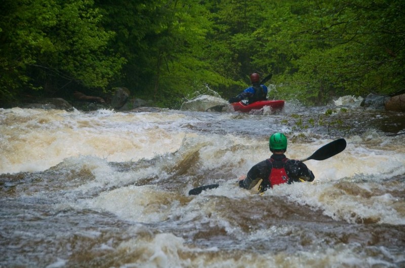
This section is a tributary to the more commonly paddled section of the Bull Branch River ( ), just outside of Bethel, ME. This is definately a park and huck style stream, that requires a significant amount of rain to be running. But, if it is going and you've already made the trip, you will be rewarded with 3-4 class 4/5 slides that are reminescent to something you would see in CA or the southeast. Most mortals put in below the first very large (V+), multi-tiered slide that defines this section and continue down to the Bull Branch River.
Rapids: Non are named to my understanding
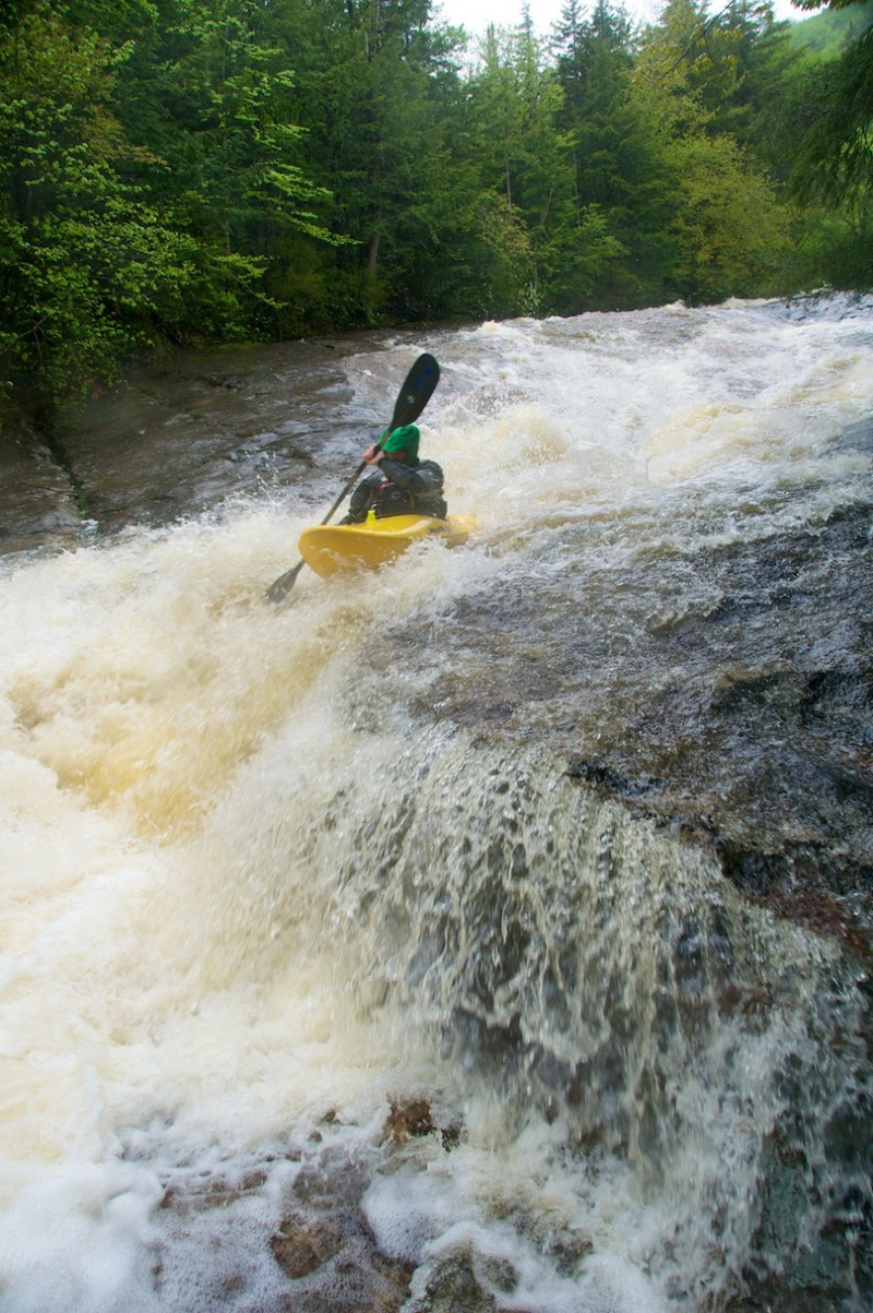
1\. Very large, multi-tiered slide that drops an estimated 75ft in total height. ( V)
Once you drop into this guy you are committed. Very scoutable drop from the river left side. Put in as high as you want and hope that you come out the bottom rightside up. The left channel feeds most of the water, but the ideal line would be down the right side at the bottom half of the rapid. This is as big as the Toxaway in NC.
2\. Remaining slides lumped for simplicity ( IV+)
Putting in below the bohemith listed above, you will be greated with a multi-tiered slide combination that again, drops about 75ft in height with stopping, in a glade-like fashion through relatively smooth bedrock. At the bottom boaters should head left, as a volkswagon sized rock awaits those less aggressive paddlers with a possible peton as a greeting.
3\. Class IV boogie water till you join up with the Bull Branch
Rapids in this Run (2)
Difficulty
Class IV-V(V+)
Length
0.7 mi
Gradient
400 ft/mi
Rapids
2
Access Points
Shuttle Info
Head North from Bethel, ME, head North on Route 2 for 2.8 miles to Sundary River Road. Turn west on Sunday River road and continue 5.5 miles till you reach Bull Branch Road (and cross the river). Follow Bull Branch road for 1.2 miles till you see Goose Eye Brook on your left. The hiking begins here.
Difficulty Classes
I Easy
II Novice
III Intermediate
IV Advanced
V Expert/Extreme
VI Unrunnable
Current Conditions
5-Day Forecast
Whitewater data from
American Whitewater
American Whitewater