Butler Road to S.Fk.Eau Claire (PnP or up to 9.6 miles)
Gauge Conditions
Runnable: ? – ? CFS
Approximate reading: This gauge is 15.8 miles away on Hay Creek. Use as a general reference only.
Data from American Whitewater & USGS
Run Map
Run Time Estimate
Select put-in and take-out to estimate time.
Plan This Trip
See wind-adjusted speed maps, forecast planning, and detailed time estimates.
Sign in to generate an AI timing estimate for this run.
Whitewater timing varies with scouting, portages, and group pace. Use as a planning baseline.
Description
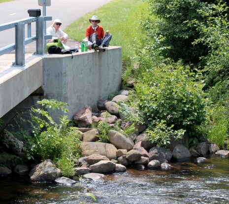
A rock-dam ledge may offer some play, and a scenic northwoods run, likely continuing onto S.Fk.Eau Claire to finish with more minor rapids.
Drainage area: 58.7 sq.mi. at put-in.
Rapids in this Run (1)
Playspots (1)
Difficulty
Class I-II
Length
8.9 mi
Rapids
1
Access Points
Shuttle Info
The 'full run' on Hay Creek is likely to involve continuing down S.Fk.Eau Claire run to its take-out at CTH.H.
Serious whitewater boaters may be mostly interested in just the PnP (at Rock Dam County Park and Campground), and will forego the shuttle.
Difficulty Classes
I Easy
II Novice
III Intermediate
IV Advanced
V Expert/Extreme
VI Unrunnable
Current Conditions
5-Day Forecast
Whitewater data from
American Whitewater
American Whitewater