C) Grandfather Falls (1 mile)
Gauge Conditions
Runnable: 2,820.0 – 12,800.0 CFS
Likely too low for decent whitewater on most of run. (Only 'fish flow' of ~50 cfs.)
Data from American Whitewater & USGS
Run Map
Run Time Estimate
Select put-in and take-out to estimate time.
Plan This Trip
See wind-adjusted speed maps, forecast planning, and detailed time estimates.
Sign in to generate an AI timing estimate for this run.
Whitewater timing varies with scouting, portages, and group pace. Use as a planning baseline.
Description
Our 'virtual gauge' subtracts the penstock capacity from the USGS gauge to *approximate* flow in the natural channel.
---
Better gauging for this run is available from ****
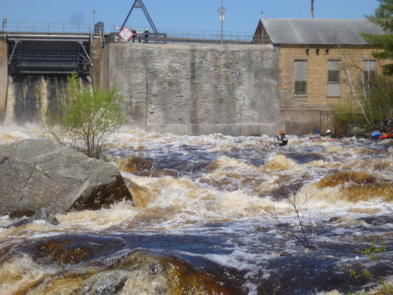
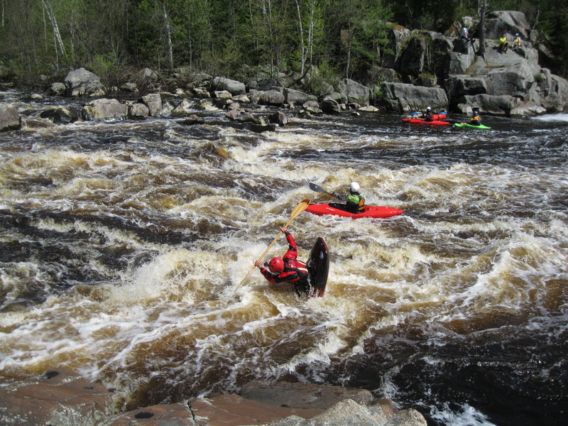
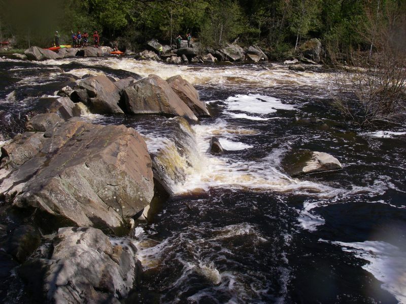
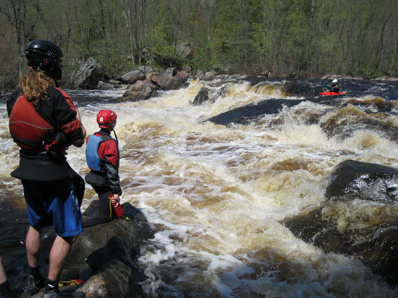
Between Grandfather Dam and the powerhouse lies very nearly a full mile of wide river, with an amazing assortment of rocks, bedrock, and ledges. With adequate water, this wild stretch of river should allow many options of routes and plenty of play possibilities. Various sites list 89-93 feet of drop, however (best that I can tell) that is the available head-height used by the powerhouse, thus includes the height of the dam, which we have subtracted to list the available drop of this section.
There is one ledge about 2/3 of the way down which rates the '(IV)' in the description at flows around/above 2000 cfs . At low-to-moderate flows, this reach may be more in the II-III range, but the continuous nature of the rapids, and pushiness (as it heads to higher water levels) should not be taken lightly.
There is a section of the Ice Age Trail on river left which may be used for scouting, and the road parallels the river not far back from that.
The capacity of the penstock and powerplant is reportedly 2,820 cfs, which would seem to indicate flows in excess of that should put water in this reach. I have seen the river at 'fish flow' (summer trickle), and it would appear that (at least parts of) this reach could certainly be boatable with much less water than the full stretch requires for boatability.
A flow study was conducted May 24, 2014. Participants in that flow study suggest that the run might be broken up into three (very roughly equal) sections, which are detailed in the rapids descriptions below.
---
A very interesting *write-up on Wikipedia*** mentions the Ojibwe name for this stretch was 'Konajewun', which translates as 'long falls'. That Wiki page also gives an accounting of 'what was probably the first and only canoe trip down the falls' in 1849 by two Indians in a birch bark canoe! So, present day whitewater canoeists are following a path blazed more than 165 years ago!
Rapids in this Run (4)
Waterfalls (2)
Hazards & Portages (2)
Caution: The following locations may require scouting or portaging. Always check current conditions.
Difficulty
Class II-III+(IV)
Length
0.9 mi
Gradient
60 ft/mi
Rapids
4
2 Hazards
Access Points
Shuttle Info
NOTE: Put-in and Take-out have not been placed on the river, but at location to allow more accurate mapping of parking areas and for shuttle route.
If you are ambitious/energetic and/or have only one vehicle, it is also possible to just walk the one-mile (parking either at lower or upper access). While the Ice Age Trail runs through here, and is convenient for scouting a fair part of the run, it is not real convenient for a hike with a boat. We would recommend instead following alongside the penstock (at least, when reconstruction is completed in late 2017) and the forebay (canal).
Difficulty Classes
I Easy
II Novice
III Intermediate
IV Advanced
V Expert/Extreme
VI Unrunnable
Current Conditions
5-Day Forecast
Whitewater data from
American Whitewater
American Whitewater