Canada Falls Lake to Pittston Farm
Gauge Conditions
Runnable: ? – ? CFS
Approximate reading: This gauge is 0.3 miles away on Penobscot. Use as a general reference only.
Data from American Whitewater & USGS
Run Map
Run Time Estimate
Select put-in and take-out to estimate time.
Plan This Trip
See wind-adjusted speed maps, forecast planning, and detailed time estimates.
Sign in to generate an AI timing estimate for this run.
Whitewater timing varies with scouting, portages, and group pace. Use as a planning baseline.
Description
Source: Greg and Sue Hanlon's Steep Creeks of New England, which has more info on this run. Text used with permission.
Located in the remote wilderness of northwestern Maine Canada Falls section of the South Branch of the Penobscot River is the latest success story for American Whitewater. The first summer recreational release occurred on Saturday July 2nd 2005. An agreement hammered out by AW director Tom Christopher with Brascan power, Plum Creek, and the Piscataquis and Penobscot Indian tribes guarantees releases every Saturday during July and August of each year for the next 50 years.
North Maine Woods Inc.
The Canada Falls section of the Penobscot lies in what is known as the North Maine Woods. North Maine woods is a consortium of private landowners (mostly paper companies), encompassing 3.5 million acres of working forest. It is rugged remote country many miles from the conveniences of modern day life. To get more information on access fees, gate locations and hours, camping information, etc. go to the North Maine Woods website.
## Directions
It's not the easiest place to get to but the scenery is nice and the dirt roads are not too bad. You will want to start your trip into the small town of Rockwood Maine on the western shore of Moosehead lake.
To get to Rockwood
1. take exit 39 off of Interstate 95
2. head north on ME 7
3. In Dexter take a left and head north on ME 23
4. In Guilford take a left and head north on ME 15/6
5. This will take you to Greenville continue on ME 15/6 by taking a left in Greenville
6. 15 miles will bring you into Rockwood
7. Continue through the other side of town then stop at the Rockwood country store on the Moose river for supplies.
If you are coming up from the Forks area
1. take ME 201 north to Jackman
2. Take a right onto ME 15/6 to Rockwood
3. It is approximately 50 miles from the Forks, there are other options to get here using logging roads but refer to the Maine atlas and Gazetteer for those options.
Once in Rockwood at the country store get all your supplies including food and gas up your vehicle there are very limited services within the North Maine Woods region.
From Rockwood to Canada Falls
1. Approximately 23 miles to the put in
2. From the country store head west ? mile then take a right on the bridge over the Moose river.
3. Bear right on the otherside of the bridge, pavement will turn to a good dirt road within a mile.
4. 20 miles on this road to the ?20 mile checkpoint? and gate run by a consortium of paper companies
5. At the gate pay $8 per person per day ($5 Maine resident)
6. Proceed towards Pittston Farm then take a left on Boyd road.
7. About 1 mile you'll pass over the South Branch of the Penobscot, this is the take out
8. After the bridge bang a left toward Canada Falls Dam and campground. This is the putin.
Camping at Canada Falls
Camp right a Canada Falls Lake Campground or use one of the DOC sites in the area. The one right at the Cabin Rapid is a personal favorite.
Rafting Outfitters on Canada Falls by Trip Advisor Score
Rafting trips are provided on Canada Falls by the following outfitters:
Penobscot Adventures
Maine Rafting Expeditions
Northeast Guide Service
Difficulty
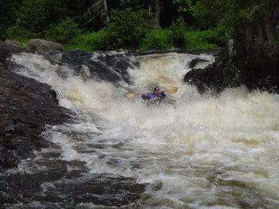
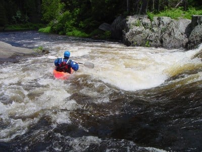
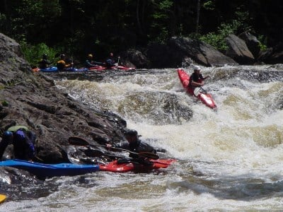
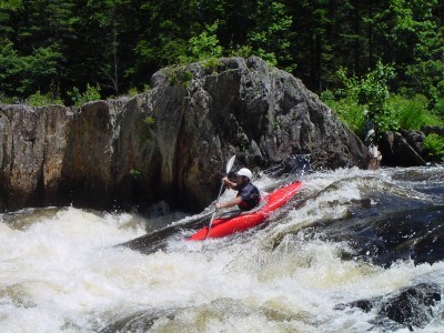
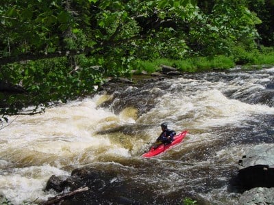
Class III-V
Length
3.8 mi
Gradient
45 ft/mi
Rapids
5
Access Points
Difficulty Classes
I Easy
II Novice
III Intermediate
IV Advanced
V Expert/Extreme
VI Unrunnable
Current Conditions
5-Day Forecast
Whitewater data from
American Whitewater
American Whitewater