Chattooga Cliffs - Grimshawes Bridge to Bull Pen Bridge Wild
Gauge Conditions
Runnable: 350.0 – 1,200.0 CFS
Due to an arbitrary decision by the Forest Service, the river is not boatable unless the river has previously exceeded 350 cfs the same day.
Data from American Whitewater & USGS
Run Map
Put-in
Take-out
Rapids/Hazards
Wild
Scenic
Recreational
Description
The upper two miles of
the Wild and Scenic corridor below Whiteside Cove Road runs through private
property. The property owner has blocked the river with cattle gates, fencing,
and razor-wire. The Forest Service prohibits
paddling on public lands immediately upstream and downstream of the private
property. Paddlers have to hike in to the river on the Chattooga River Trail
from the small parking lot on Whiteside Cove Road, turning left down an
unmarked Green Creek Trail to reach the river. The entry hike of almost two
miles is long but easier than many other runs such as the Toxaway, Horsepasture
or Ravens. Be sure to fill out a permit at the trailhead.
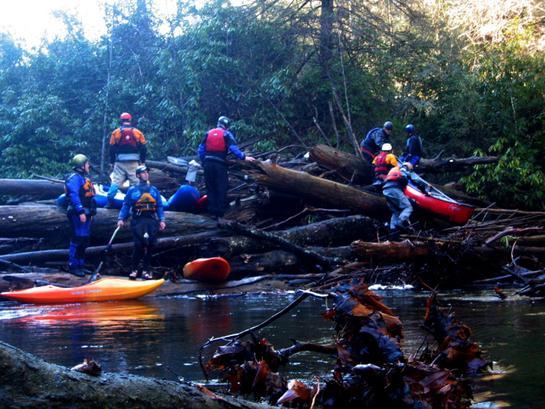
Approximately 2 miles
downstream of the Green Creek put-in, a river-wide log jam exists around two
large boulders that created three narrow channels. The log jam appears to be
from old floods and appears to function as a strainer for most floating debris
coming down upper reaches.
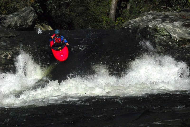
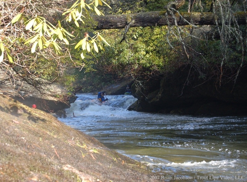
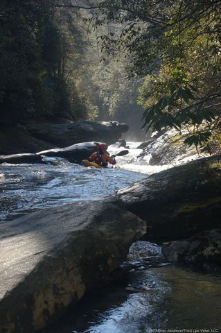
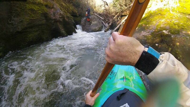
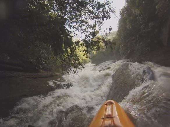
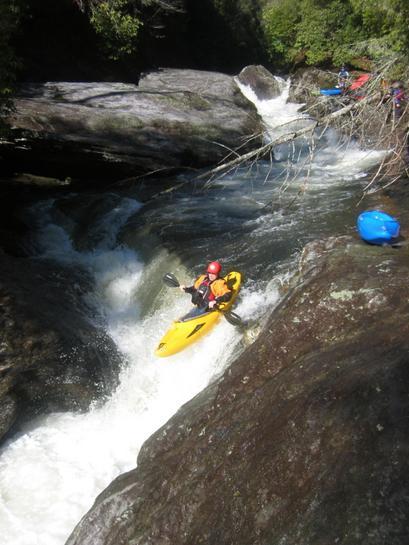
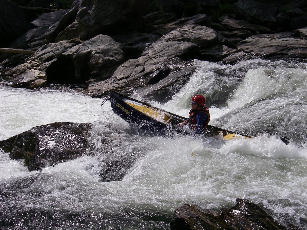
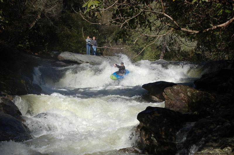
A small ledge defines the
beginning of the whitewater immediately downstream of the logjam that continues
approximately 1.2 miles down to Bull Pen Bridge. The upper 2/3-mile has the
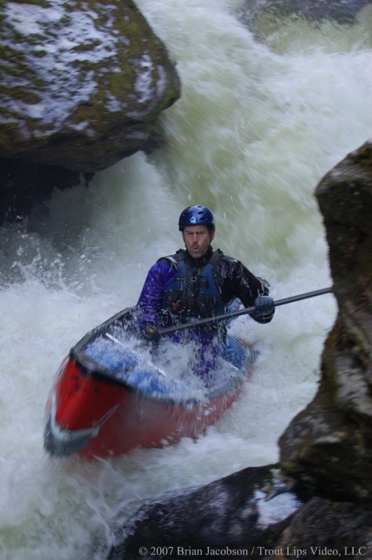
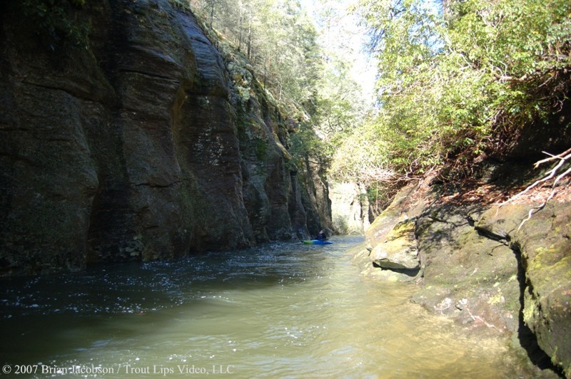
most difficult rapids. The river enters a narrow canyon defined by steep rocky
cliffs overhung above by dense vegetation. The rapids are close together,
constricted and easy to approach and scout at low or moderate flows. The rapids
are generally Class IV or V-, with one difficult sieve that may be boatable at
higher flows.Strainers and sieves are
common on this reach and a portage or two can be expected.After "the Sieve" the river mellows
to Class III-IV the last mile to the bridge.The run has required 2.5 hours for a 4-mile trip.
This run is about the
unique river features and closed-in feel of the river.It is a lot of work for the few rapids and
would be visited to experience an almost primordial sense of the river.
Here are the ridiculous
Forest Service rules:
- Paddling is allowed
only below Green Creek (not above)
- Paddling is allowed
between December 1 and April 30, on days when flows have hit 350 cfs or higher.
- No strainer removal (this is reasonable).
These severe restrictions are the only of their kind in the entire Unites States, and are intended to benefit hostile landowners and anglers who pursue heavily stocked non-native trout.
AW has been working for a decade to bring responsible, nationally consistent river management to the Chattooga, and this work continues today.
For more information about American Whitewater's efforts to remove this boating ban go to the Chattooga Project page
Emergency Locations
Bull Pen Bridge
N35°00.938'
W83°07.589'
Reach Profile
https://www.americanwhitewater.org/photos/archive/medium/891428.jpg
Related Reaches
Chattooga Cliffs (AKA Section 00)
Ellicott Rock (AKA Section 0)
Rock Gorge (AKA Section 1)
Woody Debris
This section of the Chattooga has special concerns about large woody debris for fish habitat. Please respect the environment and leave wood as you find it, even if it adds a portage. The Chattooga has a remarkable ability to clean itself and the rapid may be ready next time.
For more information about woody debris in rivers go to Large Woody Debris and Stream Ecology
Rapids in this Run (13)
 Rapid
Rapid
Parking Area
 Rapid
IV
Rapid
IV
First Falls
 Rapid
Rapid
Log Jamb (Impaction)
 Rapid
IV+
Rapid
IV+
Separation Falls
 Rapid
IV+
Rapid
IV+
Potholes Left, Logs Right
 Rapid
IV+
Rapid
IV+
Beauty and Beast
 Rapid
IV+
Rapid
IV+
Beast
 Rapid
Rapid
Alleyway
 Rapid
V+
Rapid
V+
Whoa Nellie! (aka Sieve Rapid)
 Rapid
IV+
Rapid
IV+
Crease Boof
 Rapid
III+
Rapid
III+
Sunbathers Drop
 Rapid
IV
Rapid
IV
Wakeup Ledge
 Rapid
V
Rapid
V
Bull Pen Rapid
Difficulty
Class IV-V
Length
3.5 mi
Gradient
78 ft/mi
max 174
Rapids
13
Access Points
Shuttle Info
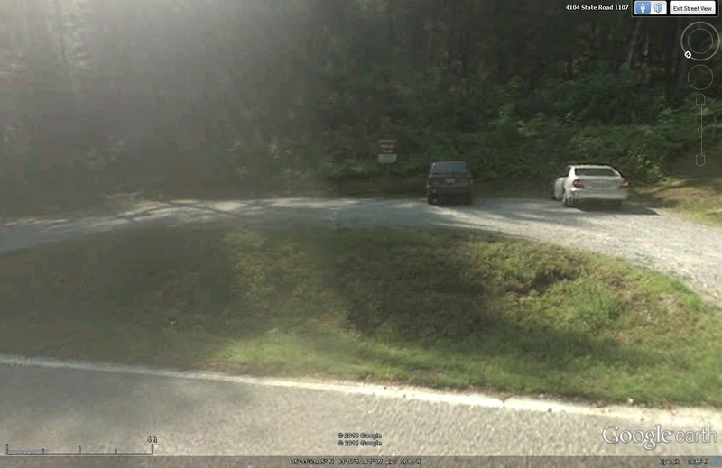
Start at Bull Pen Bridge. Continue west on Bull Pen Road (County Road S-1102) 2.7 miles to Garnet Hill Lane (County Road NC-1606) turn right (may change to Whiteside Cove Rd), and go north 2.5 miles. A small Forest Service parking area marked Whiteside Cemetery will be on the right that holds several cars. Follow the trail to the confluence with Green Creek. Bull Pen Road is approximately 16.1 miles north of the intersection of Hwy 107 and Hwy 28 in Mountain Rest, SC .
or
Boaters will access this put-in/takeout off the old County Line Road located at the Jackson/Macon county line. Take Horse Cove Road east out of Highlands, NC for approximately 4.5 miles and keep left on Whiteside Cove Road at the fork in the road. The old road bed down county line is located 0.8 miles at the Jackson/Macon county line on the right. Only roadside parking is available in this area. The registration box is approximately 0.25 miles down this trail.
Difficulty Classes
I Easy
II Novice
III Intermediate
IV Advanced
V Expert/Extreme
VI Unrunnable
Permit Required
Permit must be obtained at Green Creek Trail, County Line Trail, or Bull Pen Bridge in NC, Burrell’s Ford Rd (GA side of the river), Warwoman Campground (FR 86) and Overflow Creek in GA, or Hwy 28 boat landing, Low Water Bridge, Earl’s Ford, Sandy Ford, Fall Creek, Thrift’s Ferry, Hwy 76 / Bull Sluice lot, and Woodall Shoals in SC.
Get Permit
Current Conditions
5-Day Forecast
Whitewater data from
American Whitewater
American Whitewater