Cheney Trail–East Branch Confluence
Gauge Conditions
Runnable: 10.0 – 15.5 FT
Data from American Whitewater & USGS
Run Map
Interactive run map
Loads as you approach this section.
Description
Source: Greg and Sue Hanlon's Steep Creeks of New England, which has more info on this run. Text used with permission.
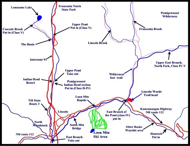
Directions: from Lincoln, drive 2.5 miles East on Rte. 112 (Kancamagus Hwy). Park in the dirt parking lot, river right, just downstream of the Loon Mtn. Bridge.
Putin: continue East on 112 ~ 6.2 miles, crossing the East Branch to the first bridge across the Hancock Branch. Park in the Cheney Brook / East Pond Trail lot on the right.
This run includes 2 miles on East Br., Pemigewasset; these two miles aren't figured in the gradient listed above.
Flow Info:
Judge the water level from the road. The gage referenced above is approximate, based on a correlation.
A better guide is the E. Br. Pemi. 12.0 ft (9000 cfs) usually means a high level on the Hancock Branch.
Rapids in this Run (1)
Difficulty
Class V
Length
4.0 mi
Gradient
171 ft/mi
Rapids
1
Access Points
Difficulty Classes
I Easy
II Novice
III Intermediate
IV Advanced
V Expert/Extreme
VI Unrunnable
Current Conditions
5-Day Forecast
Whitewater data from
American Whitewater
American Whitewater