Cleator Bend Campground to Detroit Reservoir
Gauge Conditions
Runnable: 400.0 – 2,000.0 CFS
Data from American Whitewater & USGS
Run Map
Run Time Estimate
Select put-in and take-out to estimate time.
Plan This Trip
See wind-adjusted speed maps, forecast planning, and detailed time estimates.
Sign in to generate an AI timing estimate for this run.
Whitewater timing varies with scouting, portages, and group pace. Use as a planning baseline.
Description
The Breitenbush is one of the classic intermediate runs in the Cascades and a great introductory creeking run! But it is not recommended as an introduction to class IV. Even at moderate flows, this run as handed out some bad days for class IV paddlers who let their guard down.
At lower flows (below 700 cfs) most of the rapids are class III+ but come consistently throughout the first half of the run. At these levels the second half of the run can drag on as the river spreads out and the gradient drops. Because of this at low flows some boaters take out at the upstream end of the guard rail at Humbug Creek to get the action packed upper half of the run, while cutting out the gravel cruising and open class II of the second half of the run (at the cost of missing Barbell, Woo Man Chew, and a couple other class IIIs). Just be sure to note the take out area so you don't miss it from river-level. Because this portion is 4 miles long, you can take your time catching eddies, or grab a second lap.
At higher flows (1200+) you can expect a continuous class IV experience. For the most part the rapids can be boat scouted by experienced paddlers but keep a sharp eye out for wood which can be in play anywhere along this run. At medium levels and up the second half of the run moves along fast and is good fun, doing the full run at these levels (800 and up) and taking out at the gauging station is the way to go.
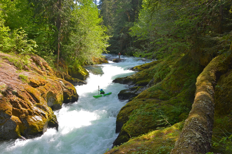
Beginning from the bridge upstream of Cleator Bend Campround, the river flows past the campground in an alluvial reach that has a tendency to collect large channel-spanning logs. Most people put in at the bottom end of the campground to avoid the potential for an early wood portage. As you come back along the road, you have an easy warm-up rapid before you soon arrive at a horizon line above The Slot.
The Slot is one of the more significant drops on the run and it's a good idea to scout and set safety from the bedrock shelf on river right--even if you know the run you want to check for wood. The crux move at The Slot is making it over the first ledge which develops a sticky hole. From there you just continue down the middle through some fun hydraulics. Beware of the surging eddy tucked into a little cove towards the bottom which can create trouble for paddlers who end up there.
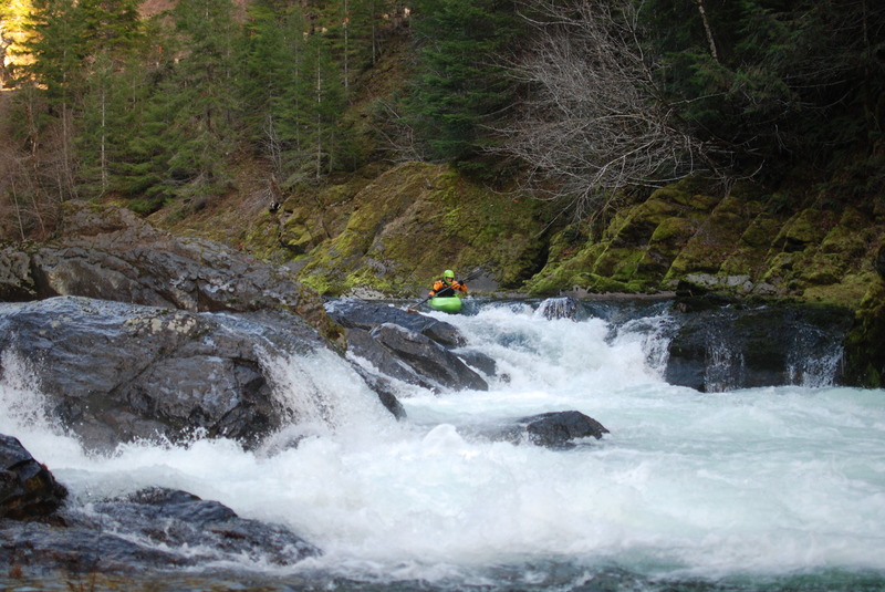
Less than a mile downstream you will come to The Notch. The Notch is a river-wide ledge with potential slots. The right slot, which was the historical line, is currently very dangerous. In previous years, there was a nice scout/portage eddy above it on the right. This eddy is now gone at most flows so plan early if you need to scout or portage. The middle slot is very narrow and not recommended, leaving the far left slot as the best option. To reach this slot boaters need to be right up against the left wall when entering. The Notch can be scouted from the road by hiking down to the river near an old quarry.
Below the Notch, the river is a bit more pool/drop but there are many fun and challenging rapids that can be difficult to boat scout. Many can have the possibility of wood in bad places so best to be cautious if you don't know the run well. Eventually the action lets up as you pass Humbug Creek and not long afterwards boaters reach a bridge. This bridge marks the last realistic change to exit the river before the bigger drops down below.
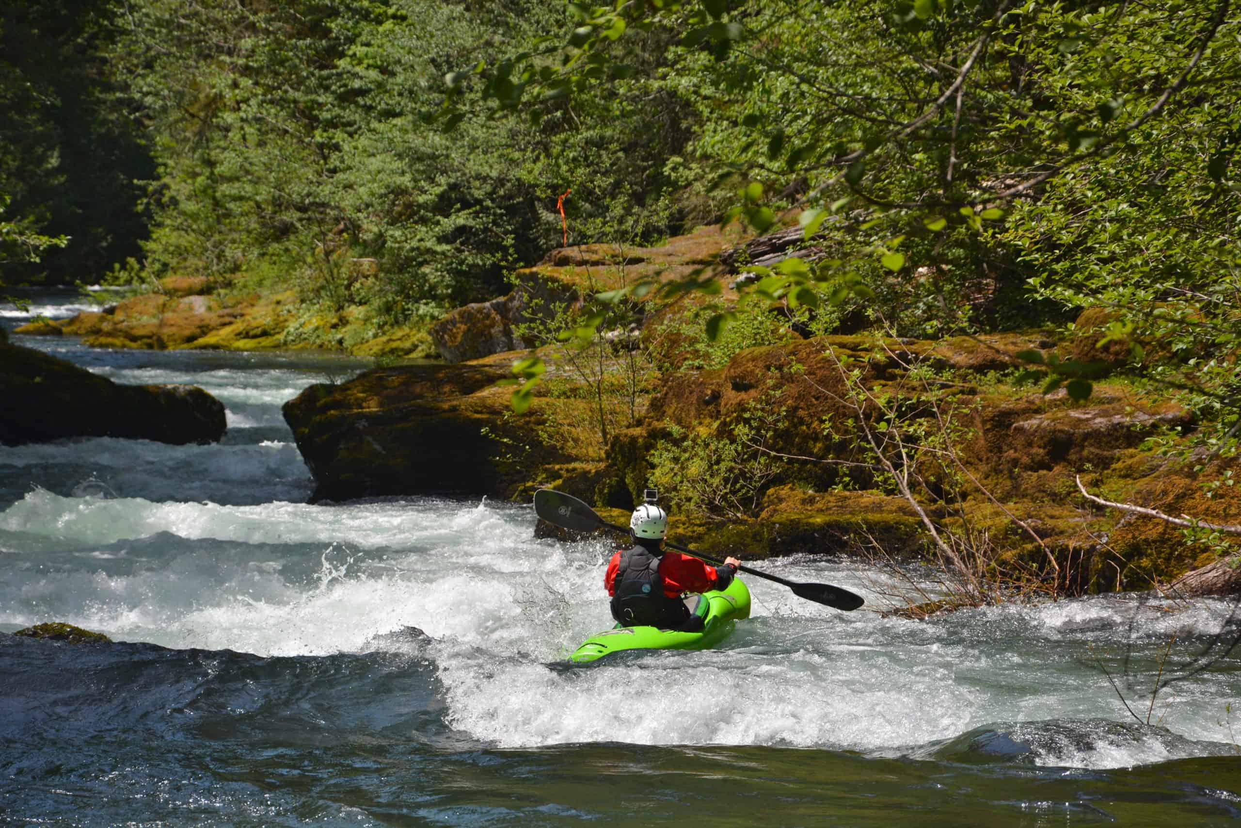
Below the bridge the river takes on a bigger feel and two named drops await. The first is Barbell named for the large barbell-shapped rock. The river right line is over a ledge that requires a precise boof to the right to avoid the hole. The alternative line is down the boulder garden on river left. Barbell has a tendancy to collect wood and some years it is not runnable.
The last big rapid is Woo Man Chew. Woo Man Chew is preceded by a steep, fast rapid with some crashing holes and waves. After a short pool, the river plunges over a steep ledge with a straight-forward line on the left and a tricky airplane turn line on the right which is only available at higher flows.
A few more small but fun rapids continue until boaters reach the USGS gage station on river left. This is the standard take-out. Boaters can also continue downriver a short ways to the Upper Arm Day Use Area is they prefer or even further downriver below the Highway 22 bridge if the reservoir is low. If you take-out below the bridge it's a bit of slog back up to the highway.
For additional information see the description and photos at Oregon Kayaking.
Logistics: The Breitenbush runs along FR 46. Head to Detroit and at Hwy 22 mile 50.0 turn onto FR 46 which is signed for Breitenbush. The Detroit Store at this corner is a standard meeting place for river trips. You can take-out downstream river right of the Hwy 22 bridge when reservoir levels are low but this is rarely done.
Heading up FR 46 to mile 0.9 you will reach the Upper Arm Day Use Area representing the head of Detroit Reservoir and one potential take-out when reservoir levels are low. The standard take-out is at mile 1.7 at the USGS gage station.
Rapids in this Run (5)


Difficulty
Class IV
Length
8.7 mi
Gradient
80 ft/mi
Rapids
5
Access Points
Difficulty Classes
I Easy
II Novice
III Intermediate
IV Advanced
V Expert/Extreme
VI Unrunnable
Current Conditions
5-Day Forecast
Whitewater data from
American Whitewater
American Whitewater