Cumberland Gap National Historical Park to route 987 (1.6 miles)
Gauge Conditions
Runnable: 2,000.0 – 8,000.0 CFS
Data from American Whitewater & USGS
Run Map
Description
_Original Trip Report from Boatertalk, (edited):_
Toby mentioned to me about 7 years ago, this creek up in KY that hadn't been run. Martins Fork. He said he had hiked it and it looked good. I scoped it on the map, but forgot about it for a while and then Karl Whipp mentioned it to me again. A month later, Keith, Tony and I scouted it, and reallized it was pretty good, with great water quality, good views, and a short stretch of serious and quality class 5 before "flattening out" to class 3-4. That was a little over a year ago, and just this December, 2008, I finally found sufficient flows to go out on a hunch.
A normal plateau run affected by pine plantations and mining wouldn't hold water, but this run is different. It is on the edge of the cumberlands overlooking the valley ridge and gets alot of rain. It is high elevation for the plateau, and the watershed, which is around 8 square miles, hasn't been massively logged, if at all, and has remained relatively untouched for most of human history. It is also protected by Cumberland Gap National Historical Park. So all that rain gathers in the bowl, and runs flat for around 8 miles before dropping to the valley below. The most abrupt drop occurs in a mile or so. The run drops slower than comparable ones on Walden Ridge, and holds better, runs more. So I caught it today at a good low level. Perfect first time level. I hiked 2.2 miles up an old jeep track to the put in above the gradient. I paddled 1.6 miles that dropped 450 feet, with the steepest mile being 320 feet, and the stacked 4/10 of a mile at the top averaging 540 feet per mile.
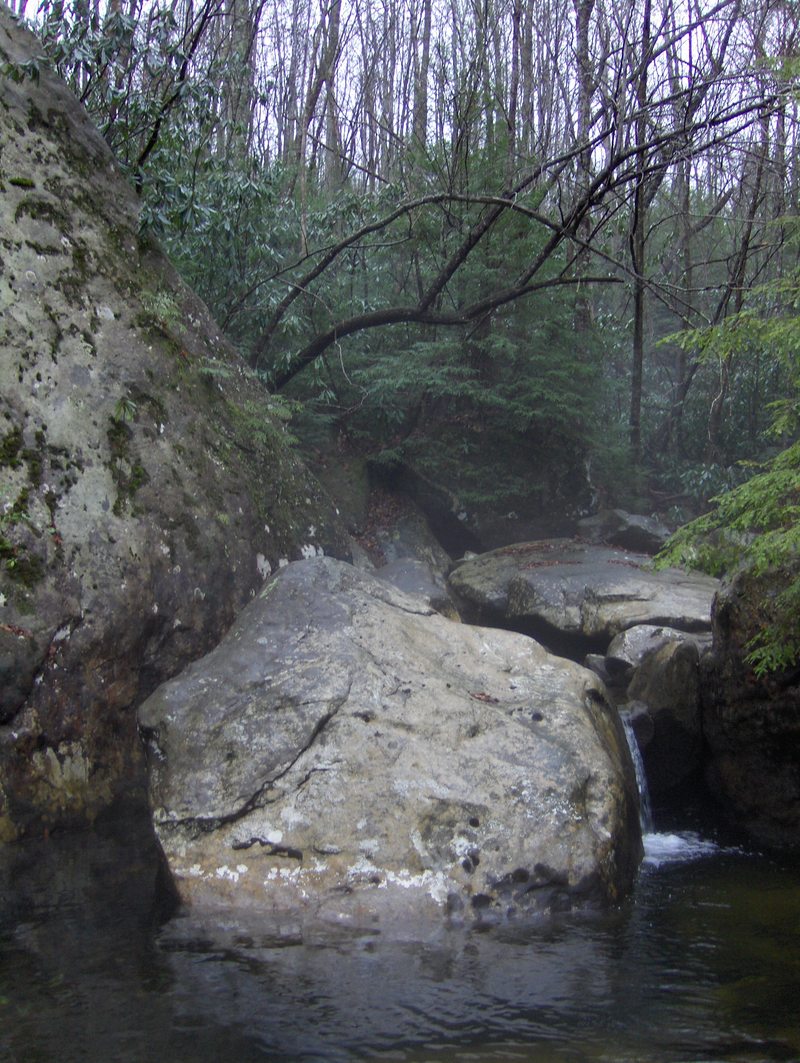
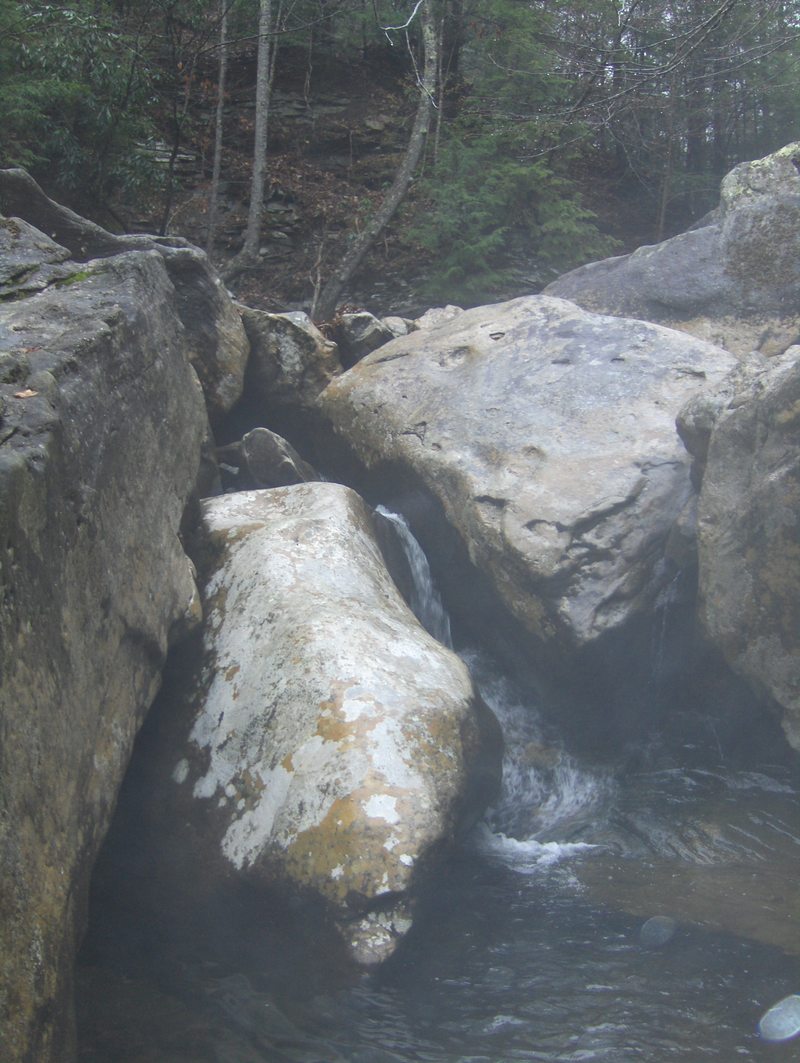
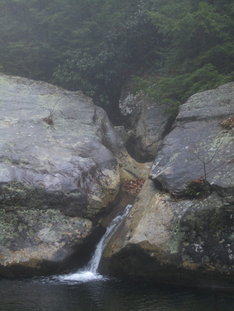
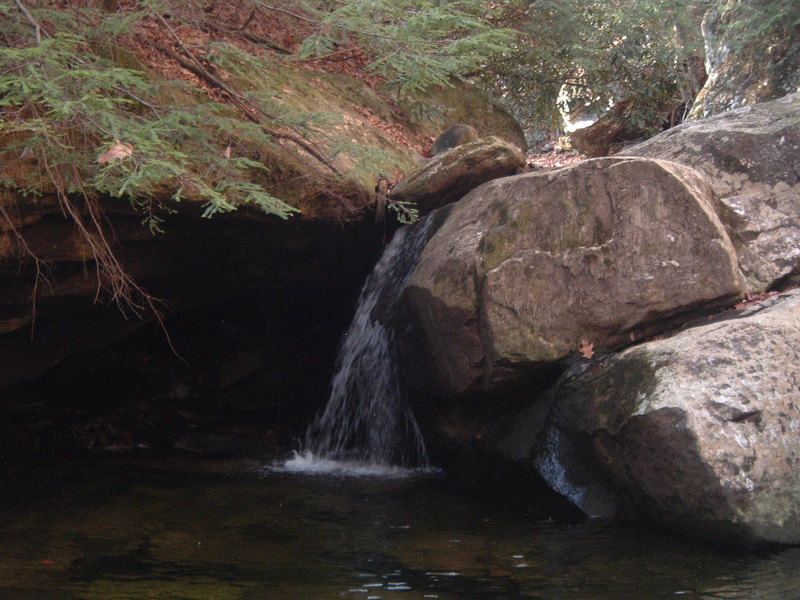
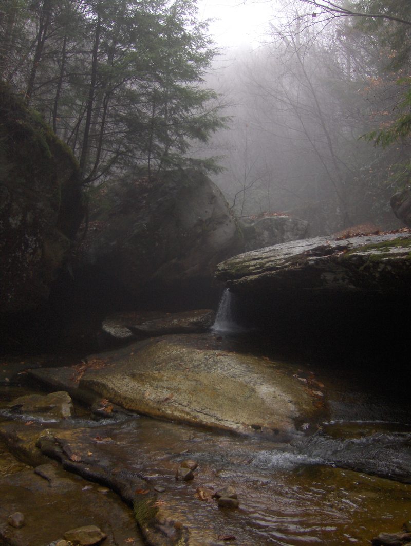
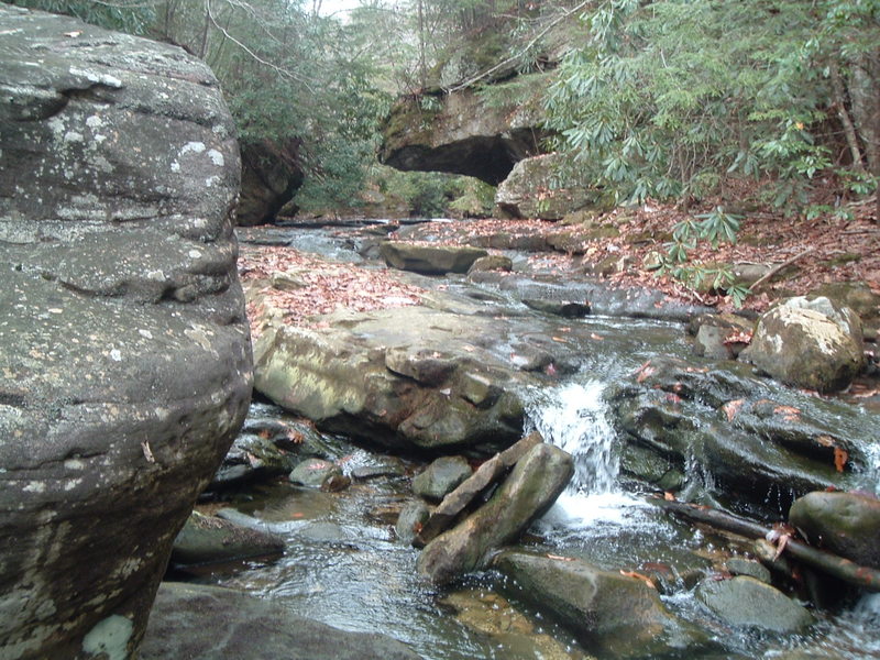
First, to the aesthetics. The water quality is better than some smokies runs. It was SO clear. The forest and canyon in general were very unspoiled. Overall, it meets and possibly exceeds the pristine qualities of really clean plateau runs like North Chick and Island Creek. The rock is horizontally bedded sandstone, just like further south. The entirety of the run herein described is withing the boundary of Martins Fork WMA.
The first drop is a slide of 12 feet, then the creek drops into the hardest rapid, The Holding Cell. This is the only one I walked on the whole run. It is class 5+ for sure, but totally good. Photo quality and safety mandatory. The next set was a series of ledgy drops within this continuous bedrock minigorge called The Catacombs. There were three tight drops of class 4+ difficulty, all stringed together. Even at low water this run blends quickly. After this was a quality boulder series with non stop moves of 3-5 foot drops, then the big one, Harlan County Two Step. Here the creek bottles up against the left wall and drops 7 feet into a cauldronous corridor before dropping down to the right off a 15 foot slot/falls into a mandatory meltdown and a little bit of a hole. This is the highlight rapid and really photogenic. This also marks the end of the really steep stuff, but the next half mile is still pretty solid. Right below a trib comes in adding a bit of flow, then boulder gardens kick start the lower. Soon you approach a long blind rapid where undercut overhangs exist on both sides of the creek. You definitely don't want to touch the banks here at The Unforgiven. Tight and fun, this one runs out into some low angle bedrock slides around some midstream monoliths. Next is a great 8-9 foot boof on the right that is just perfect. From here the creek tones down to normal class 3-4. I limboed one log, but didn't have to get out. There are a few slot boofs in the 5 foot range here and there, and a few ledges of the same height. Then right above where I took out was a really long and fast low angle bedrock slide that took 4 or 5 turns before pooling up. This lower "paddle out" was not boring, but a great ending with good stuff to the end.
I would say it is kinda like Little Clear Creek in TN on crack. And it is definitely the hardest and best run in KY(that I know of)! The section above where I put in has never been paddled, and would likely be many miles of beautiful and tiny class 2-3. There is a clean 15 foot waterfall further up in the headwaters, but I am not sure where it is located. Access would be up near the Hensley settlement, and LOTS of rain would be required to float the stream that high up, but it also might be a pretty good little overnight expedition, as when you got to the steep section you would want the water to drop. Good place to spend the night and paddle out in the morning.
Kirk Eddlemon
Check out the VIMEO video:
Martins Fork of the Cumberland from Kirk Eddlemon on Vimeo.
Rapids in this Run (2)
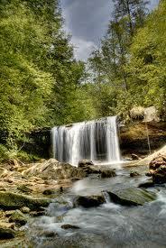
Waterfalls (4)
Hazards & Portages (4)
Caution: The following locations may require scouting or portaging. Always check current conditions.
Difficulty
Class V
Length
1.7 mi
Gradient
290 ft/mi
max 320
Rapids
2
4 Hazards
Access Points
Shuttle Info
It is a long drive from anywhere to access this run. It is on the north side of Cumberland Mountain in KY, about 25 miles east of Middlesboro, and 25 miles southwest of Harlan. You will have to consult a good map or better yet, googlemaps to find your way to the area.
River Right put-in
If coming from Middlesboro on hwy 987, you will cross over into Harlan County and a few miles later, begin descending to where Martins Fork eventually appears on your right, with downstream going the direction you are driving. Around a mile or less later, a little asphalt drive will branch sharply off to the right and back over the creek. Turn right here. Check the gauge at the bridge and continue back upstream on river right. You will pass a few homes, drive slowly. Then the road will immediately deteriorate to cobbly 4wd material. From here you will parallel the creek for a while until you are a ways from the residential area. A short distance further and just when the road starts to climb away from the creek, there is a spur down and to the right. Leave a car down this spur at the creek, as this is right below the last good section before the creek flattens out and chokes up with wood. Flag your car at the takeout from the stream so you know when to pull out. Due to the isolated nature of the the community below this access point, paddling on down through the little mountainside community is not advised. Be low profile and curteous.
From here, go back to the main trail and head up the mountain. There will be a few spurs coming off the line here and there, just stay on the obvious trail for around 2 miles. You will eventually reach a gate. Park, or better yet hike to this point. Then saddle up for around 1/2 mile hike to the top of the steep stuff, shortly in crossing a feeder stream. After crossing the feeder a few hundred yards in, veer right to head to the top of the steepest half mile. You will reach a crossing a few minutes later right at a bedrock slide. This is the easiest put in and the beginning of the class five.
There are possibly other options for access, this is just the most simple with one car, as the shuttle can be hiked with relative ease. Bring a zoomed in printed topo map so that you won't get lost. There could be access to the same put in spot from river left via a road that comes over the top of the mountain from 987, but this has not been verified as a viable access yet. Please note that this is the route the googlemaps link on this page has highlighted. The current route is to take Hemlock Branch Road up to the put in along river RIGHT! A final option is to use the access road to the Hensley settlement as a put in, but this would require very high water, a long shuttle, and would likely result in non recommended flows on the steep section.
......................................................................................................................
River LEFT put-in.
This option for a put-in to the Martins Fork is directly accessible from hwy 987, and is managed by the state of Ky. The directions are the same coming from Middlesborrow or Harlan, the only change is that you do not turn on to Hemlock Branch Road. From Harlan, stay on 987 until about a quarter of a mile past Hemlock Branch you will notice a blue gate on the left side of the road. From Middlesborrow you drive a quarter mile less than you would to the Hemlock Branch turn. The gate will be on your right. There is enough parking for a couple cars. This is where you start the hike. This option makes the trip about 3 river miles.
The first mile of the walk is a meandering logging road up to the top of Brush Mtn. There will be a few predominant forks in the trail, take the RIGHT forks, you need to be headed up and west. After about a mile you will reach the top of the hill, from there you will follow the ridge trail another mile, this section is pretty flat and easy to walk. You will come upon a fork in the trail, the left fork will have a blue gate just like the one at the parking and on the way up the hill. Take the trail with the blue gate, in about a third of a mile, it will lead you to the river.
This option is a little shorter than the river right trail and easier on the legs. You also add about a half a mile of class III and IV rapids and Quadrule Falls. Through the river right access you would not be able to run the falls and would be trespassing most of the hike.
The river left option however is more difficult for parties with a single vehicle, but totally good for a two car shuttle. Paddle down the river a bit more from the old take-out until you reach another blue gate on river left. Then follow the trail from that gate which leads to the hwy. From here you could walk a short ways to your car or have a shuttle ready at the end of the take out trail. The takeout is visible on the river side of the hwy, you will notice a large brown sign in the middle of the field that says Martins Fork WMA/SNA. Park roadside or down on the trail for the take-out shuttle.
Difficulty Classes
I Easy
II Novice
III Intermediate
IV Advanced
V Expert/Extreme
VI Unrunnable
Current Conditions
5-Day Forecast
Whitewater data from
American Whitewater
American Whitewater