D) Narrows Park to Conglomerate Falls (8 miles) Scenic
Gauge Conditions
Runnable: 2.8 – 4.6 FT
Almost certainly too low (<125cfs) for any real whitewater. We need your input! Help out your fellow boaters with a comment or report on flows.
Data from American Whitewater & USGS
Run Map
Put-in
Take-out
Rapids/Hazards
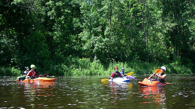
Scenic
Run Time Estimate
Select put-in and take-out to estimate time.
Plan This Trip
See wind-adjusted speed maps, forecast planning, and detailed time estimates.
Sign in to generate an AI timing estimate for this run.
Whitewater timing varies with scouting, portages, and group pace. Use as a planning baseline.
Description
Quick Facts:
Location: Western Upper Peninsula, MI, about 5.5 miles NNE of Bessemer.
Shuttle Length: 6.8 miles. (See details in "Directions" Tab.)
Character: Beautiful northwoods run. Mostly open easy rapids, finishing with a big drop.
Drainage: 200 sq.mi. (at gauge site 5 miles upriver).
* * *
_(Description based on one run, at 275 cfs.)_
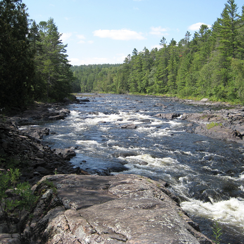
This run starts off with perhaps a mile of easy wide boulder-garden rapids with a few minor (at this water level) playable waves. At mile 1.5, Reed Creek enters from the left. Mostly flatwater continues until nearing the Copper Peak Ski Flying tower. (This can be used as an alternate put-in to cut off some of the (mostly uninteresting) length of the run. This would likely put you below the following described drop.)
Chippewa Falls (about mile 3.4), a somewhat technical, wide, boulder jumble drop (class II-III) of maybe 50 yards precedes a right-hand bend in the river. This was easily boat-scoutable. (Obviously, it is much more of a 'rapids' than a 'falls'.) A few random waves and holes follow before action subsides for a bit. At mile 4.0, Kirby Creek enters from the right, followed almost immediately by a backroad crossing.
Before long, the character of the river changes. Instead of the wide open grassy shores and red-granite boulder strewn stream (as it had been down to this point), you encounter an area of vertical walls and sloping bedrock drops with a couple random appearances of conglomerate, hinting at the character of the river in the lower reach. Again, at 275 cfs, all was boat-scoutable. A couple drops provided great surf opportunities. My guess is that with perhaps 1.5-2.0 times as much water (400-500 cfs or higher), some holes could become rather meaty, and provide (intentional or unintentional) rodeo activity. (I believe the main drop in this area is what is marked on maps as Algonquin Falls (5.7 miles). Again, it is much more of a 'rapids' (a quick sliding drop) than a real 'falls'.)
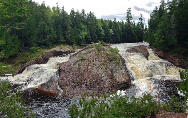
Quickly the river returns to its prior more pastoral state. At mile 7.0, a backroad nears on the left, and Sand Island Creek enters from the right. Mile 8.0 brings you to Great Conglomerate Falls, where a great dome of conglomerate rock divides the flow into three channels. At 275 cfs, it was quite easy to eddy out river right and carefully wade across the (relatively smaller) river-right channel to scout the main (center) channel. (With any appreciably increased flow it would be necessary to beach on the 'hump', which could become a bit unnerving at some flows!) A huge log blocked both the very small left channel and the somewhat larger right channel. The wide, main, center channel was clear, and provided a quite straight-forward slide into a surging, but not grabby hole at the base of the falls. Most of the group took out here, while two of us ran the twisted, rocky, short rapids immediately below before eddying out to carry back up the three-quarters of a mile trail to the parking area. (Ugh! Long hike!)
The following video (via YouTube, courtesy of "Duck Wild Producktions") shows a very-high-flow raft run of this section.
Click here for Part 1 of an article from the AW Journal, way back in 1981!
Click here for Part 2 of the article.
The article describes the following: Michigan's, Upper Presque Isle, Lower Presque Isle, Middle Black, Lower Black, Upper Silver, Lower Silver, Falls, and Rock; and Wisconsin's Lower Brunsweiler, Montreal Canyon, and West Branch Montreal.
Rapids in this Run (2)
Waterfalls (1)
Difficulty
Class II-III+
Length
8.5 mi
Gradient
24 ft/mi
max 52
Rapids
2
Access Points
Difficulty Classes
I Easy
II Novice
III Intermediate
IV Advanced
V Expert/Extreme
VI Unrunnable
Current Conditions
5-Day Forecast
Whitewater data from
American Whitewater
American Whitewater