Diamond Falls to NF Smith River Scenic
Gauge Conditions
Runnable: ? – ? CFS
Approximate reading: This gauge is 13.6 miles away on Diamond Creek. Use as a general reference only.
Data from American Whitewater & USGS
Run Map
Put-in
Take-out
Rapids/Hazards
Scenic
Recreational
Description
Wild and remote, Diamond Creek flows through the heart of the red rock peridotite country known as the Redrock Rainforest to join the North Fork Smith River just about one mile below the typical put-in point at Major Moore's Bridge. This means you get the full adventure of Diamond Creek (including getting to the creek) plus almost the full North Fork run. It's a full and amazing day of boating! It's even possible to extend the run another few miles by starting higher up on the North Fork of Diamond Creek.
Infrequently run due to the challenging drive in to the creek, most boaters opt to put in on the lowermost reach of North Fork Diamond Creek so they can start the day on the water by running the triple-drop of Diamond Falls. If getting the biggest thrill of the day straight out of the shuttle rig isn't your game, simply put in below it. North Fork Diamond Creek joins Diamond Creek proper not far below the falls.
This is a run fed by winter rain and, usually if there's been enough rain to bring up Diamond Creek, there's going to be some snow on the higher elevation portions of the drive in via Patrick Creek Road access. Don't underestimate the challenge: be prepared for snow and downed trees, rocks, and landslides on the drive. A skilled shuttle driver with knowledge of the area is key: you don't want to come back at the end of the day to retrieve your rig from the put-in and you also don't want to get lost out in this vastly remote landscape where you're likely the only human beings.
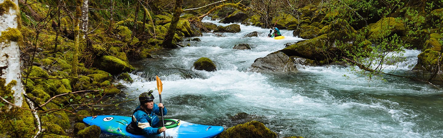
On the water, Diamond Creek is wide open for the first two miles below the falls with mostly Class II and III whitewater, flowing thorugh a sparse and recently burned forest. The red rock landscape is surreal. The lower two miles is where the Class IV rapids lie, descending into a tighter bedrock gorge on the way to join the North Fork Smith at a spectacular confluence complete with a waterfall cascading from a side stream into the confluence pool.
Rapids in this Run (3)
Difficulty
Class IV
Length
4.1 mi
Rapids
3
Access Points
Difficulty Classes
I Easy
II Novice
III Intermediate
IV Advanced
V Expert/Extreme
VI Unrunnable
Current Conditions
5-Day Forecast
Whitewater data from
American Whitewater
American Whitewater