Dinkey Creek to Main Kings Confluence
Linked via: Nhdplus discovery 90% confidence Synced 6mo ago
Gauge Conditions
Runnable: ? – ? CFS
Approximate reading: This gauge is 17.8 miles away on Kings. Use as a general reference only.
Data from American Whitewater & USGS
CDEC Flow Data California
Data from California Data Exchange Center (CDEC)
Run Map
Description
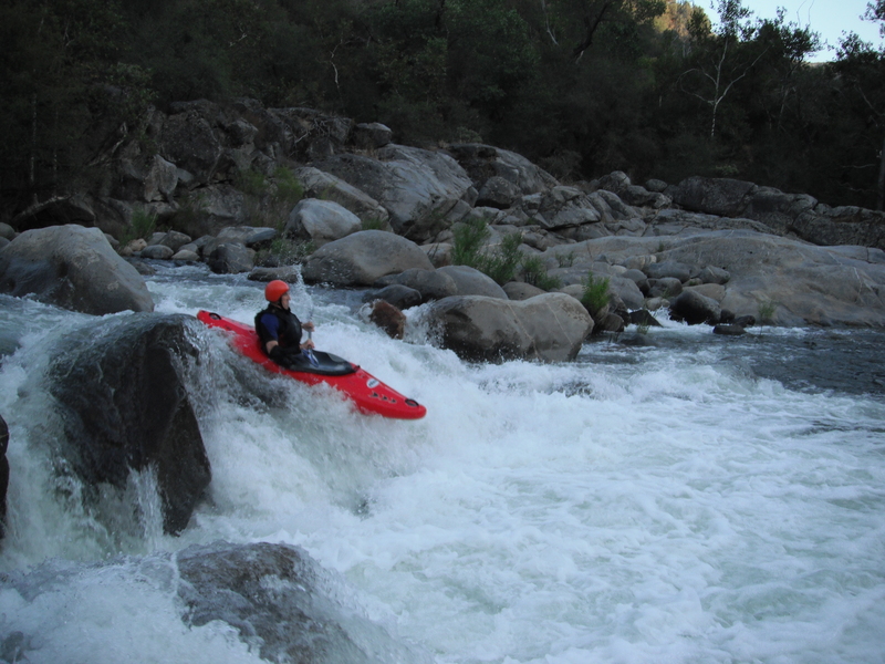
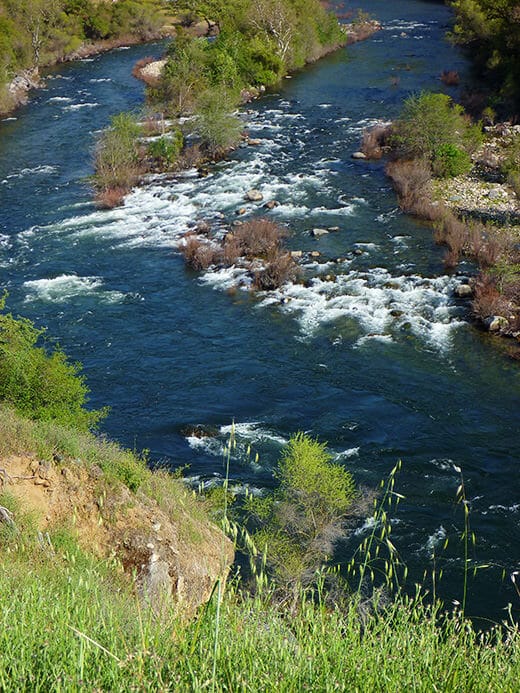
This is a pretty run with many bedrock drops, especially in the upper half. It has a long and dependable season from mid winter to memorial weekend or even mid June. Kayakers will sometimes run the NF at very low flows early in the winter before other runs in the area get going. Large winter rain storms will often bring the NF up to medium or even high runnable levels.
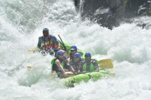
Normally all the water in this reach is supplied by Dinkey Creek, so most years flows may not go above 600 to 1,000 cfs.. In big years, Dinkey gets bigger and upstream dams on the N. Fork spill, so flows can climb to 2,000 or 3,000 cfs. Above 2,000 cfs the run is huge, with monstrous ledge holes. It is still mostly runnable but some of the lines are pretty sneaky over shallows, or worse, insanely narrow in the midst of the killer holes.
Most of the rapids are visible from the road, but a few are hidden by trees. Everything is scoutable or portagable at river level.
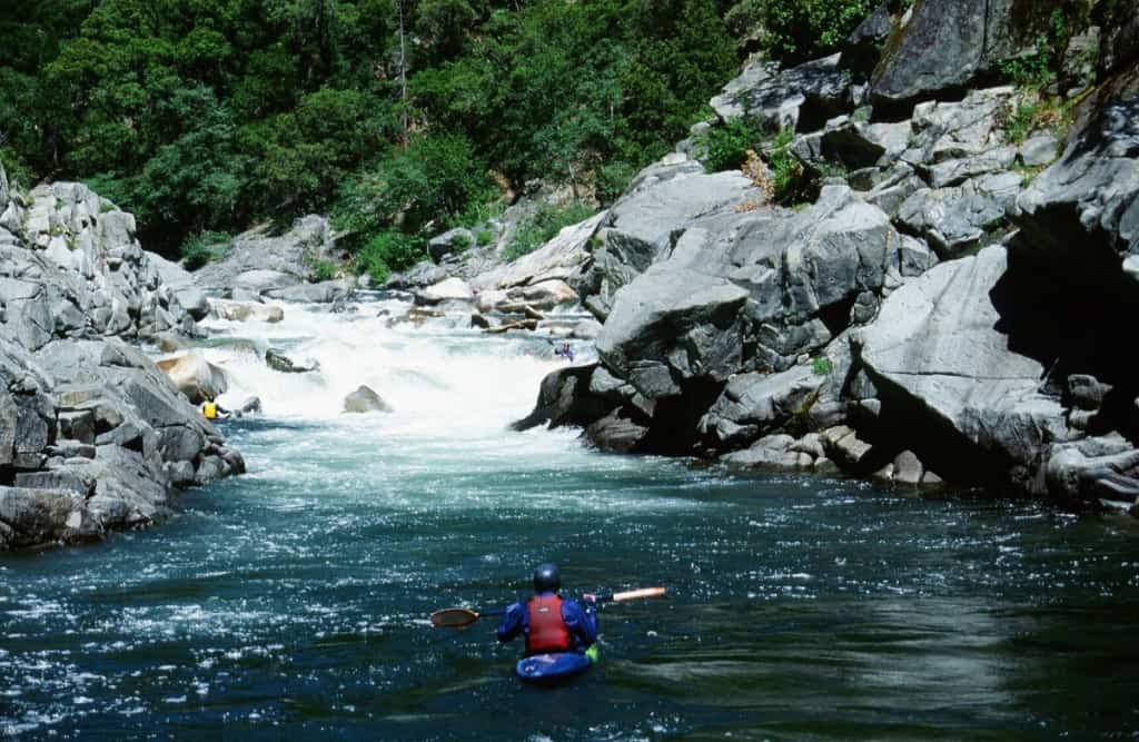
Last few hundred yards above the confluence with the main Kings was the site of the 1972 west coast Olympic slalom trials. This channel is an excellent technical slalom course even without gates and is worth a look by intermediate boaters not interested in the upstream class 5 rapids.
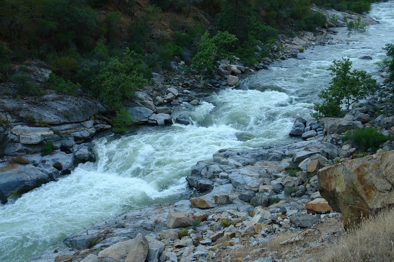
Every group seems to come up with their own names for rapids, but a few seem worth passing on. Driving upstream from the main Kings, the NF runs straight then bends sharply east. The rapids in this straight section are easy, but "Rock Pile" (4+) hides in the corner. A nice class 4ish rapid ends at the gauge in the middle of the straight section going east (driving upstream). "Red Rocks" is the obvious reddish ledge rapid where the river bends north again. "Three ledges" is an obvious name for the next big drop upstream. "Dewell's Demise" and "Furrow's Filet" are local names for the big drops continuing upstream. Chuck Stanley wrote about getting stuck in "Chuck's Leap" but I have never figured out for sure which rapid that might be since there are several reasonable candidates that will hold boats or swimmers. If your group has different names or additional names please write a comment in the comment tab.
Shortly into the run watch for a large oddly textured boulder on river right. It marks an 8 foot waterfall (perhaps Chuck's Leap) which is not visible from the road. Also in this section look for the steel bridge wrapped around a boulder. It was trying to make a highwater descent of this reach one year but just did not have the skills to pull it off unscathed. It should be a lesson to all of us.
This section of the N. Fork is often boated in combination with the short Dinkey Creek Balch Camp section, just upstream. The NF flows into the class 3 Main Kings: Banzai section so groups with both experts and intermediate boaters can camp together while paddling different sections. The Balch Afterbay section is also nearby. It often has boatable flows for a few weeks in January and sometimes in the spring.
Getting There: From Fresno take freeway 180 east, to its end, jog to Belmont Avenue and continue east. Belmont will curve and become Trimmer Springs Rd. Stay on Trimmer springs road all the way around Pine Flat Reservoir. As you go around the reservoir you will pass several marinas, and cross bridges over large two inlets formed by Sycamore Creek and then Big Creek. Eventually you will reach the Kings River and you will go past the Kings River Powerhouse with its large pipe carrying most of the water from the N. Fork Kings. Continue past Kirch Flat Campground, cross a concrete bridge to the south side of the river, then cross the noisy steel Bailey Bridge back to the north side of the river. Stay on the paved road going left at this bridge. In 100 yards you will reach the canyon of the N. Fork Kings.
Take out: You can leave a car at the NF and main confluence or downstream anywhere along the main Kings. google map.
Put-in: Continue 3 miles along the paved road and you will reach Balch Camp, a PG&E residential camp for workers who run the nearby powerhouses and dams. You can park before you cross a bridge and carry a short ways along the river left to the nice pool at the confluence with Dinkey Creek. There are nice flat slabs on the left side of this pool. Alternatively drive across the first bridge then turn left down into a clearing between Dinkey and the NF. This gives a much shorter carry but more awkward put in. google map.

Click To Play

Click To Play
Local Clubs:
For more information on this and other local paddling areas, contact these local clubs: SJPaddlers, NEW Kayak Club, or Gold Country Paddlers.
Online:
You can get more information from California's Whitewater Community at boof.com.
FERC information:
The Balch Project, #175, licensed 4/18/1980 to 4/30/2026
Haas-Kings River Project, #1988 , licensed 3/6/2001 till 2/28/2041


Rapids in this Run (7)
Waterfalls (1)
Hazards & Portages (1)
Caution: The following locations may require scouting or portaging. Always check current conditions.
Difficulty
Class V
Length
3.0 mi
Gradient
90 ft/mi
Rapids
7
1 Hazard
Access Points
Shuttle Info
The paved shuttle road follows the river from the take-out to the put-in. You can see a lot of the rapids from the road, so expect to stop frequently to enjoy the view. The road is fairly level, so it makes an easy and very nice bicycle ride or shuttle.
The map below sends you off on an all day journey instead of the 4 minute drive on pavement next to the river. It seems that a short section of the paved road from Kirch Flat campground to a short ways up the NF Kings, must not show up in the google road database.


Difficulty Classes
I Easy
II Novice
III Intermediate
IV Advanced
V Expert/Extreme
VI Unrunnable
Current Conditions
5-Day Forecast
Whitewater data from
American Whitewater
American Whitewater