Effinger (VA 251) to Buffalo Forge (VA 70)
No sufficiently local live gauge linked. 1 automated match was excluded because the closest is 66.5 miles away. Difficulty and route details are not current water conditions.
Run Map
Run Time Estimate
Select put-in and take-out to estimate time.
Plan This Trip
See wind-adjusted speed maps, forecast planning, and detailed time estimates.
Sign in to generate an AI timing estimate for this run.
Whitewater timing varies with scouting, portages, and group pace. Use as a planning baseline.
Description
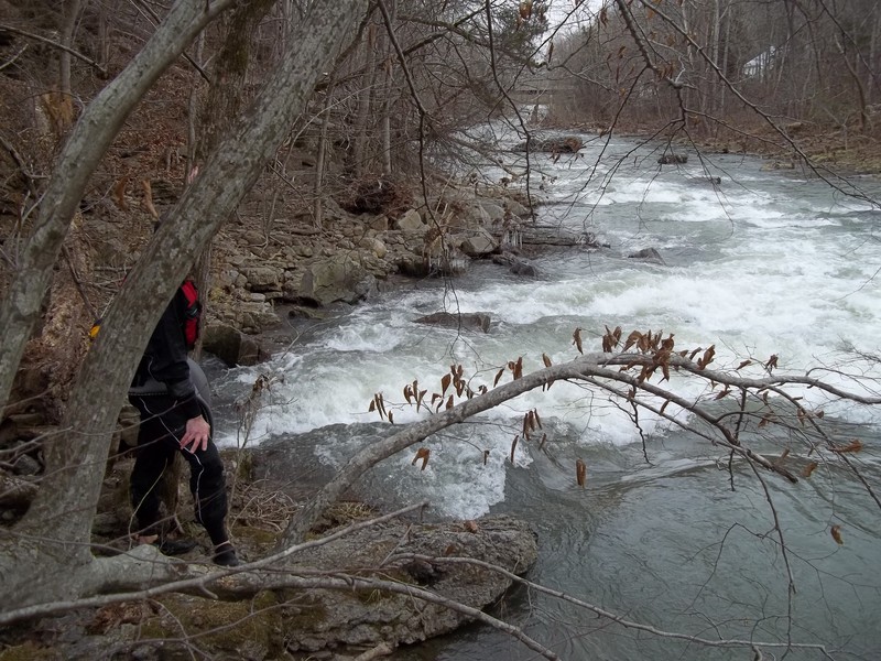
This run usually begins on Colliers Creek at the Effinger Fire Department. Usually the Fire Department is very quiet. Park away from the building and be respectful. It is possible to put in further upstream on Colliers Creek at higher levels. About 1/4 mile downstream of the put-in, Colliers Creek merges with Buffalo Creek which comes in on river right.
The first takeout possibility is at the Route 251 bridge at Murat on river left. Obey posted signs and stick close to the bridge. Do not block the gravel driveway that goes down to the creek. The run can be extended down to the low bridge at Mateer Road (Rte. 670). This bridge must be portaged to continue downstream. This section of the creek can have questionable water quality during boatable flows due to the large dairy farm that a feeder creek passes through.
The next low bridge occurs at Zollmans Mill Road (Rte. 674). It may be possible to run under this bridge at lower levels, but portage is probably needed. There are several more low bridges further downstream on the run that will require portage. Most of these will offer good options to set shuttle for put-in or take-out depending on the desired run length. The final take-out is prior to where Buffalo enters the Maury River on Millers Landing Road at a concrete driveway low-water bridge.
There is an online gauge for this section at the following website http://water.weather.gov/ahps2/hydrograph.php?wfo=rnk&gage=murv2. 3.7 feet on the Buffalo Creek Murat gauge would be considered kayaking zero level with significant bumping on the Colliers Creek portion. Above ~4.5 feet you will be able to put together a longer run with more of Colliers Creek upstream.
See Also:
_Classic Virginia Rivers,_ Ed Grove (1992 ed), p. 198.
_Virginia Whitewater_, Roger Corbett (2000 ed.), p. 229.
_Exploring Virginia's Waterways_, Ed Gertler (2022 ed.), p. 164.
Rapids in this Run (1)
Difficulty
Class I-II+(III)
Length
11.0 mi
Rapids
1
Access Points
Difficulty Classes
I Easy
II Novice
III Intermediate
IV Advanced
V Expert/Extreme
VI Unrunnable
Current Conditions
5-Day Forecast
Whitewater data from
American Whitewater
American Whitewater