Ellicott Rock - Bull Pen Bridge to Burrell's Ford Wild
Gauge Conditions
Runnable: 225.0 – 1,500.0 CFS
Due to an arbitrary decision by the Forest Service, the river is not boatable unless the river has previously exceeded 350 cfs the same day.
Data from American Whitewater & USGS
Run Map
Put-in
Take-out
Rapids/Hazards
Wild
Scenic
Recreational
Description
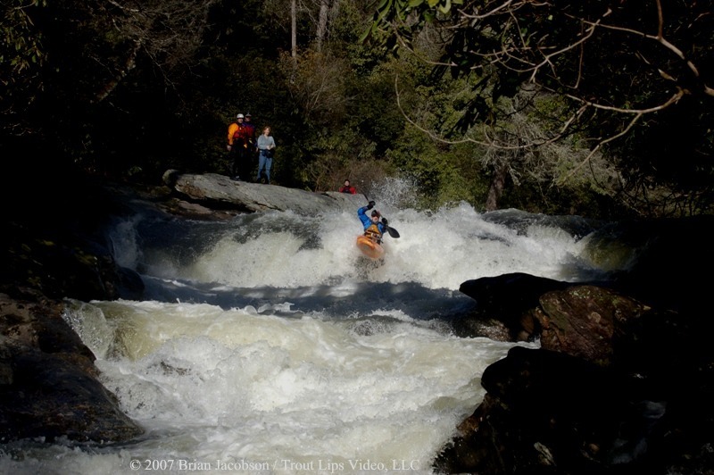
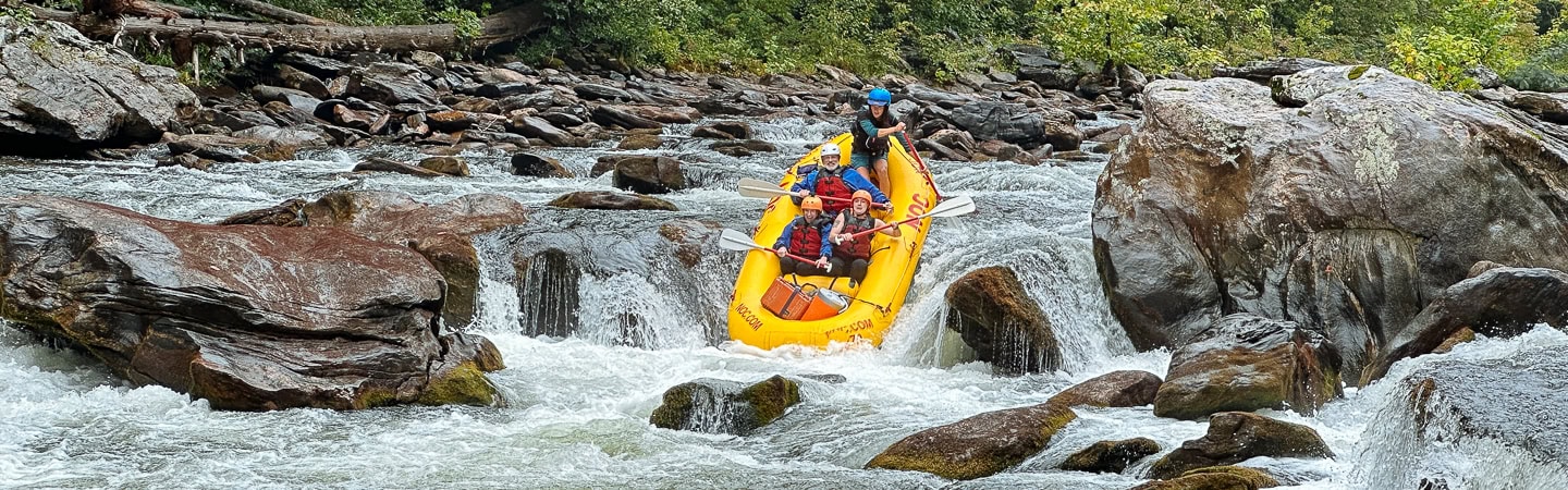
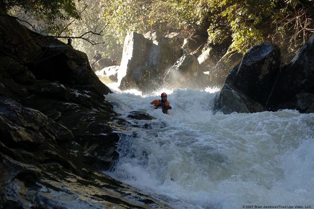
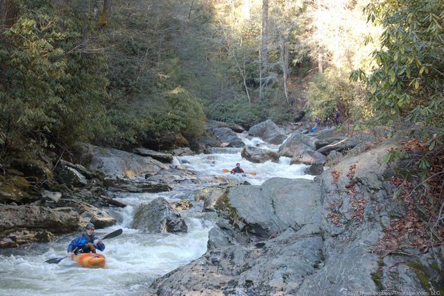
The five mile long Ellicott Rock reach, also known as Section 0, starts with a Class V drop at Bull Pen Bridge that defines the end of the Chattooga Cliffs reach and the beginning of the Ellicott Rock reach. You can put in above or below this rapid, the second hardest on the run. The two or so miles immediately below Bull Pen Bridge to Ellicott Rock are read-and-run, Class IV, with a series of ledge drops and boulder-filled rapids. Approximately 2 miles into the run is Super Corkscrew, the only other Class V rapid on the run. The rapid is a long series of off-set ledge drops with increasingly powerful hydraulics and a shallow, short run out. The rapids below Super Corkscrew extending down to Ellicott Rock are similar to those above Super Corkscrew; the rapids are a combination of Class III-IV ledges and boulder fields. The run requires about 2 hours assuming you move quickly through the last three miles of Class II shoals above Burrell's Ford.
This section does not have the unique scenery found on the Chattooga Cliffs or Rock Gorge reaches in that the views are limited due to the narrowness of the riverbed, however the whitewater is exceptional. It is noteworthy in that it passes through Ellicott Wilderness and has few trails paralleling the river allowing boaters to enjoy the run with little chance of encounters until you reach the Ellicotts Rock trail.
This section (as well as the sections immediately up and downstream) is subject to some draconian limits by the Forest Service.
1. Paddling is allowed between December 1 and April 30, on days when flows have hit 350 cfs or higher.
2. An on-site permit must be filled out: Bull Pen Bridge or Burrell's Ford (GA side) both have permit stations.
3. Strainer removal is prohibited. Please leave wood as you find it, even if it adds a portage. For more information about woody debris in rivers go to Large Woody Debris and Stream Ecology
AW has been working for a decade to bring responsible, nationally consistent river management to the Chattooga that does not include these unique restrictions, and this work continues today. The river was totally off limits to paddlers for 37 years prior to numerous appeals and litigation by AW and our partners.
Learn more about the run from this video and Trip Report from the USFS sanctioned boating study.
Emergency Locations
Bull Pen Bridge
N35°00.938'
W83°07.589'
Super Corkscrew
N35°00.784'
W83°06.872'
Ellicott Rock Trailhead
N35°00.050'
W83°06.515'
Burrell’s Ford Bridge
N34°58.401'
W83°06.933'
Reach Profile

Related Reaches
Chattooga Cliffs (AKA Section 00)
Rock Gorge (AKA Section 1)
Rapids in this Run (4)
Difficulty
Class III-IV+(V)
Length
5.3 mi
Gradient
67 ft/mi
max 154
Rapids
4
Access Points
Shuttle Info
**Shuttle Directions**
Start at Burrell’s Ford bridge. Return on Burrell’s Ford Road 2.6 miles to Hwy 107, turn left and go north 6.1 miles and turn left on Bull Pen Road (County Road S-1102), follow Bull Pen Road 5.1 miles to Bull Pen Bridge. Burrell’s Ford Road is approximately 10 miles north of the intersection of Hwy 107 and Hwy 28 in Mountain Rest, SC
Difficulty Classes
I Easy
II Novice
III Intermediate
IV Advanced
V Expert/Extreme
VI Unrunnable
Permit Required
Permit must be obtained at Green Creek Trail, County Line Trail, or Bull Pen Bridge in NC, Burrell’s Ford Rd (GA side of the river), Warwoman Campground (FR 86) and Overflow Creek in GA, or Hwy 28 boat landing, Low Water Bridge, Earl’s Ford, Sandy Ford, Fall Creek, Thrift’s Ferry, Hwy 76 / Bull Sluice lot, and Woodall Shoals in SC.
Get Permit
Current Conditions
5-Day Forecast
Whitewater data from
American Whitewater
American Whitewater