Flat Rock Dam
Gauge Conditions
Runnable: 500.0 – 4,000.0 CFS
Data from American Whitewater & USGS
Run Map
Run Time Estimate
Select put-in and take-out to estimate time.
Plan This Trip
See wind-adjusted speed maps, forecast planning, and detailed time estimates.
Sign in to generate an AI timing estimate for this run.
Whitewater timing varies with scouting, portages, and group pace. Use as a planning baseline.
Description
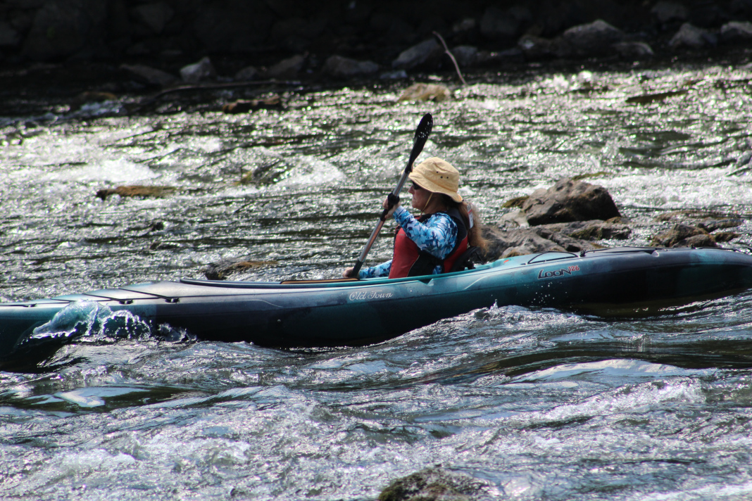
5/22/05:
We paddled our kayaks over a 20 ft waterfall/dam illegally on the Schuykill, just upstream of Philly. You can see the dam from Rt 76. Super fun. That is a record for me and waterfalls. Gotta lean in towards the dam and brace on which ever side you're leaning your boat. Kinda scary from the top, but going over the edge felt like going down a body slide at a waterpark. Real smooth. Got it all on video.
As always, be very careful around dams. \[Edited\] It has been illegal to run Flat Rock Dam since 1997 and contrary to reports, the Philadelphia Canoe Club does not have any permits to run Flat Rock Dam.\[/Edit\]
There are several miles of of Class I-II whitewater from here to the Belmont Avenue Bridge. Anne's Rock Rapid, which offers good high-water pop-ups, is just upstream. Then there's another mile of flatwater to the Canoe Club, which is at the junction of Wissahickon Creek and the Schuylkill. The club is just off Ridge Avenue, before the entrance to the Schuylkill expressway.
Rapids in this Run (1)
Waterfalls (1)
Hazards & Portages (1)
Caution: The following locations may require scouting or portaging. Always check current conditions.
Difficulty
Class I-IV
Length
3.3 mi
Rapids
1
1 Portage
Access Points
Difficulty Classes
I Easy
II Novice
III Intermediate
IV Advanced
V Expert/Extreme
VI Unrunnable
Current Conditions
5-Day Forecast
Whitewater data from
American Whitewater
American Whitewater