Footbridge Trailhead to Milepost 12: The Narrows Run
Gauge Conditions
Runnable: 900.0 – 7,000.0 CFS
Data from American Whitewater & USGS
Run Map
Run Time Estimate
Select put-in and take-out to estimate time.
Plan This Trip
See wind-adjusted speed maps, forecast planning, and detailed time estimates.
Sign in to generate an AI timing estimate for this run.
Whitewater timing varies with scouting, portages, and group pace. Use as a planning baseline.
Description
The Wilson is a whitewater gem of the Oregon Coast. During the winter rainy season it runs after each storm comes in from the Pacific. In the summer it dries to a trickle between swimming holes. It flows west through a bed of dark gray basalt and a cloud-shrouded wonderland of mossy coastal forest. The Wilson River's upper reaches are less than an hour from Portland, and it flows through the Tillamook State Forest in the Coastal Range down to the Tillamook, a dairy town whose name is adopted from the Salish tribe of the region.
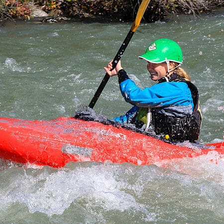
If you launch at the Footbridge Trailhead you shove off into a big recirculating eddy then drop into the basalt formations with a waterfall coming in from the left. The highway might be up there but you won't notice it. The rapids are mostly easy class III in character with lovely swooping moves to be made and smallish playspots everywhere. There is one sheer horizon on a left bend that makes a stomping big hole but there is a tongue past it on the far left side. There are lots of smaller horizons that open up to easy rapids once you get close enough.
The most difficult rapid on the Narrows Run is (of course) the Narrows. At high flows the Narrows jumps up in difficulty and danger more than the rest of the river, hence people often take out above it or launch below it when the flows are over 2,000cfs or so. Putting in at the Footbridge Trailhead sets you up for ~5 miles of warmup before you get to the Narrows. You'll know you're getting close to the Narrows when the highway is visible on the left for a mile or more.
You'll know you're at the Narrows when the river ramps downhill into a narrow gorge reminiscent of Mule Creek Canyon on the Rogue. By the time the river reaches the 90 degree left bend most of the gradient is spent, but wood does catch here, as well as around the bend. Your best plan is to get a recent wood report from local sources. If you don't know the wood status of the Narrows, it would be smart to scout on river right. I'm told it's possible to portage on the right as well. It's also possible to eddy out after the corner and above the narrowest pinch point.
Below the Narrows there is a recovery pool at least at lower flows. Not far downstream the river bends right and a bigger creek cascades in on the left. This is the beginning of the Ledges, a fine surfing section. Big dogs work their way down the center and left, catching each wave or hole on the way down. More conservative boaters can cling to the right side of the river to avoid the big stuff.
At the bottom of the Ledges boaters tend to pile up in the last eddy on the right above the horizon line. This is Yard Sale. At low water the only clean line is on the right. At medium and higher the middle fills in and becomes runnable. Some class IV-ish creek slots on the left look runnable but you might want to scout before you try those. At some flow the giant hump of a boulder center left must have just the right flow on it to be an incredible boof. Let us know when you figure that out.
Below here there are a few more great surf waves, and then it gets really flat for a while and there are houses lining the left bank. There's one more rapid, at the Milepost 12/Hwy 6 bridge takeout. Takeout Wave is good at a wide variety of flows. Land on the rocky outcrop river left below the rapid to find the steep trail back up to the highway.
Much of this section heads west toward the winter sun. If you are so lucky as to catch a sunny day, you will wish you had sunglasses. The weather often changes from one side of the Coastal Range to the other. It can be cold in Portland and warm on the coast, or the opposite. It's worth checking conditions on the coastal side before heading that way in the winter.
Logistics: Oregon Highway 6 parallels the river and although you can't easily see the most challenging rapids from the highway you can get an idea of the general character of the run.
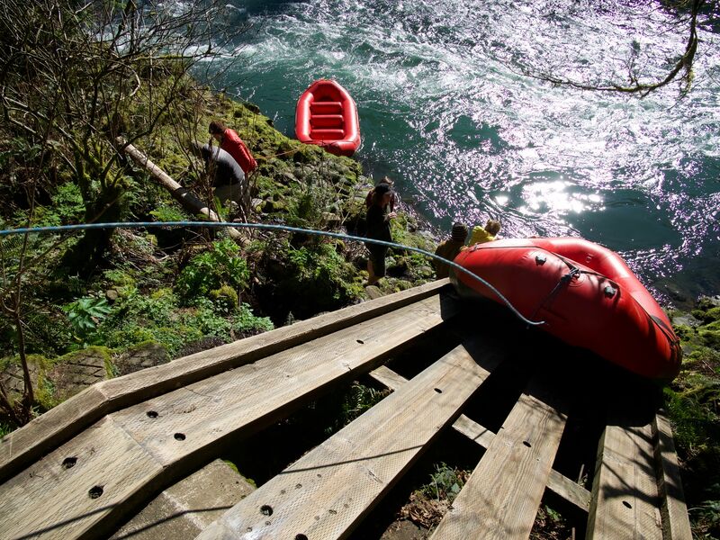
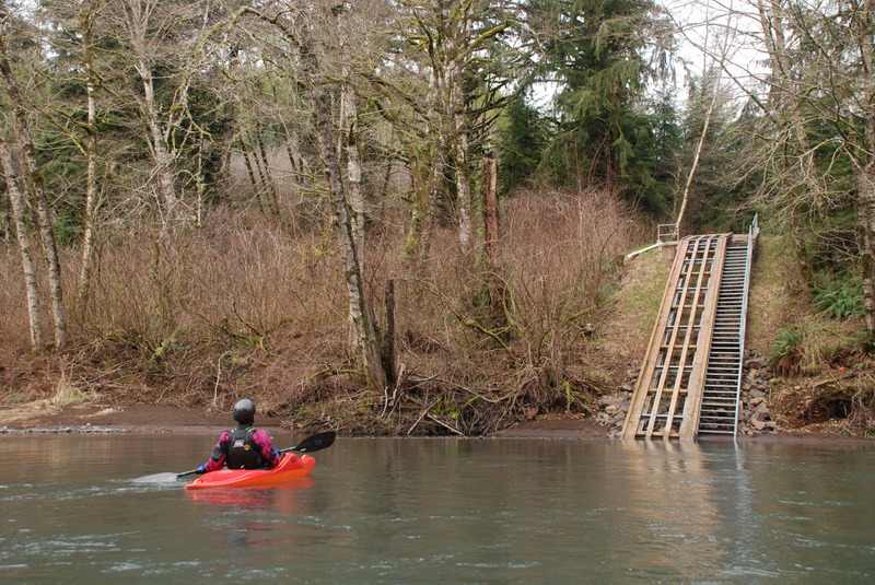
There is an access point less than a mile above the Narrows near Milepost 15. It is a narrow pull-out alongside the highway and not a great place to hang out. Turning around to go back upstream involves driving downstream to the pull-out at the curve, where you can see farther. Milepost 15 is used as a takeout when flows are too high for the Narrows, and as a put-in by some who float down to Milepost 8, the Siskey Boat Launch. Often used by fishermen to launch drift boats, Siskey Boat Launch has a boat slide. The turn-off for this access looks like a driveway from Highway 6 and is easy to miss. There is an alternate take-out at mile post 7 where a short drive and fisherman's trail head down to the river.
Difficulty
Class III
Length
8.3 mi
Rapids
4
Access Points
Difficulty Classes
I Easy
II Novice
III Intermediate
IV Advanced
V Expert/Extreme
VI Unrunnable
Current Conditions
5-Day Forecast
Whitewater data from
American Whitewater
American Whitewater