FR 2920 Bridge to FR 2918 Bridge
Gauge Conditions
Runnable: ? – ? CFS
Approximate reading: This gauge is 16.6 miles away on Sol Duc. Use as a general reference only.
Data from American Whitewater & USGS
Run Map
Interactive run map
Loads as you approach this section.
Description
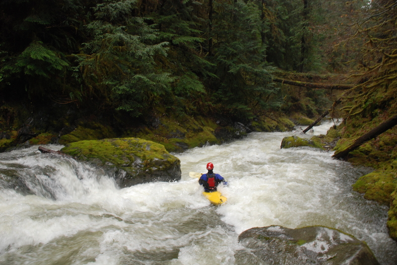
This is a fun river when flows are moderately high but not flooding and you have water to fill in the boulder gardens. It generally runs on winter storms and features constant action all the way to the confluence of the Sol Duc, a distance of 1.8 miles. It's one of those runs that packs plenty of action into a short distance. At the confluence you can either head back upstream for another lap or contine for another mile on the Main Sol Duc through a great section as you come out just upstream of the Ledge Drop and the gage station. This run can be a great option if you arrive to run the Sol Duc in mid-winter and find the gate to the National Park road locked.
You can get an idea of flows as you cross the South Fork at its confluence at the bridge on Forest Road 2918. If you've got enough water to bounce down through these boulder gardens under the bridge across the South Fork, the gorge section will still be really fun. If the rocks are all covered and the river is high you'll probably have your hands full in the gorge. Look for something in between.
The run starts out with continuous boulder gardens and short little ledges for about a mile or so. You'll be moving fast and the eddies are tight. Some years the rivers is clean but other years it is choked with wood so stay alert and keep your spacing as you may have to make a portage or two.
As the bedrock walls rise up on both sides of the river you enter the gorge. The gorge has about 5 great rapids with the entrance rapid and Ross's Drop standing out as the most challenging of the sequence. These drops are mostly IV+ with good recovery sections in between but at higher flows this whole section becomes class V. Expect to encounter a couple of holes. Use caution as portaging can be difficult and log hazards can be significant.
The gorge walls slowly peel back with more fun class III rapids and a beautiful waterfall that cascades in from the left, before you reach the confluence of Tom Creek. The FR 2918 Bridge and the confluence with the Sol Duc is just around the corner. The river then dumps into the main stem and you can enjoy a final section of the Upper Sol Duc run.
Access Logisitics: From Highway 101 mile 216.4 turn south on FR 2918. Follow this road to mile 3.0 and the bridge across the Sol Duc. You can use this as a take-out if you are running the main Sol Duc or find an access downstream closer to Highway 101 for a longer run. To reach the put-in continue up FR 2918 (bear left at the fork) and get a visual peak at the level from the bridge at mile 4.1. This is the take-out if you are just running the South Fork. Continue on up to mile 5.5 and turn right on FR 2920. It's 0.2 miles to the bridge across the South Fork.
for additional information see
- Korb, G. 1997. A paddlers guide to the Olympic Peninsula. third edition.
- Pacific Ranger District, North - USFS Olympic National Forest web site
Rapids in this Run (2)
Difficulty
Class IV+
Length
1.7 mi
Rapids
2
Access Points
Difficulty Classes
I Easy
II Novice
III Intermediate
IV Advanced
V Expert/Extreme
VI Unrunnable
Current Conditions
5-Day Forecast
Whitewater data from
American Whitewater
American Whitewater