GA SR 135 in Echols Co. to Fla SR 150 on the Alapaha
Gauge Conditions
Runnable: 63.5 – 75.0 FT
Likely low. River may be paddled, but rapids may be marginal.
Data from American Whitewater & USGS
Run Map
Description
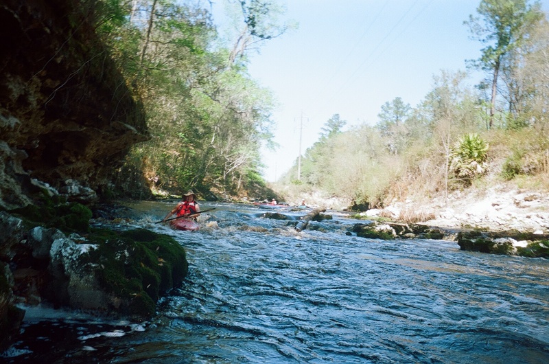
Runnable nearly all year, this section is swift with few obstuctions. The rapid occurs about .5 miles below the abandoned bridge halfway into the run. At low water there are two distinct sets of Class II drops. As the water level rises, the two drops merge into one ledge/wavetrain.
Downstream, just above the confluence with the Alapaha, look for Turket Creek entering on the right. At low levels this is a 12' waterfall into a beautiful grotto. At high levels (heavy local rains) this drop turns into a pretty radical Class III-IV creeky double drop.
_Thanks to Dan Webb for this description._
Playspots (1)
Difficulty
Class II
Length
3.0 mi
Rapids
0
Access Points
Difficulty Classes
I Easy
II Novice
III Intermediate
IV Advanced
V Expert/Extreme
VI Unrunnable
Current Conditions
5-Day Forecast
Whitewater data from
American Whitewater
American Whitewater