Euchre Bar to Mineral Bar Wild
Gauge Conditions
Runnable: 500.0 – 2,500.0 CFS
Data from American Whitewater & USGS
CDEC Flow Data California
Data from California Data Exchange Center (CDEC)
Run Map
Put-in
Take-out
Rapids/Hazards
Wild
Run Time Estimate
Select put-in and take-out to estimate time.
Plan This Trip
See wind-adjusted speed maps, forecast planning, and detailed time estimates.
Sign in to generate an AI timing estimate for this run.
Whitewater timing varies with scouting, portages, and group pace. Use as a planning baseline.
Description
History:
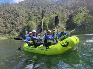
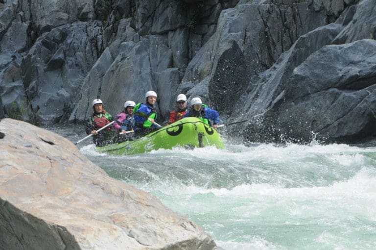
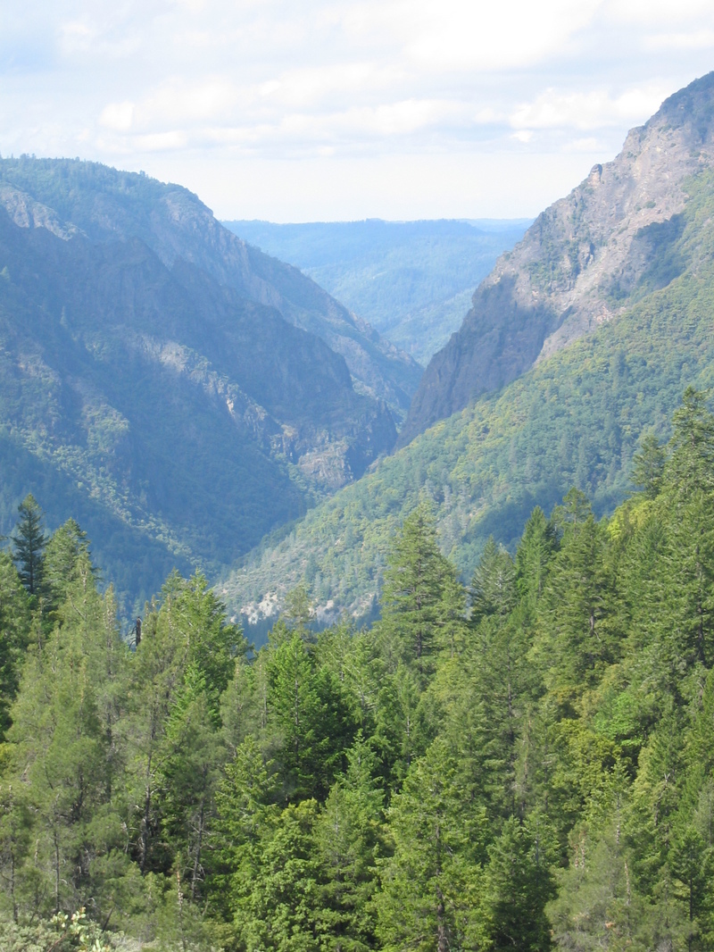
The Run: Giant Gap is a California classic run with great canyon wilderness scenery and two spectacular vertical walled gorges. Its down side is that it has inconsistent difficulty, and were there easy mid-run access, it would likely be paddled as two different sections. It can be paddled as a two day run but that is uncommon as most groups choose to meet very early at the Colfax-Iowa Hill Road campground to set shuttle. An 8am meeting here should see a group off the river by 5pm with a leisurely pace which is fine in May but a problem in January.
From the put-in boaters are faced with a 1.5 mile, 1700 foot descent down a well defined trail that contours and switchbacks down to the river. This trail starts rocky but quickly becomes leaf covered and common practice over the years has had boaters tying a sling to front and rear grab loops and dragging (or being dragged) to the river which should take about 40 minutes. Whilst poison oak lines the brush either side, the trail its self is free from any vegetation. The trail hits the river at the Euchre Bar footbridge by a large slow moving pool.
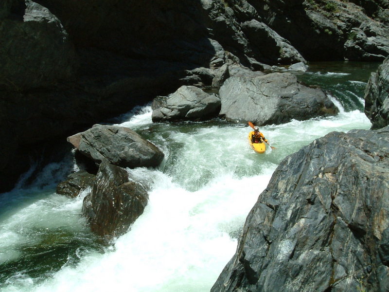
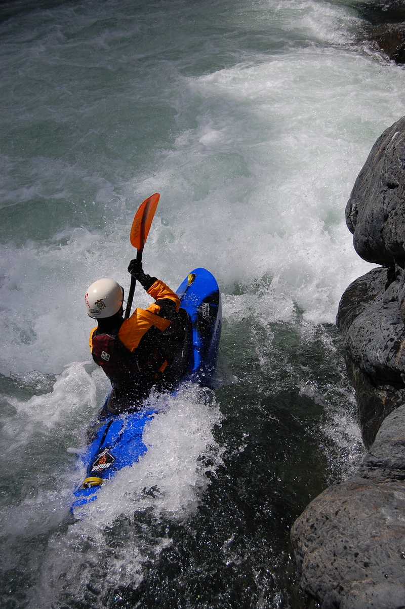
Moving downstream the run is immediately class III water and quickly enters the first vertical walled gorge, which in wetter months can have a spectacular waterfall running down the wall. No harder rapids are encountered in this gorge, just the odd larger hole and the river emerges into the open space of Green Valley and eases to class II/III. Giant Gap can be seen approaching downstream, a narrow gorge between 2000 foot rock faces. Just before entering Giant Gap proper a rapid with undercut house sized rock center is encountered. A large tree trunk had been pinned to this rock for many years until it was washed downstrem in Dec 2010 floods.
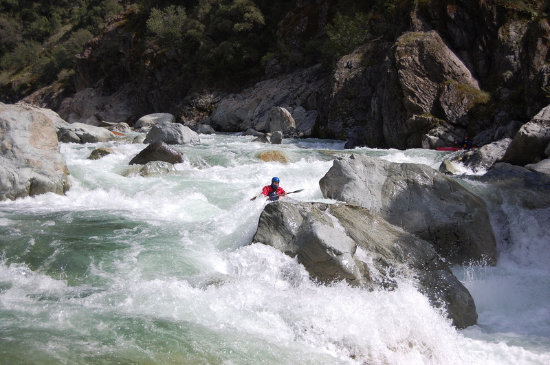
As Giant Gap is entered the difficulty climbs to class IV, and _Grater_ is encountered, a congested shallow rapid whose blind line is not immediately apparent but is generally run far left then back to centre. The left side of Grater was changed for the worst in Dec 2010 high water, becoming a little more manky. Soon after an obvious horizon line with right side cliff and headwall is encountered, frequently with sunlight clouds of water vapor for added atmosphere. This is _Nutcracker_, the first class V, a rapid that leaves most people grinning and is simply run down the gut crashing through the wave holes. Easy water for 200 yards leads to an eddy against the right wall under the cliff face with a view of two midstream rocks. This is the scouting eddy and possible portage for Locomotive falls. The water in the eddy is shallow at reasonable flows, and an easy rock climb (5.3) must be made to gain a ledge on the river right. At moderate flows most teams just run without safety, staying right and running a tongue visible at the last second hard right over the final drop. It seems that in general Locomotive Falls is somewhat easier as of 2007 with the tongue being more pronounced and the typewriter effect left being less pronounced. A pool and large eddy lies below the drop, but at higher flows a swimmers equipment can easily be swept downstream into Five Alive rapid leading to a formidable problem in this vertical walled section with little walkable shoreline. Difficult class IV or easy class V rapids (depending on flow) continue for some distance with many possible good lines. When in doubt, sneak lines left almost always seem to yield successful outcomes. The scenery eventually opens out into steep wooded canyon again, but the difficulties are not over.
Class V- _Dominator_ lies about river mile 5 and is heralded by a large boulder garden with most flow going left and a downstream cliff visible on the left. The conservative scout is immediate along the rocky right shore for 100 yards. The committed scout is from a left side eddy immediately above the last drop. Dominator was changed in early 2009 when the rock that formed the final boof over hole move collapsed making the rapid easier but less aesthetic. The line now runs just to the left of a large boulder in a steep banking left turn with no significant hole. At higher water a class IV sneak can be worked the whole length of the rapid far right but it is shallow and pinning is a real possibility. Fun rapids continue class IV for sometime but eventually gradually ease. A great lunch spot lies about river mile 6 by a right side waterfall.
Somewhere in the middle of the run a steep class III rapid is found to have a large under cut center rock which has caught many people out and caused more swims than might be expected. Otherwise the next eight miles are largely class II/III water with the odd surprise hole and great scenery.
Around mile 14 alert paddlers will have already observed subtle changes to the geology and suddenly a large long rapid, _Pinball_, is encountered. This rapid has the look, hazards and feel of downstream Chamberlain falls rather than Giant Gap, and an eddy on the left at the top can be caught. A quarter mile downstream the takeout is found river left.
Put-in: Euchre Bar trailhead, google map.
Euchre Bar google map
Take-Out: Colfax-Iowa Hill Rd. google map
See also: California Creeks, Preston Holmes,
. Cassady & Calhoun, Holbek & Stanley, Martin, Penny
Rapids in this Run (5)
Hazards & Portages (2)
Caution: The following locations may require scouting or portaging. Always check current conditions.
Difficulty
Class IV-V
Length
14.4 mi
Gradient
54 ft/mi
max 120
Rapids
5
1 Hazard
1 Portage
Access Points
Difficulty Classes
I Easy
II Novice
III Intermediate
IV Advanced
V Expert/Extreme
VI Unrunnable
Current Conditions
5-Day Forecast
Whitewater data from
American Whitewater
American Whitewater