Gorge
Gauge Conditions
Runnable: ? – ? CFS
Approximate reading: This gauge is 6.0 miles away on Trout Creek. Use as a general reference only.
Data from American Whitewater & USGS
Run Map
Run Time Estimate
Select put-in and take-out to estimate time.
Plan This Trip
See wind-adjusted speed maps, forecast planning, and detailed time estimates.
Sign in to generate an AI timing estimate for this run.
Whitewater timing varies with scouting, portages, and group pace. Use as a planning baseline.
Description
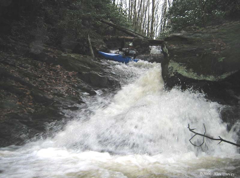
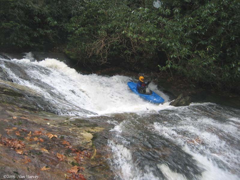
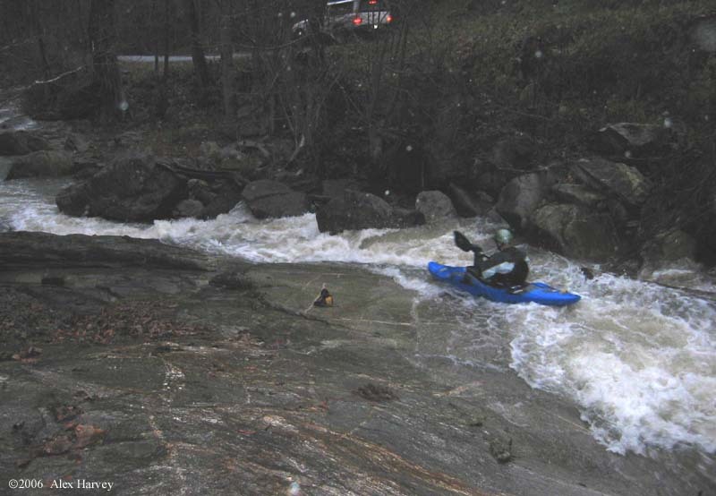
Trout Creek is a tiny creek that does not run often. But when it does it is worth the effort. Here is some beta: Drops ~980 feet in 2.5 miles alongside Trout Creek Road. See the map in the photos/videos section below for directions. There are numerous homes along the creek, some residential, some vacation so exercise good judgment and be friendly. Beginning section is the steepest at an estimated 660 feet per mile for 0.6 miles, ending with the tentatively named Anoxia Falls. Anoxia Falls is a monster drop of five cascades dropping an estimated 80 feet. It is very runnable. Onion Cliff Falls is downstream which should be looked at on the way up for prior exit points. The gorge ends with a steep, technical section not dissimilar to the Lower Rocky Broad, but steeper and tighter. From the run in the photos on this page, it had rained 2.0 to 2.7 inches at the AWFS Jackson County rain gauges 1866, 1880 and 1880 in the previous 12 hours. It was very bony in spots but still good. If anyone has any information on previous runs, names of rapids, etc please contact the streamkeeper.
Rapids in this Run (3)
Difficulty
Class IV-V
Length
2.4 mi
Gradient
400 ft/mi
max 660
Rapids
3
Access Points
Difficulty Classes
I Easy
II Novice
III Intermediate
IV Advanced
V Expert/Extreme
VI Unrunnable
Current Conditions
5-Day Forecast
Whitewater data from
American Whitewater
American Whitewater