Green River Reservoir to Lamoille River
Gauge Conditions
Runnable: ? – ? CFS
Approximate reading: This gauge is 6.7 miles away on Green River (Lamoille Trib). Use as a general reference only.
Data from American Whitewater & USGS
Run Map
Interactive run map
Loads as you approach this section.
Run Time Estimate
Select put-in and take-out to estimate time.
Plan This Trip
See wind-adjusted speed maps, forecast planning, and detailed time estimates.
Sign in to generate an AI timing estimate for this run.
Whitewater timing varies with scouting, portages, and group pace. Use as a planning baseline.
Description
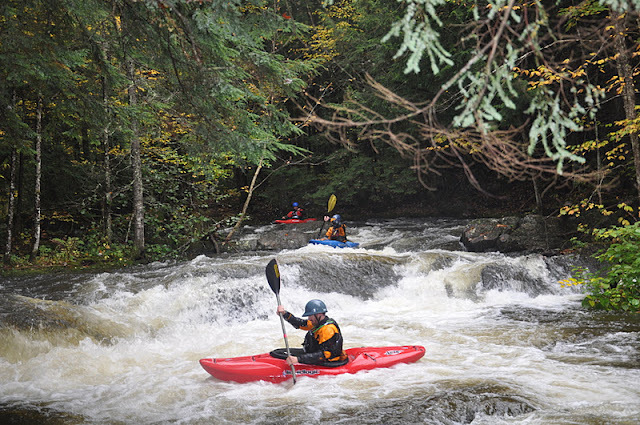
The Green River is a dam release Class IV and V creek run currently being analyzed through the FERC dam relicensing process. There are two distinct sections. The first is the Upper Class I/II Section from the dam down to just above the putin culvert for the Lower Class IV/V Section.
The Upper Green River (Class I/II):
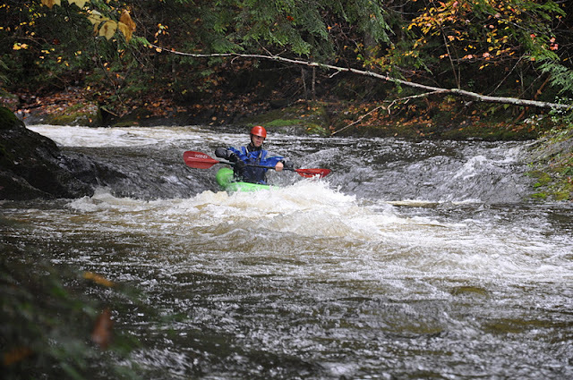
The river itself, tiny and no more than 30 feet wide, starts directly below the dam in a gorge of sorts where the toes of the valley walls end directly at the water’s edge. They aren’t vertical bedrock but steep enough that you notice how “V” shaped the valley is once you put on the water. Approximately 200 yards down from the foot of the dam is a very nice river wide play wave with decent eddy service on river right. This is far and away the largest whitewater feature on this stretch of the river. Below this play wave the river flattens and becomes moving water down what feels like a hallway, beautiful. After some meanderings and a few riffles, you pop out into the first of three wetland complexes, complete with sedge meadows, beaver lodges, and tannin laden water probably loaded with some big old brown trout. The river meanders through the meadows backing on its self several times before you run into the next pinch in the hillsides, where there is a set of class I/II- riffles leading to the next open sedge-wetland complex. There are three of these open areas and pinches in total before the river necks down and you are channeled in moving water for the final stretch. You will see a VERY low green bridge that is hard to limbo, even in a kayak, so if you are uncomfortable in tight places eddy out on river right and portage or use this as your take out. The actual take out is a short stretch downstream on the road side (river left) of the river across from the stick flow gauge. CAUTION – make sure to take out at this location because just below is a class V rapid into a culvert and 40 foot unrunable falls.
This stretch of river makes for a nice short moving water paddle and is benign enough for even recreational boaters to enjoy the scenery while paddling. Fishermen, birders, and wild life enthusiasts take note – this makes a nice alternative to the reservoir with different geography.
The put in is a slog down to the river (could use some improvement). Instead of driving to the Green River Reservoir access area you stay straight on the road to the dam. You will it a “T” where there should be a cable across the road proper to the dam. Park up at the pull off and carry down to the fence where the power house is. Where the road curves along the fence to the right go left and look for a draw that you can hike/climb down. Put in and enjoy.
The take out is road side on the access road to the reservoir recreational area and directly across from the stick flow gauge (river right). Unless you would rather take out at a green access bridge that you would likely want to portage anyways.
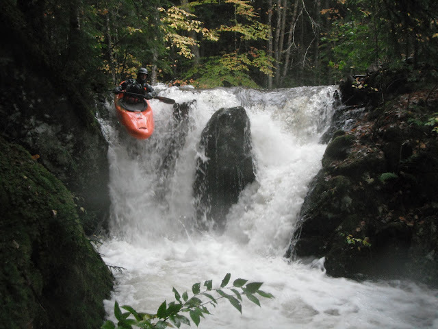
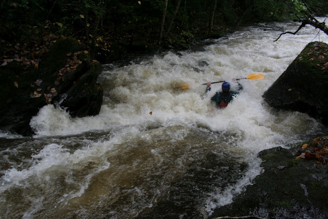
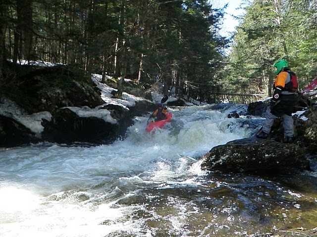
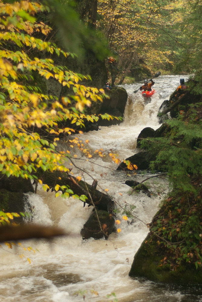
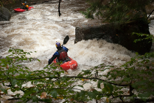
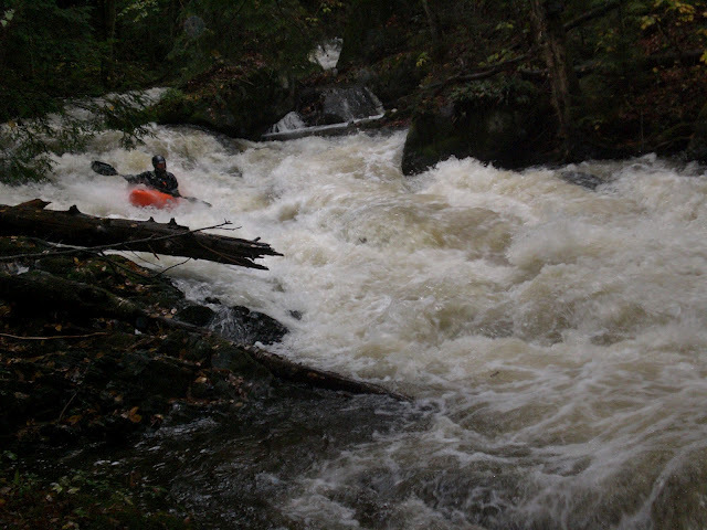
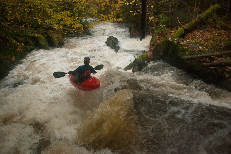
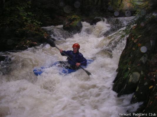
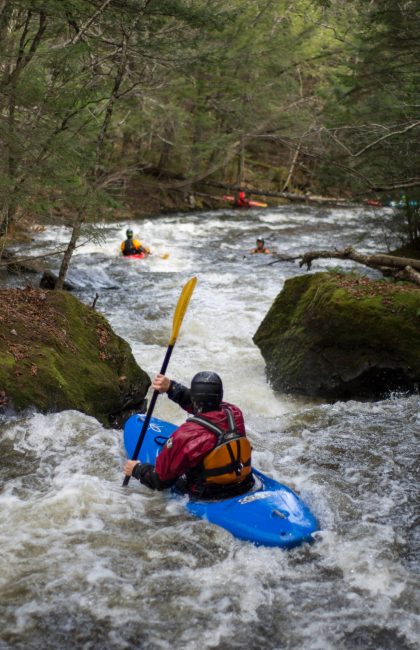
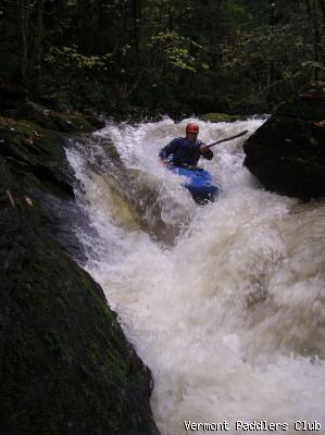
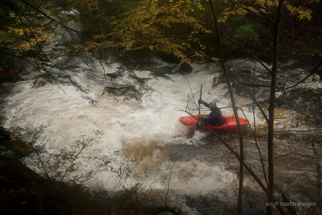
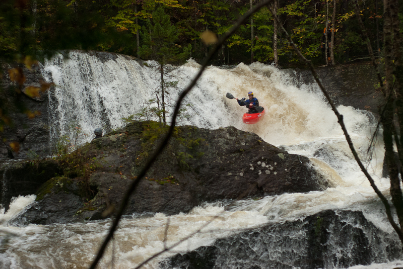
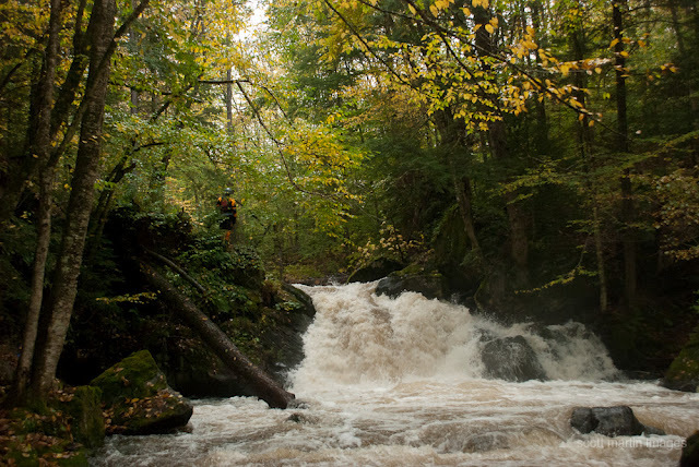
The Lower Section (Class IV/V):
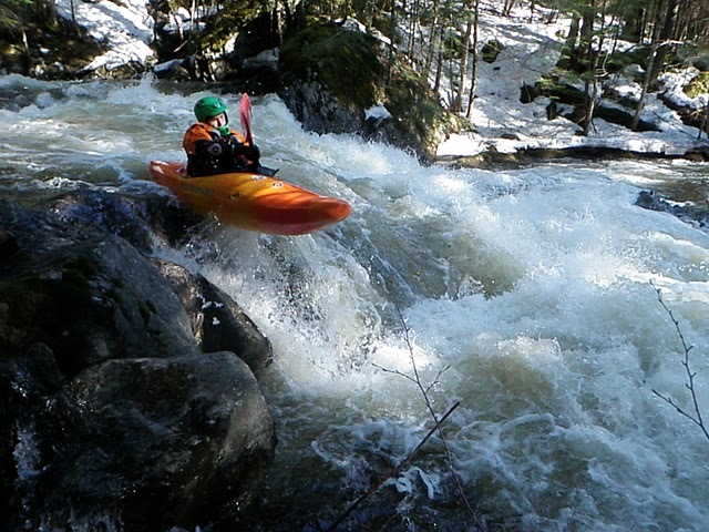
The Green River drops about 400 feet over the 2.75 miles from the Garfield Road to Route 15 and in to the Lamoille River. The river meanders through an uninhabited, deeply wooded area with several exceptional gorges, falls and drops that provide an exceptional opportunity for whitewater boating. The upper part of the river has a gentler slope dropping about 150 feet over the 1.6 miles from the dam to the Garfield Road. The rapids are many and some are pretty stout (3 - Class V's). All are scoutable and easily portaged.
Put In: Below the culvert under Garfield Rd, River left. First place you can. Moonshine (Class V) and Plop Plop Fizz Fizz (Class 4- sneak) both come up quickly (1/4 mile). Scout both.
Take Out: _Until further notice_: Due to some conflicts with parking at the bridge (the used car/junkyard business and power pole), please continue to the confluence of the Lamoille and paddle an additional mile to the Lamoille Fishing Access area on Rte 15. Any and all new information about the parking at the take out will be posted here as well as the Vermont Paddlers Club message board and the Northeast Paddlers Message Board. Communication channels are open and until a solution has been arrived at and agreed to, please be considerate and on your best behavior!
The river gauge is on downstream river rt. abutment of the bridge.
Rapids in this Run (14)
Waterfalls (2)
Difficulty
Class IV-V
Length
3.0 mi
Rapids
14
Access Points
Difficulty Classes
I Easy
II Novice
III Intermediate
IV Advanced
V Expert/Extreme
VI Unrunnable
Current Conditions
5-Day Forecast
Whitewater data from
American Whitewater
American Whitewater