Harvest Rd to McLeansville Rd
Gauge Conditions
Runnable: 100.0 – 1,300.0 CFS
Uncertain as to bottom limit.
Data from American Whitewater & USGS
Run Map
Run Time Estimate
Select put-in and take-out to estimate time.
Plan This Trip
See wind-adjusted speed maps, forecast planning, and detailed time estimates.
Sign in to generate an AI timing estimate for this run.
Whitewater timing varies with scouting, portages, and group pace. Use as a planning baseline.
Description
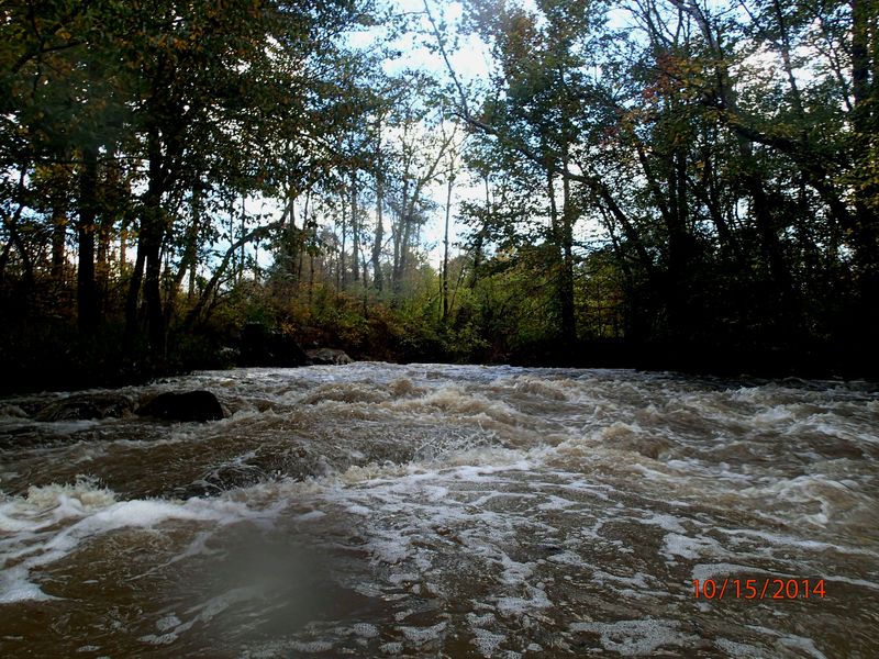
Buffalo Creek starts as a north and south fork on the eastern side of Greensboro. Due to large amounts of runoff from an urban environment, this reach is runnable almost anytime there is significant precipitation in the city. This runoff also provides a steady supply of plastic bottles. Generally, there are enough periodic flows to keep strainers from being a constant worry.
This first reach is very accessible and offers one small Class II rapid if the water is up. Shuttling is easy and can be done with vehicles, walking, or biking.
The put-in at Harvest Road is impossible to miss as there is a moderate S-curve where the bridge is. Pull off on the northwest shoulder and walk your boat in on the southwest side, upstream side of the bridge. Very easy spot to gear up and slide in.
The float starts off with a nice Class I run and then predictably pauses for a stretch before finding several more easy riffles. This continues and there is one almost fun rapid before going under Dicks Mill Rd.
Just after passing under the bridge, the creek begins bending to the left and you can start to see and hear the "Dicks Mill Rapid". There's nothing remarkable about this rapid, but there is a slightly retentive ledge just to the right of center about a 1/3 of the way through the rapid if flows are between 300 and 800. This is about the only "playspot" on the run that could be mildly entertaining and it is possible to hike back to the road from here.
After this, the creek continues to provide the occassional riffle, but otherwise provides a relaxing float. The North Fork joins up just before the McLeansville Road bridge. To avoid kudzu and briars at the take-out: pull out on river right and hike up the DOT boulder field on the upstream side. Cars can be parked on the eastern shoulder, southern side preferred for egress.
Playspots (1)
Difficulty
Class I(II)
Length
1.4 mi
Gradient
12 ft/mi
max 18
Rapids
0
Access Points
Shuttle Info
From Greensboro: Take Wendover / 70 / Burlington Road east until you pass the 840 loop. Cross the RR tracks and turn left (north) on McLeansville Rd. Take this past the Post Office and take the first road to the left: Harvest Road. Creek is approximately 0.8 miles.
Difficulty Classes
I Easy
II Novice
III Intermediate
IV Advanced
V Expert/Extreme
VI Unrunnable
Current Conditions
5-Day Forecast
Whitewater data from
American Whitewater
American Whitewater