Hatchery Ford to above Upper Mesa Falls
Gauge Conditions
Runnable: 1,000.0 – 3,000.0 CFS
Data from American Whitewater & USGS
Run Map
Description
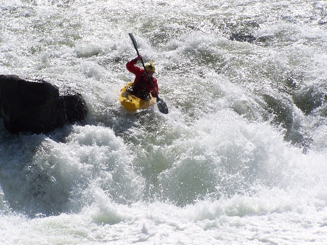
This run is a beautiful canyon consisting of mellow class II-III whitewater and three class V drops.
The old Idaho guide book describes this as a scenic run with three portages. Other people think of it as a fun run with three good rapids and some flat water. Either way it is beautiful and worth the effort. Also, generally runs all season.
From Hatchery Ford to Sheep Falls there is a class III rapid called 'Chips flip'.
It is one mile from hatchery ford. It always has wood on the left so run it right.
Portage Sheep Falls river right.
We call the second drop 'Son of a Sheep Falls'. The put in for the portage is right after this. Follow the trail down a small cliff to a big ledge to another small cliff. The climb down is is worth it and lets you hit almost everything after son of a sheep falls. The place you stand is always in water from 6 inches to a foot and a half deep but its always there. Its safe and almost always is in an eddy.
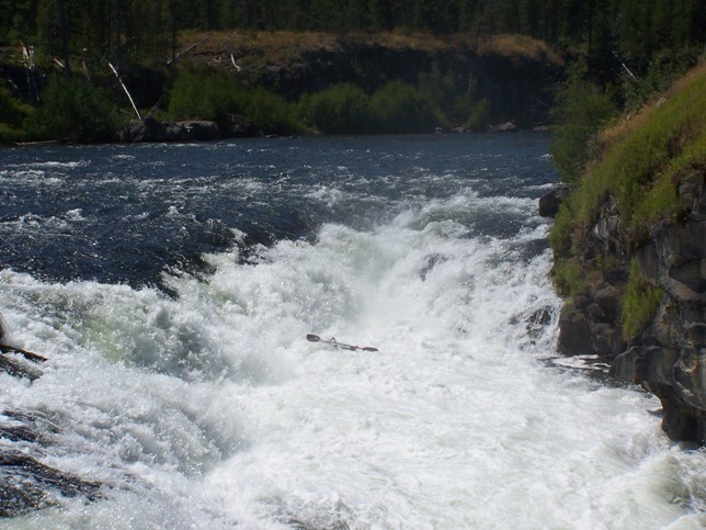
Mile 3.0 is Toilet Bowl rapid. It's short but its really swirly at high water and less so at lower water. If you catch it right its really fun and if not it flips you.
At mile 4.0 is Cottam's Curve. At lower water levels the line is left with a hard curve to run to miss wrap it rock. This is really only hard for rafts. At levels above 1600 CFS you can run the rapid anywhere.
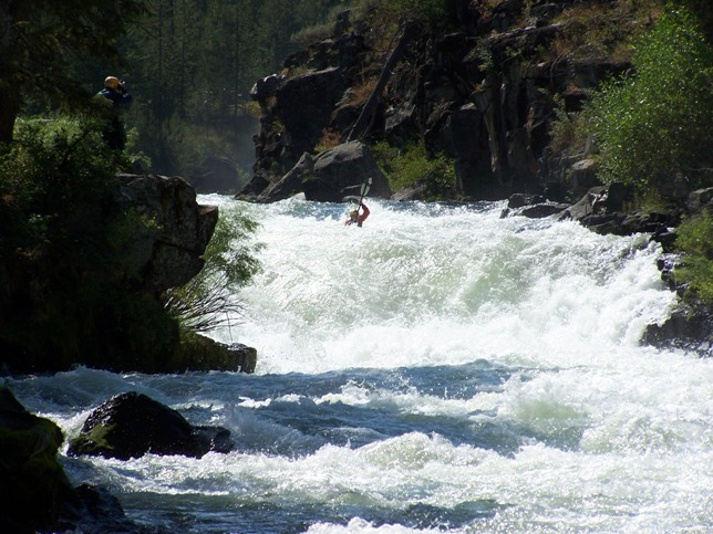
The third drop is called Gun Site Falls since you line up the boof rock and go for it. The bypass is on the right and there is a clear trail there and the best place to scout the rapid.
From Mile 5.2 to 6.1 is a long series of wave trains called screaming eagle because there always seems to be bald eagles there.
An alternate put in for the run is to put in right at Sheep Falls.
Sheep falls road is signed of highway 20 approximately 15 miles from ashton near mile marker 370. Follow the road down till you come to forest road 760 and turn left there. The road dead ends to a trail that is a short 10 minute walk downhill to sheep falls. You bypass all the slow stuff and chips flip and get straight to the action.
See G. Amaral, _Idaho: the Whitewater State_ (Watershed, 1992).
Rapids in this Run (2)
Hazards & Portages (1)
Caution: The following locations may require scouting or portaging. Always check current conditions.
Difficulty
Class III+(V)
Length
6.9 mi
Gradient
44 ft/mi
Rapids
2
1 Hazard
Access Points
Difficulty Classes
I Easy
II Novice
III Intermediate
IV Advanced
V Expert/Extreme
VI Unrunnable
Current Conditions
5-Day Forecast
Whitewater data from
American Whitewater
American Whitewater