Headwaters to EFLB (2 miles)
Gauge Conditions
Runnable: ? – ? CFS
Approximate reading: This gauge is 11.9 miles away on Sandy Springs Hollow. Use as a general reference only.
Data from American Whitewater & USGS
Run Map
Interactive run map
Loads as you approach this section.
Run Time Estimate
Select put-in and take-out to estimate time.
Plan This Trip
See wind-adjusted speed maps, forecast planning, and detailed time estimates.
Sign in to generate an AI timing estimate for this run.
Whitewater timing varies with scouting, portages, and group pace. Use as a planning baseline.
Description
Note: The combination of Steep banks and storms tend to clog the creek with wood from time to time, so keep look out.
Put-in: Go North on County Road 8872 from Hwy 16 for 1.7 miles and take the road to the right to descend the hill. At the bottom, follow to the left and park at the end. (elevation ~1850). This road is no longer maintained and may have wash-outs as it descends the hill.
Take-out: Option 1) Carry up the road at the put-in for the standard EFLB run. This road is passable for an ATV.
Option 2) Paddle down the main East Fork Little Buffalo to Murray. This run will be kickin' and offer some big water features near the bottom. Be on the look out for Johnson's Falls.
The creek is the cousin of Barberry Creek which is located on the West side of Heydenrich Road and joins Sandy Springs/EFLB at the standard putin for the East Fork Little Buffalo run.
Sandy is mainly boulder drops with a few bedrock drops, Barberry is mainly bedrock drops with a few boulder drops.
Highlight is 'Rooster's Two Step'. Stairsteping 12+ foot waterfall with a curving slide entrance.
See more info on the Ozark Whitewater Page for Sandy Springs Hollow (aka Mystery Creek).
Rapids in this Run (1)
Waterfalls (2)
Hazards & Portages (2)
Caution: The following locations may require scouting or portaging. Always check current conditions.
Difficulty
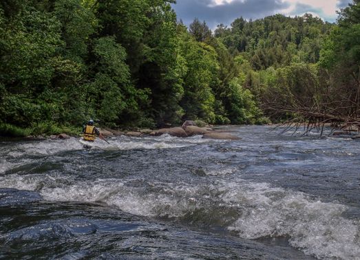
Class III-IV+
Length
2.1 mi
Gradient
180 ft/mi
max 320
Rapids
1
2 Hazards
Access Points
Shuttle Info
**Put-in:** Go North on County Road NE198 (Heydenrich Road) from Hwy 16 for 1.7 miles and take the road to the right to descend the hill. At the bottom, follow to the left and park at the end next to the creek. (elevation ~1850)
**Take-out:** Option 1) Carry up the road at the put-in for the standard [EFLB run](http://www.americanwhitewater.org/rivers/id/3364/). This road is passable with a good 4-WD.
Option 2) Paddle down the main [East Fork Little Buffalo](http://www.americanwhitewater.org/rivers/id/3364/) to Murray. This run will be kickin' and offer some big water features near the bottom. Be on the look out for Johnson's Falls. [Barberry Creek](http://www.americanwhitewater.org/rivers/id/5022/) which is located on the West side of Heydenrich Road and joins Sandy Springs/EFLB at the standard putin for the [East Fork Little Buffalo](http://www.americanwhitewater.org/rivers/id/3364/) run.
The creek is the cousin of
Difficulty Classes
I Easy
II Novice
III Intermediate
IV Advanced
V Expert/Extreme
VI Unrunnable
Current Conditions
5-Day Forecast
Whitewater data from
American Whitewater
American Whitewater