Headwaters to ELFB (1.8 miles)
Gauge Conditions
Runnable: ? – ? CFS
Approximate reading: This gauge is 11.9 miles away on Barberry Creek. Use as a general reference only.
Data from American Whitewater & USGS
Run Map
Description
Note: The combination of Steep banks and lots of deadfalls tend to clog the creek with wood from time to time, so keep look out.
Put-in: Go North on County Road 8872 from Hwy 16 for 1 mile and look for a bermed forest service logging road on the left (West) just past where the road loop reconnects. Park and follow the logging road for 1/2 mile and when a fence and clearing are visible, look for an ATV trail to the left and follow down to the creek. (elevation ~1840)
Take-out: Option 1) Carry up the road at the put-in for the standard East Fork Little Buffalo run.
Option 2) Paddle down the main EFLB to Murray. This run will be kickin and offer some big water features near the bottom. Be on the look out for Johnson's Falls in the middle of the run.
The creek is the cousin of Sandy Springs Hollow which is located on the East side of County Road 8872 and joins Barberry at the standard putin for the East Fork Little Buffalo.
Sandy is mainly boulder drops with a few bedrock drops, Barberry is mainly bedrock drops with a few boulder drops.
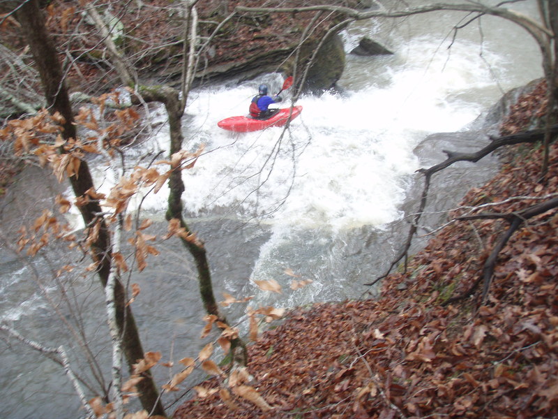
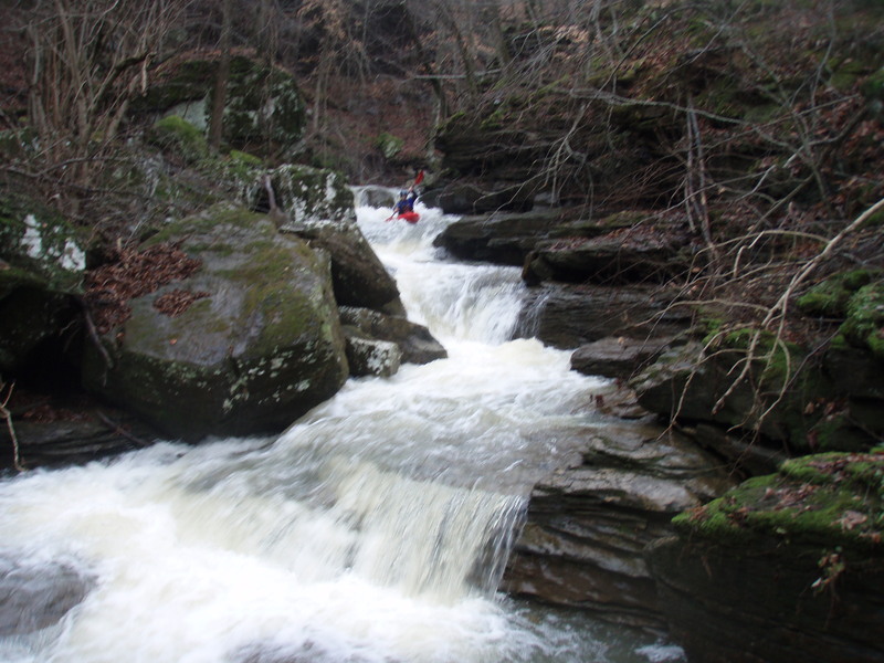
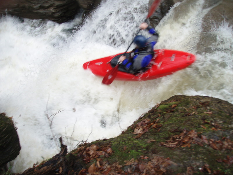
Highlights are the 4 main drops. First is a 8-footer onto a short slide a couple hundred yards down from the put-in. Second is _Gimme 3 Steps_ just downstream below a small tributary waterfall on the left. Third is _Monday Morning Surprise_ comes quickly downstream at the end of a long bedrock slide. Next are a couple of small drops then another low angle slide followed by the tight bouldery drops of _Down South Jukin'_. Good idea to stop and scout in this area in preparation for _Barbarian Falls_ which is the fourth main drop and signals the end of the steep gradient.
Rapids in this Run (2)
Waterfalls (4)
Hazards & Portages (3)
Caution: The following locations may require scouting or portaging. Always check current conditions.
Difficulty
Class III-V
Length
1.8 mi
Gradient
190 ft/mi
max 300
Rapids
2
3 Hazards
Access Points
Shuttle Info
**Put-in:** Go North on County Road NE198 (Heydenrich Road) from Hwy 16 for 1 mile and look for a bermed forest service logging road on the left (West) just past where the grey gravel road rejoins the brown gravel road. Follow the logging road for 1/2 mile and when a fence and clearing are visible, look for an ATV trail to the left and follow down to the creek. (elevation ~1840)
**Take-out:** Option 1) Carry up the road at the put-in for the standard [East Fork Little Buffalo](http://www.americanwhitewater.org/rivers/id/3364/) run. This road may be passable with a good 4-WD.
Option 2) Paddle down the main [EFLB](http://www.americanwhitewater.org/rivers/id/3364/) to Murray. This run will be kickin and offer some big water features near the bottom. Be on the look out for Johnson's Falls
Difficulty Classes
I Easy
II Novice
III Intermediate
IV Advanced
V Expert/Extreme
VI Unrunnable
Current Conditions
5-Day Forecast
Whitewater data from
American Whitewater
American Whitewater