Highway 12 to Powell Reservoir
Linked via: Nhdplus discovery 90% confidence Synced 6mo ago
Gauge Conditions
Runnable: 50.0 – 300.0 CFS
Expect some boat dragging.
Data from American Whitewater & USGS
Run Map
Run Time Estimate
Select put-in and take-out to estimate time.
Unlock Advanced Trip Planning
See wind-adjusted speed maps, forecast planning, and detailed time estimates.
Sign in to generate an AI timing estimate for this run.
Whitewater timing varies with scouting, portages, and group pace. Use as a planning baseline.
Description
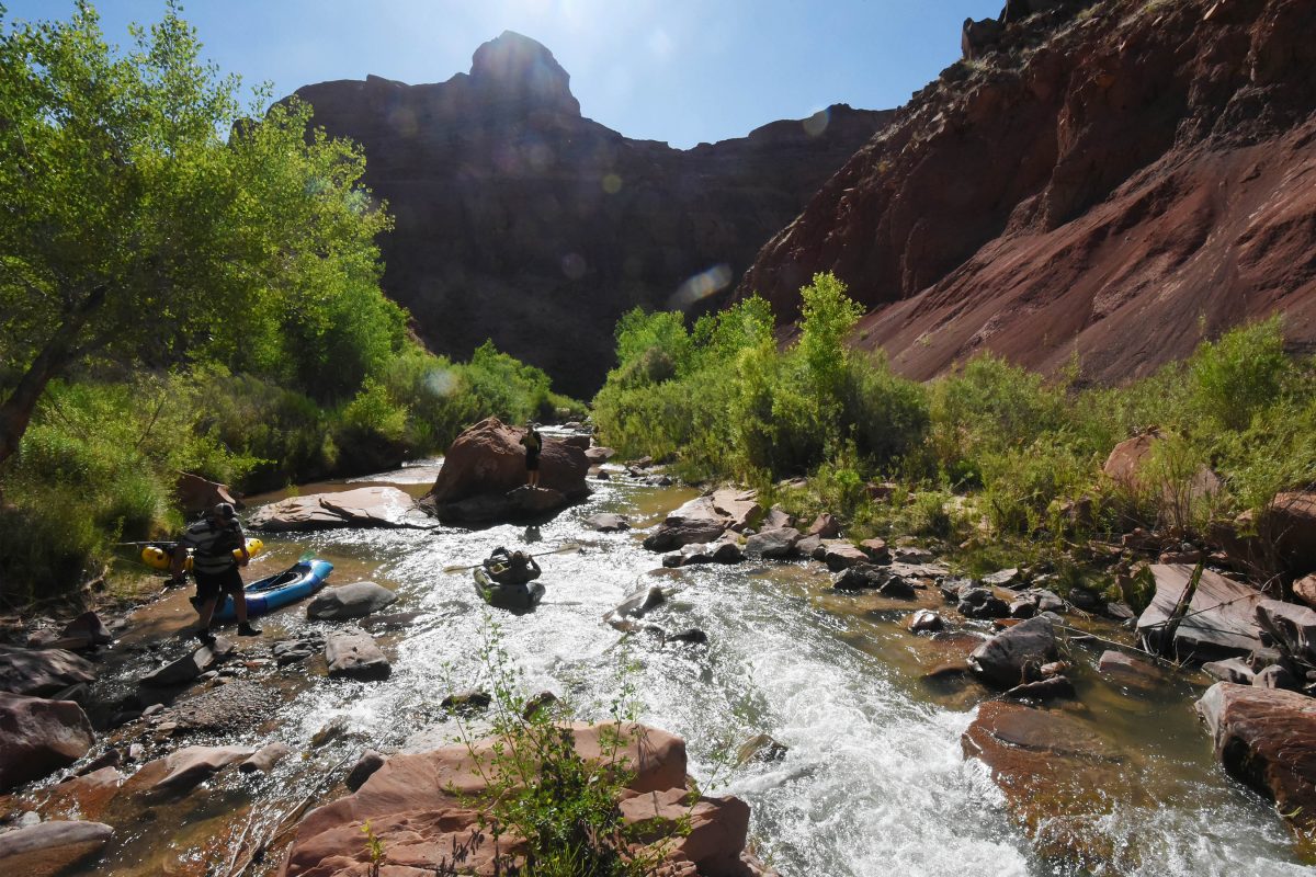
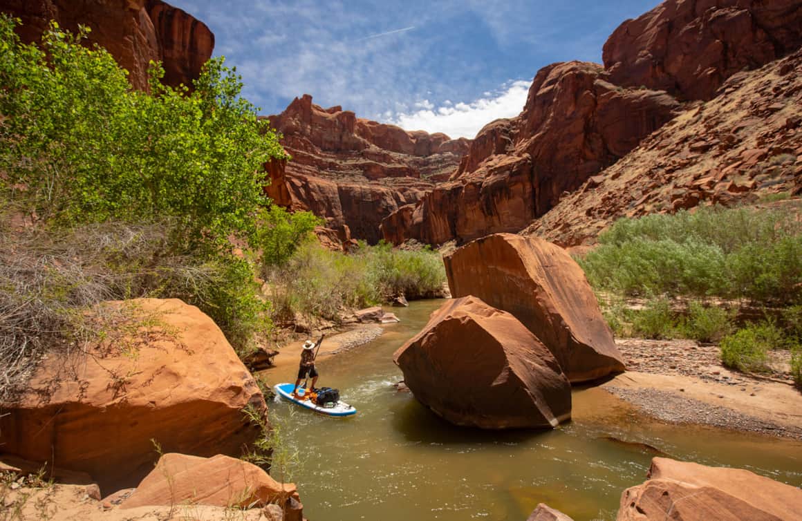
This 70 mile run is highly prized because of its incredible beauty and the rarity of decent boatable flows. In most years, flows will not get high enough for standard boating trip. In years when the snowpack provides sufficient spring snowmelt, the window of opportunity may only be a few weeks at best. The highest snowmelt flows are typically sometime in early to mid May to early June. Countering the above wisdom is a growing trend of people enjoying the river canyon at extremely low flows as a hiking and packrafting trip. This also offers more flexibility for alternative put-ins and take-outs that can shorten the actual on-river distance.
Permits:
Backcountry permits are required by Grand Staircase Escalante National Monument and Glen Canyon National Recreation Area. Stop at the Interagency Visitor Center in Escalante for permit information.
Put in:
Highway 12 crosses the Escalante River about 10 miles east of the town of Escalante. Look for signs for trailhead parking. Parking is not allowed on the side of highway 12 and the trailhead parking areas are small. Elevation at the put in is 5200 feet.
An alternate put in and take out is at Fence Canyon. It is a 4 mile hike down to the river and it is a nice trail and fairly easy to follow. This is around mile 36 from the bridge. There is a spring at Fence Canyon to fill your water before or after your journey.
.
Take out:
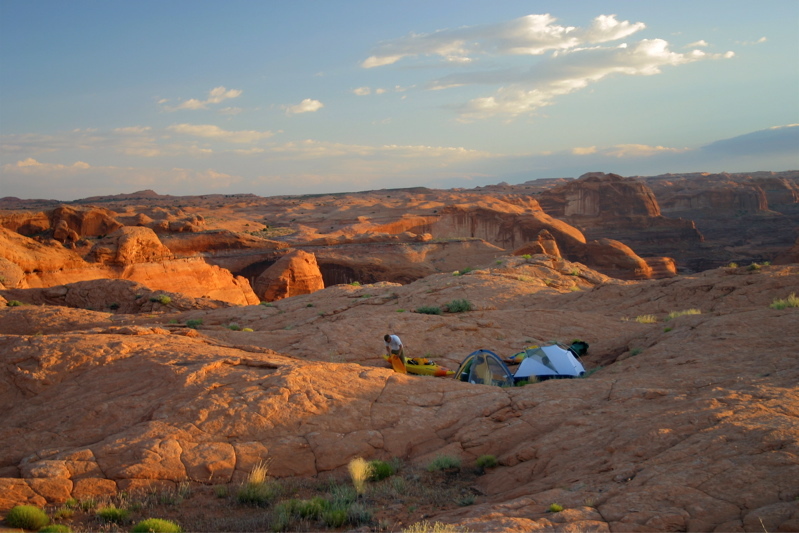
Paddlers have three main take-out options although packrafts have opened up more options for those who want to hike in or out at one of several side canyons that enter from the south side of the river.
Every option for the take out is difficult once you pass Fence Canyon. If you put in at the road it is tempting to load up the boats with things like tripods, chairs, etc. Don't do it as you will suffer later.
If you do decide to take out at Coyote Gulch the first obstacle is getting out of the canyon. There are two ways. The most common way out of Coyote involves 4th class climbing on the left side around 400 yards up the canyon. You will know you have gone too far once you hit a giant rock slide blocking your passage. Then go back 50 yards and begin climbing the wall on your left. Then you will see that a trail goes to where you can start. Your reward after climbing this is a 600 foot sand hill (1000 feet of total climbing). Bring plenty of water as the sand hill is in full sun and even cool days are very hot.
At the top of the sand hill you will arrive at the very famous 'crack in the wall' which is literally a crack in the wall. You can't get any gear up this crack and you will need a 50 foot rope to pull all your gear up the cliff next to the crack. From there it is only a mile to your car over rock and sand and then the 'short' sand hill to your car.
There is an alternate way out but it involves 4th class climbing with higher consequences and its around 100 yards downstream from the mouth. If you can imagine yourself climbing up this then you are where you want to be. The reward for this exposed climbing is again that 600 foot sand hill to crack in the wall.
The last option for exiting the canyon is going all the way to Lake Powel. You won't have to climb a 600 foot sand hill but you will have to drag your boat over miles of sand bars as the silt from the lake has created very shallow channels that make boating all the way impossible in all but estremely high water.
Other information sources:
Grand Staircase Escalante National Monument
BLM permit information
USGS mileage and gage map pdf
Escalante Calling \- Canoe & Kayak magazine
FLOATING THE ESCALANTE By Rich Henke
Yak-Packing Utah’s Escalante River by Jeff Wallach
Packrafting Utah's Escalante River in Late March by Bill Stadwiser
Wikipedia-Escalante
Books:
River Runners Guide to Utah and Adjacent Areas, by Gary C. Nichols, 2002 University of Utah Press
Canyon Country Paddles, by Verne Huser, 1978 Wasatch Publishers Inc.


Difficulty
Class II(III)
Length
74.0 mi
Gradient
21 ft/mi
Rapids
5
Access Points
Shuttle Info
Coyote Gulch take out:
The Hole in the Wall road is dirt and gravel, but the spur to the Crack in the Wall trailhead is reported to have deep sand in spots.
Lake Powell take out:
The Burr road connects Highway 12 to Bulfrog Marina. The Burr Road is gravel and dirt, but is fine for passenger cars.
Difficulty Classes
I Easy
II Novice
III Intermediate
IV Advanced
V Expert/Extreme
VI Unrunnable
Permit Required
Permits are required by Glen Canyon National Recreation Area.
Get Permit
Current Conditions
5-Day Forecast
Whitewater data from
American Whitewater
American Whitewater