Highway 504 Bridge to Tower Rd. Bridge
Gauge Conditions
Runnable: 1,500.0 – 4,000.0 CFS
Data from American Whitewater & USGS
Run Map
Run Time Estimate
Select put-in and take-out to estimate time.
Plan This Trip
See wind-adjusted speed maps, forecast planning, and detailed time estimates.
Sign in to generate an AI timing estimate for this run.
Whitewater timing varies with scouting, portages, and group pace. Use as a planning baseline.
Description
SEASON
This run is generally good throughout the winter rainy season and during spring snowmelt.
DESCRIPTION
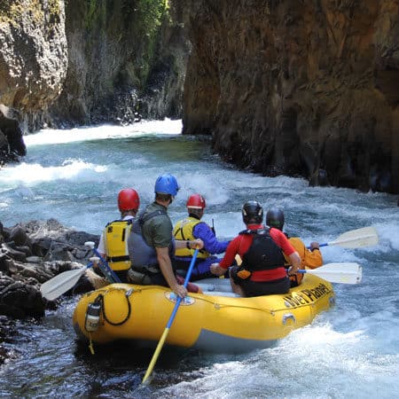
From the confluence of the North and South Forks there is about a mile of class I water with broad vistas and an occasional surf wave. After the 504 bridge the river begins to carve into the first gorge, with a gradual increase in whitewater. Class II and then III rapids build in intensity, marked by large basalt boulders and powerful channels. Toward the end of the gorge there is a long rapid that divides around a cobble bar, with the largest channel sweeping toward the right bank and back out to the middle. Eddy out on the right below this rapid and walk downstream to scout the next horizon, which is Stairstep. At low water a steep class IV, this rapid is easier when the holes are washed out and the rocks are under water. At most flows there is a sneak far river left but check to be sure it isn't log-clogged before committing.
After a short section of class II the river drops again and a giant boulder stands tall on the right. This is Tempest in a Teapot. There are 3 possible routes. At flows of 2,000cfs or more it is possible to bang through to rocks on the far river left to sneak the whole thing. The main flow is in the center channel which piles into the rock and then forms a dangerous pocket hole against the rock. Avoid this hole by driving left. Some have suggested the rapid is under-rated because of the retentiveness of this narrow hole, however it is not hard to avoid if you have strong class III skills.
A second sneak option exists on the far right, to the right of the rock that the water piles onto. Catch the large eddy and paddle through the shadows to an easy small ledge. Runnable at low water by canoes and kayaks, but bony enough that rafts will probably want 2,000cfs of more before attempting this route.
After a few more fun rapids the action tapers off as you enter a more open alluvial section. Here you'll see sand and ash deposits on the riparian terraces that are a couple feet thick. There are a few homes and easy class II rapids through shifting gravel bars that characterize this section. If flows are low or you are looking for a shorter run (4.2 miles to take-out) you can use the alternate access at the end of Basie Road which provides access at the end of this section.
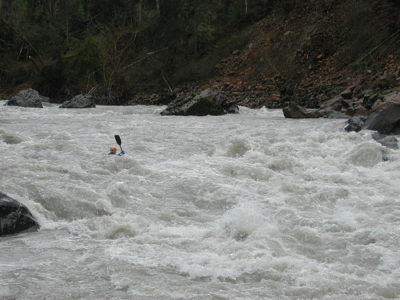
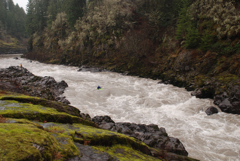
Less than a mile into the next gorged-in section you will find yourself at the most challenging rapid of the run: Hollywood. Recognition: after a left bend, a beach on the right is the last stopping place before the water rushes headlong into a narrow channel and disappears. The scout is an easy walk on almost level rocks down to see the first drop, where a rock plugs the middle of the river leaving the larger channel on the left. Holes on both sides narrow the line. Below this drop you have time for two roll attempts before you will be swept over the second ledge which is rockier/holier in the center with a broad clean channel on the right and a thin line far left. It is easy to portage this first drop and launch above the clean channel to the large recovery pool and giant right eddy which await anyone whose run didn't go as planned.
Below this point there are 3 more good class III rapids and quite a few nice playspots and moves. When the takeout bridge comes into sight, look for an eddy against the left wall that gives access to a lovely surfing wave--at some flows. Take out river left before the bridge.
Overall this is a great run with interesting geology. Some find the middle class II section a little long especially at the lower limit of flows. Those who don't want to run Hollywood Gorge will find a relatively easy portage across bedrock putting this run well within the reach of solid class III paddlers.
MOUNT ST HELENS ERUPTION: One day after the eruption of Mount Saint Helens on May 18, 1980, a lahar came down the Toutle River. Technically a lahar is a mud and debris flow caused by hot ash and lava melting snow on a volcano. This sudden melt can cause a flash flood of massive proportions sending a slurry of sediment, trees, logging trucks, bridges and household debris down the Toutle at speeds near 50 mph. Aerial photos from the time show the impressive devastation. The flow nearly surmounted the I-5 bridge. Tangles of rebar and spaghetti'd steel spans curled remain in and beside the river.
What's even more amazing is the recovery that has occurred. Although evidence of the eruption remains four decades later, the signs are subtle. The most striking feature is the cloudy brown water, can make reading the river a challenge as rocks just a few inches below the surface are not visible. The sediment load has decreased in the last decade but when the water is up it is still opaque. The river still transports a large volume of sand which fills the eddies and deposits on the banks during high flows. Alder forests have grown on much of the land that was denuded, bald eagles sore overhead, and but for a few homes along the banks the river feels wild.
LOGISTICS:
TAKEOUT
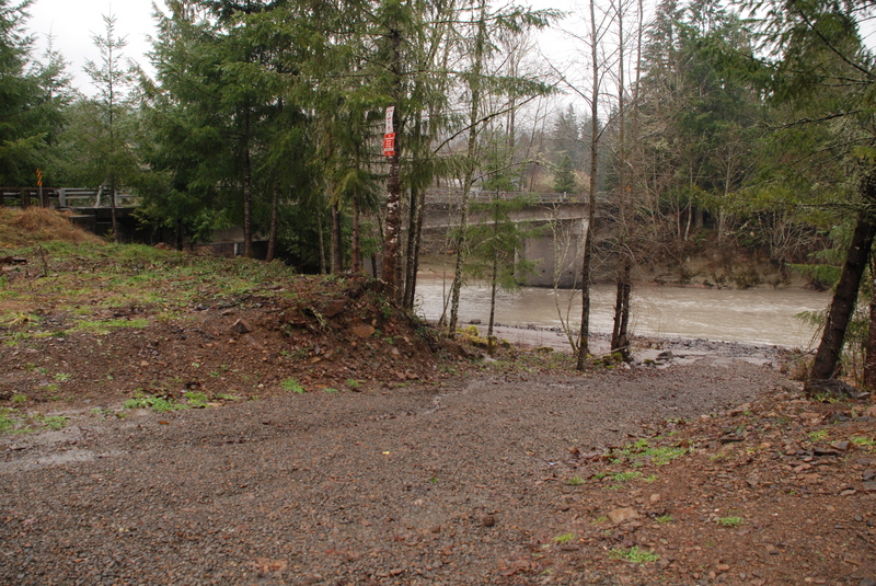
From I-5 take exit 49 and head east on Highway 504 toward Mt. St. Helens. To reach the take-out, stay on Highway 504 for 2.0 miles and turn north (left) onto Tower Road (at the Shell station in 2020). Stay left at the immediate Y and in 2.7 miles you will reach the Tower Road Bridge. Before you cross the bridge, turn right into Woodard Gould State Park where there is river access on river left, upstream from the bridge. A Discover Pass is required to park here.
PUT-IN
To reach the put-in head back out to Highway 504 and turn left/continue east to the town of Toutle. If you continue on 504 at mile 11.0 you'll cross the Toutle River. There is limited roadside parking on the upstream left right side of the bridge. A trail heads down to the river on the river left downstream side of the bridge.
You can also use Tower Road as a slightly shorter alternate shuttle route along the north side of the river. It joins Highway 504 at mile 13.6 so turn right to head back towards the put-in bridge. Another access option is where Basie Road dead ends at the river. This puts you in downstream of the middle braided section, a good option when flows are low. To reach this access head upstream on Tower Road and 3.2 miles from the take-out bridge you will see the right turn for Basie Road. Follow this road to where it dead ends at the river.
For an alternate put-in that doesn't involved parking beside the highway, turn right (southeast) in the town of Toutle onto S. Toutle Road. Continue until you cross the SF Toutle and turn left into Harry Gardner Park. Wind your way to the back of the park and then turn left/upstream to find an easy and pleasant launch spot. A short distance downstream from this launch the North Fork enters from the right.
lat/long approximated by Tiger map server
for additional information see
- Bennett, J. and T. Bennett. 1997. A guide to the whitewater rivers of Washington, second edition. Swiftwater Publishing. Portland, OR.
- Deschner, Whit. 1997. The Toutle: Life After Death. _In_ Travels with a Kayak. The Eddie Tern Press.
- North, D.A. 1999. Washington Whitewater. Mountaineers. Seattle, WA.
Difficulty
Class III+(IV)
Length
9.9 mi
Gradient
32 ft/mi
Rapids
6
Access Points
Difficulty Classes
I Easy
II Novice
III Intermediate
IV Advanced
V Expert/Extreme
VI Unrunnable
Current Conditions
5-Day Forecast
Whitewater data from
American Whitewater
American Whitewater