Highway 97 culvert to Wenatchee River
Gauge Conditions
Runnable: ? – ? CFS
Approximate reading: This gauge is 6.0 miles away on Peshastin Creek. Use as a general reference only.
Data from American Whitewater & USGS
Run Map
Run Time Estimate
Select put-in and take-out to estimate time.
Plan This Trip
See wind-adjusted speed maps, forecast planning, and detailed time estimates.
Sign in to generate an AI timing estimate for this run.
Whitewater timing varies with scouting, portages, and group pace. Use as a planning baseline.
Description
FUN FACT: Extend your run on the Wenatchee
SEASON: Late spring (as soon as the snow melt kicks into gear) through early summer (as long as the snowmelt lasts).
LOGISTICS: To reach the put-in take Hwy. 97 7.5 miles up the hill from the junction with Hwy. 2 near the town of Peshastin. More challenging rapids can be found by going another 0.6 miles upstream. To reach the take-out turn off from Highway 2 just south of the Highway 2 bridge across Peshastin Creek and follow the road back to an unimproved parking area next to Dryden Dam on the Wenatchee River.
An earlier take-out is necessary with the construction of the Lower Peshastin Restoration Project in the final 0.3 miles of Peshastin Creek - implemented in summer of 2025. The project placed river-wide log structures in the existing channel and a new floodplain channel, necessitating an earlier take-out. The location will share parking with the Dryden Dam portage.
Boaters can also combine the big water of the Wenatchee with a creek boating entry by boating Peshastin Creek down to the Wenatchee. To continue on the Wenatchee see the description of the run from Peshastin to Cashmere. You can also kick start this trip with a run down Ingalls creek. There are a few more access spots along the highway for those wanting an easier run or to run laps on the upper section. (Most of the more difficult rapids are in the first few miles and the run eases off downstream, but is continuous in gradient the whole way)
SHUTTLE: Highway 97 parallels the river and gives you a good look at the character of this run during the shuttle. Keep in mind however that Fresh Squeezed and the signifcant rapids are not visible from the road.
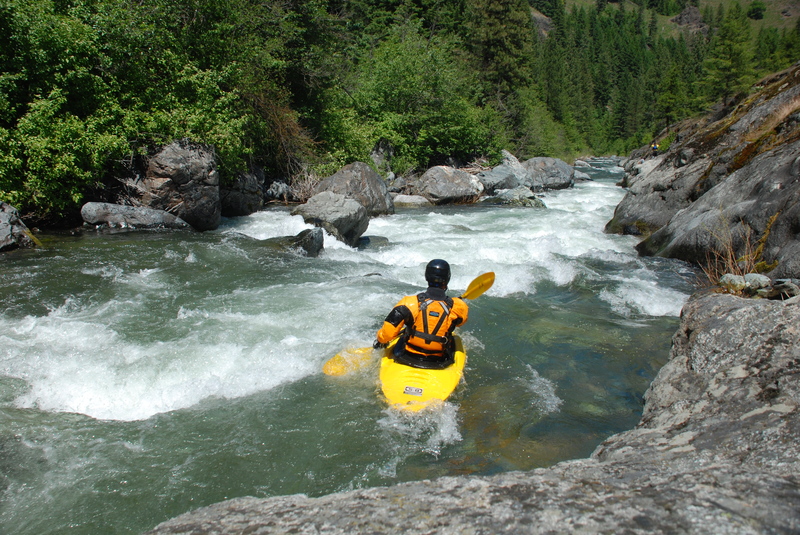
DESCRIPTION:
The run starts out with nearly continuous class III rapids punctuated by a more challenging class IV rapid known as Fresh Squeezed. You can scout Fresh Squeezed from the road. It's about 0.8 north of the village of Ingall's Creek where a grassy knoll separates the creek from the highway. Those not wanting to tackle Fresh Squeezed can find a trail here to put-in just below. Below this point the river tapers off to continuous class II with a couple more fun class III rapids before settling down to more consistent class II once you pass under the Highway 97 bridge (an alternate access point). There is a runnable diversion dam a couple of miles downstream of this point.
There are often logs in the creek, and they tend to change quickly.
for additional information see
- Bennett, J. and T. Bennett. 1997. A guide to the whitewater rivers of Washington, second edition. Swiftwater Publishing. Portland, OR.
Rapids in this Run (3)
Difficulty
Class III-IV
Length
9.2 mi
Gradient
150 ft/mi
max 200
Rapids
3
Access Points
Difficulty Classes
I Easy
II Novice
III Intermediate
IV Advanced
V Expert/Extreme
VI Unrunnable
Current Conditions
5-Day Forecast
Whitewater data from
American Whitewater
American Whitewater