hike up back to parking area
Gauge Conditions
Runnable: 7.0 – 15.0 FT
Data from American Whitewater & USGS
Run Map
Description
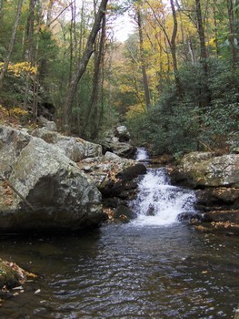
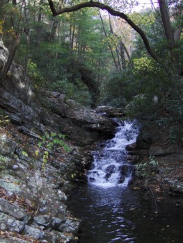
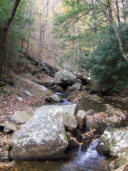
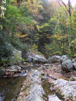
This run is a novelty. It will help soothe an otherwise skunked day in the area. It is very beautiful, but also very short. Hiking a mile yields around 8 quality ledge drops and a bew boulder jumbles. This is all in the first 1/3 of a mile. The last 2/3 of the run back to the car is class 3-4 boogie rapids with some wood to look out for.
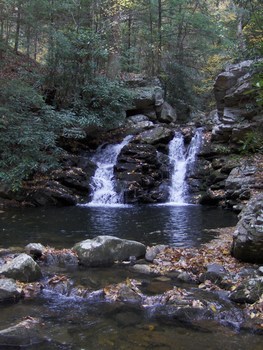
To get to the creek, turn east off of 411 just 1 mile north of the road that goes to Gee Creek Campground. This is Gee Creek road and goes through the impoverished community of Wetmore. After crossing the RR tracks, make a right and stay on this road as it goes around 2 miles around to the takeout for the creek. From here it is a 1 mile hike to the top of the good stuff. Once you have made it to the top of the double boof rapid shown below, there is nothing else above but wood choked class 2-3, though the hike is interesting.
Here is a description from the late Stan Guy:
Gee Creek is VERY Goforth-esque in that it is a hike up run from the takeout, it is REAL TIGHT, and you will always spend more time hiking-in/scouting than you will on the creek cause it is SO fast and the eddy count is slim.
1st known run by Jason Murrell, Winter of 2003.
This is a definite IV+/V-(V)run. While it doesn't have a lot of wood, it does have one log jam and another hidden danger of a tunnel in the middle of the run. You won't known it is there at highwater.
On the way up you will want to memorize the run. For the most part you just have to stay in the flow and keep your bow up. Stayin in the main flow is easy enough cause this creek is probably 15-20 FEET wide at its WIDEST point.
The only other eddy on the creek was just above the log-jam and portaging wouldnt be bad at all.
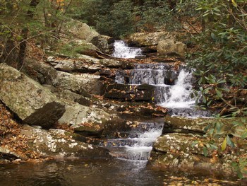
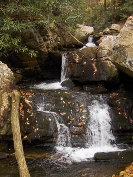
Just above the log-jam eddys is where Gee Creek gets steep and fun. There are five large ledge drops of class 3 to 4+ difficulty in a row with III+ boogie water in between.
Of these drops the first one is the tallest at 14 feet and it is clean into a deep pool. The hike from the top of the second drop to the top of the first drop goes from class II+ hiking to class IV+. It is slick and it is straight uphill. There are 2 great looking class 5 boulder gardens above these ledge drops that are kinda like some on the Trailhead section of the West Prong. Fun stuff.
The second drop is about 8 feet, but the line is tight. The next three drops look almost identical at about 4-5 feet each and the move on all three is center-to-left with the bow UP. This gets you to the top log-jam eddy.
The entrance to the tunnel was at the bottom of the 4th drop and right above my eddy to portage from. The tunnel was completely underwater and I decided that as long as I kept the bow up and didn't go down the center then everything would still be ok.
The rest of the run is mostly just a matter of not pitoning or broaching on any of the piss-me-off rocks that were all over the place.
Rapids in this Run (2)
Hazards & Portages (2)
Caution: The following locations may require scouting or portaging. Always check current conditions.
Difficulty
Class IV-V
Length
1.7 mi
Gradient
400 ft/mi
max 500
Rapids
2
2 Hazards
Access Points
Difficulty Classes
I Easy
II Novice
III Intermediate
IV Advanced
V Expert/Extreme
VI Unrunnable
Current Conditions
5-Day Forecast
Whitewater data from
American Whitewater
American Whitewater