Hurricane Shoals County Park
Gauge Conditions
Runnable: 200.0 – 5,000.0 CFS
Upper limit for best boatability uncertain. Please help your fellow boaters with a comment or report.
Data from American Whitewater & USGS
Run Map
Description
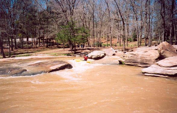
With a name like Hurricane Shoals, this little county park might draw any boaters attention. Careful examination of a topographic map shows a steep little section of rapids within the Park boundaries. The Park officials are not adverse to boaters, so this little section of rapids is open for playing. The water quality is not exceptionally poor and in the summer you are guaranteed to get some eye candy on the banks sunning themselves.
Now the bad news. Despite the name ÂHurricane Shoals the river is not all that exciting. Boaters will find a small dam followed by a series of three steep slides and a boulder field. The slides produce some surfing holes at the right water level. That is it. So this is a run for locals or UGA students who live near Commerce. It is not a hair run as you might surmise from the name of the Park and shoals.
The Park can close during the winter but you can easily boat down to the rapids and walk an extra 20 yards to get back to your car.
Also consider that the guage is downstream in Athens and is only an indicator of the water level in the run.
At high flow this set of shoals can pack a punch but also had good play spots.
Playspots (1)
Difficulty
Class III
Length
0.1 mi
Gradient
80 ft/mi
Rapids
0
Access Points
Difficulty Classes
I Easy
II Novice
III Intermediate
IV Advanced
V Expert/Extreme
VI Unrunnable
Current Conditions
5-Day Forecast
Whitewater data from
American Whitewater
American Whitewater