Jamesville Reservoir to Route 481
Gauge Conditions
Runnable: 150.0 – 800.0 CFS
Data from American Whitewater & USGS
Run Map
Run Time Estimate
Select put-in and take-out to estimate time.
Plan This Trip
See wind-adjusted speed maps, forecast planning, and detailed time estimates.
Sign in to generate an AI timing estimate for this run.
Whitewater timing varies with scouting, portages, and group pace. Use as a planning baseline.
Description
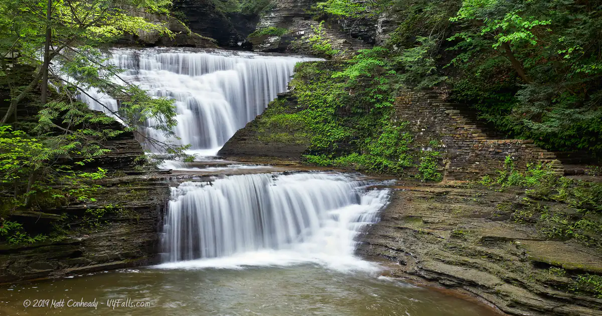
Starting at the Jamesville Reservoir and continuing to a fishing access just before Rt. 481, Butternut creek is mainly a tight class II+ run. This is punctuated by Dunlop falls, a double-drop just below the bridge at Solvay Rd, and a small dam just before Jamesville Rd. Both are easily scouted and can be portaged on river left.
There have been numerous run-ins with the owner of the A-Frame style house at Dunlop Falls. The best option is to scout the drop from the bridge in street clothes and run it quickly and quietly. Ultimately the river acesses are all public land making the run completely legal despite the fact that he owns both sides of the river at the falls. ( Update: The property now has a new owner who has been extremely friendly to kayakers. Please be friendly and help protect access)
The run can be done as a whole, or shortened to putting in above Dunlop Falls at Fiddler's Green Park, and taking out at the fishing access at Jamesville Road to get more laps in on the drops.
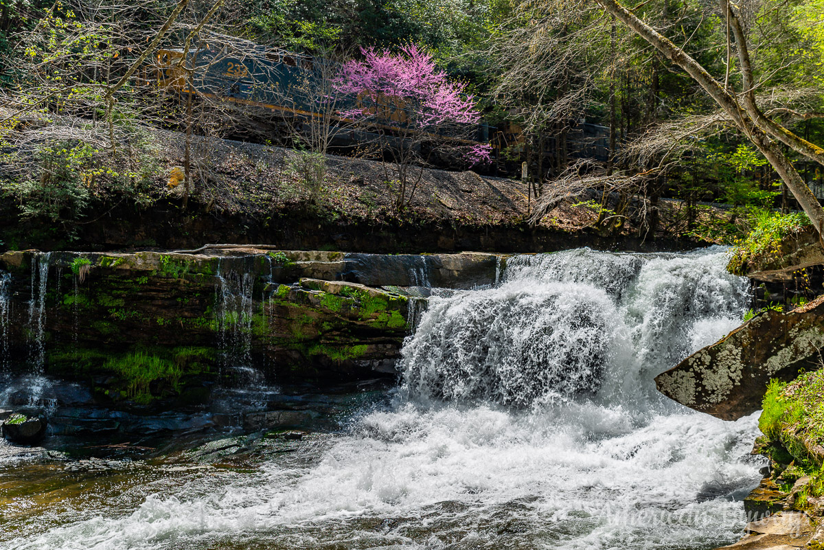
At high flows be sure to check the dam drop by Jamesville Road. A nasty hole forms at the bottom.
Trees are the largest hazard on this tight run. Be on the lookout and bring a saw or hatchet.
Tip from the locals:
There are no public bathrooms anywhere nearby. You'll have to make a run to Dewitt if nature calls.
Syracuse Area Runs:
Butternut Creek Chittenango Creek (Cazenovia)
Chittenango Creek (Chittenango) Fish Creek E. Branch (Taberg)
Limestone Creek (Edwards Falls) Oriskany Creek (Oriskany Falls)
Oriskany Creek (Clinton) Owasco River (Outlet)
Salmon River (Section 1) Salmon River (Section 2)
Google Map of New York Whitewater
New York Whitewater Paddlers Facebook Group
Waterfalls (2)
Difficulty
Class I-III+(IV)
Length
2.0 mi
Rapids
0
Access Points
Shuttle Info
1. From the Jamesville exit on 481 head south towards Jamesville
2. The takeout will be located at the DEC fishing access by the 481N offramp
3. Turn left onto Solvay Rd and pull into the gravel parking lot immediately on the right. Scout the dam drop below. This is an alternate takeout for quick laps.
4. Continue on Solvay Rd and take the first right. Pull into the parking lot to scout Dunlop Falls. This is the alternate put-in.
5. Backtrack to your last turn and continue up the hill to your right.
6. Continue until you hit 173. Make a left and then quick right to continue upstream on 91/Pompey Rd.
7. Turn right into the Highway Dept Depot as the Reservior comes into view.
8. At the gate turn left into the fisherman's access parking lot.
Difficulty Classes
I Easy
II Novice
III Intermediate
IV Advanced
V Expert/Extreme
VI Unrunnable
Current Conditions
5-Day Forecast
Whitewater data from
American Whitewater
American Whitewater