Kilkenny Loop Road to Spruceville Road
Gauge Conditions
Runnable: 2,200.0 – 4,000.0 CFS
Data from American Whitewater & USGS
Run Map
Run Time Estimate
Select put-in and take-out to estimate time.
Plan This Trip
See wind-adjusted speed maps, forecast planning, and detailed time estimates.
Sign in to generate an AI timing estimate for this run.
Whitewater timing varies with scouting, portages, and group pace. Use as a planning baseline.
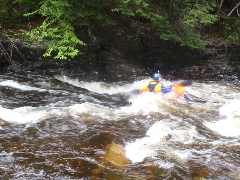
Description
The Upper Ammo needs a lot water for a fluid run. Therefore you would be hard pressed to find this river running unless everything else in the neighborhood is at or near flood stage. The river itself is an easy class I-II at the begining and eventually builds up to a steady class II with a few small ledge drops. Gorge-us is the most difficult section in this run. It is recognized by a sharp right bend up against a shear granite wall on river left approximately 4.8 miles below the put-in. Gorge-us should be considered a class II+ or III depending on level. It is easily portaged on river right.
Be aware that most of this run is wild and a difficult bush wack back to civilization, it makes for a great northern New England wilderness experience but a nightmare if problems arise.
Rapids in this Run (1)
Difficulty
Class II
Length
6.1 mi
Gradient
30 ft/mi
max 45
Rapids
1
Access Points
Difficulty Classes
I Easy
II Novice
III Intermediate
IV Advanced
V Expert/Extreme
VI Unrunnable
Current Conditions
5-Day Forecast
Whitewater data from
American Whitewater
American Whitewater