Lentsch Access to Phinney Park (3.1 - 13.8 miles)
Gauge Conditions
Data from American Whitewater & USGS
Run Map
Run Time Estimate
Select put-in and take-out to estimate time.
Plan This Trip
See wind-adjusted speed maps, forecast planning, and detailed time estimates.
Sign in to generate an AI timing estimate for this run.
Whitewater timing varies with scouting, portages, and group pace. Use as a planning baseline.
Description
Lizard Creek is an intimate paddle through forested shoreline and sandstone bluffs that can be nearly a full-day ~14 mile run from Lentsch Access to the confluence with the Des Moines river in Fort Dodge. Most paddlers will prefer doing one or more of the shorter stretches, using listed options for access points:
Lentsch Access to Cunningham Access: ~3.1 miles
Cunningham Access to Rasch Access: ~5.2 miles
Rasch Access to Phinney Access: ~5.6 miles
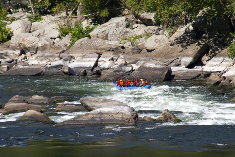
The final mile of Lizard creek before it enters the Des Moines river contains some Class 2 rapids, thus the final section will be the choice for those mostly intent on whitewater.
Optimum paddling levels are 5’ – 8’ on the USGS Lizard creek gauge.
Paddlers should be careful of strainers and railroad bridge piling hazards, especially at higher flows.
An Iowa DNR water trail map contains detailed access points, paddling information, and other useful details (CLICKABLE LINK): _www.iowadnr.gov/Things-to-Do/Canoeing-Kayaking/Water-Trail-Maps-Brochures_


Difficulty
Class I-II
Length
13.8 mi
Gradient
7 ft/mi
max 14
Rapids
5
Access Points
Difficulty Classes
I Easy
II Novice
III Intermediate
IV Advanced
V Expert/Extreme
VI Unrunnable
Current Conditions
5-Day Forecast
Whitewater data from
American Whitewater
American Whitewater