Ludlowville Falls to Cayuga Lake
Gauge Conditions
Runnable: 150.0 – 1,000.0 CFS
Flow range for best boatability uncertain. Please help your fellow boaters with a comment or report.
Data from American Whitewater & USGS
Run Map
Run Time Estimate
Select put-in and take-out to estimate time.
Plan This Trip
See wind-adjusted speed maps, forecast planning, and detailed time estimates.
Sign in to generate an AI timing estimate for this run.
Whitewater timing varies with scouting, portages, and group pace. Use as a planning baseline.
Description
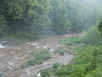
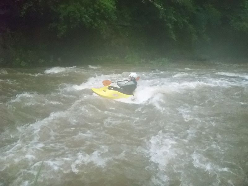
Salmon Creek is a Class I-II river with Class III surfing opportunities.
Salmon Creek is usually dry, but about an inch of precipitation within days can bring it up from 20 cfs to 300 cfs, which adds on average about a foot of water to the creek.
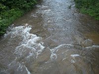
Salmon Creek is all about small wave surfing. When it comes to low-key surfing & playing, nothing beat Salmon Creek within an hour of driving from Ithaca. The whitewater features on Salmon Creek come in the form of small waves and holes. Small though they are, they are extremely great for surfing and playing. Plus, all the good features have eddy service.
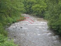
The first half mile of the river forms a nice loop and is highly continuously with most of the fun features. One can take out after the Ludlowville Road bridge and walk just a quarter mile back to the put in
If you just run down the river with little play, this is an easy 15-30 minutes run. If you take your time and surf, this 1.6 miles run can easily take up to 2-3 hours.
Finger Lakes Area Runs
Bowman CreekCascadilla Creek Canandaigua Outlet
Canaseraga Creek Canisteo Cayuga Lake Hole
Cayuta Creek Conesus Creek Fall Creek (1.)
Fall Creek (2.)Fall Creek (3.) Great Gully Creek
Honeoye CreekIrondequoit Creek Keshequa Creek
Keuka Outlet Lock 32 Whitewater Course Owasco River (Outlet)
Salmon Creek Sixmile Creek Sugar Creek
Taughannock Creek (1.) Taughannock Creek (2.) Trumansburg Creek
Vanbuskirk Gulf
Google Map of New York Whitewater
New York Whitewater Paddlers Facebook Group
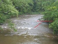
Rapids in this Run (6)

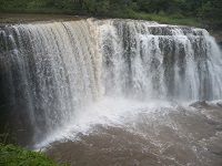
Waterfalls (1)
Hazards & Portages (1)
Caution: The following locations may require scouting or portaging. Always check current conditions.
Difficulty
Class I-II
Length
1.3 mi
Rapids
6
1 Portage
Access Points
Shuttle Info
Putin:
For a full run, park at Ludlowville Falls Park and walk down to the falls, or park at Mill Street roundabout for the park and play putin. Or, if you want mostly Class I water, put in at the fisherman access next to Ludlowville Road bridge.
Takeout:
For a short run or a loop run, you can take out at either the Mill Street roundabout park and play, or the fisherman access next to Ludlowville Road Bridge. For a full run, just paddle all the way down to Cayuga Lake. You can either take out river right (Salt Point, free) or river left (Myers Point, in summer you need to pay ~$2 to get in the park).
Difficulty Classes
I Easy
II Novice
III Intermediate
IV Advanced
V Expert/Extreme
VI Unrunnable
Current Conditions
5-Day Forecast
Whitewater data from
American Whitewater
American Whitewater