Markle to County Road 150 S (1.2 miles)
Gauge Conditions
Runnable: 300.0 – 3,000.0 CFS
Lower than most prefer, but some play is possible.
Data from American Whitewater & USGS
Run Map
Run Time Estimate
Select put-in and take-out to estimate time.
Plan This Trip
See wind-adjusted speed maps, forecast planning, and detailed time estimates.
Sign in to generate an AI timing estimate for this run.
Whitewater timing varies with scouting, portages, and group pace. Use as a planning baseline.
Description
Put in on south side of a dike at the end of Wilt Street. Walk past the gates and down the stone road to the river's south channel. (The north channel is all flat water.)
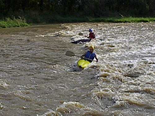
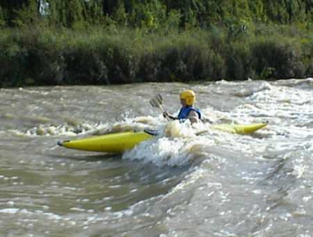
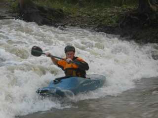
The rapids start 600' downstream of Hwy.3 bridge and continue for 1,500'. Class 1 riffles are followed by a river wide ledge that has a wave to surf. The next ledge is broken with 1.5' to 2' waves.
Scout the next one -- the waves and hole are close together so look at them both. The entrance is a sloping drop of 3' to 4' with some bigger waves and a good eddy on the left. Just below is a river wide hole with good eddies on both sides so you can stop to play. This hole can be a stopper (hard to get out of at some levels), with 500 cfs or a little more being a good play level. At higher levels this hole gets bigger than any on the East Race.
This is followed by a smaller rapid that has a fast chute with a strong eddy line on the right with deep water that is fun to play in. A bit of flat water leads to the take out on river-left at the end of County Road 150 S.
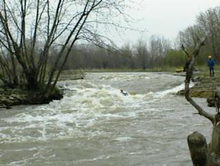
At 2,000 cfs the waves can reach 3 to 4' and the holes get big. Rescue could be difficult and scouting is recommended.
At 2,500 the river starts to go out out of it's banks, with big waves and holes which are stoppers (though they don't seem to keep you). The current is very fast so be careful!
This is a man-made channel which tends to change a bit each year. If the water is high, Rock Creek is a good warm up which uses the same take out.
The following YouTube video shows the run quite well: _Wabash at Markle_
Playspots (5)
Hazards & Portages (2)
Caution: The following locations may require scouting or portaging. Always check current conditions.
Difficulty
Class I-II(III)
Length
1.3 mi
Gradient
10 ft/mi
Rapids
0
2 Hazards
Access Points
Shuttle Info
**Put in.** From I-69 go east on 224, right on 116 to 4-way stop, stay on 116 and take the next right, then left on Wilt and go till it ends.
**Take out.** Go back to the 4-way stop, go left on 3, after you cross the river twice take the first right (County Road 150S), go to the end of this road.
Difficulty Classes
I Easy
II Novice
III Intermediate
IV Advanced
V Expert/Extreme
VI Unrunnable
Current Conditions
5-Day Forecast
Whitewater data from
American Whitewater
American Whitewater