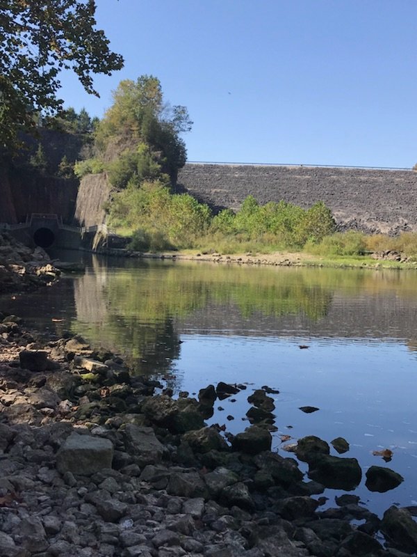
McCoppin Mill Rd (below Rocky Fk Lake Dam) to Paint Creek
Gauge Conditions
Runnable: 250.0 – 1,000.0 CFS
Suitable for class 1-2 boaters and for a scenic float.
Data from American Whitewater & USGS
Run Map
Run Time Estimate
Select put-in and take-out to estimate time.
Plan This Trip
See wind-adjusted speed maps, forecast planning, and detailed time estimates.
Sign in to generate an AI timing estimate for this run.
Whitewater timing varies with scouting, portages, and group pace. Use as a planning baseline.
Description
This lovely class I-II stream is a gem of central Ohio. The stream is mostly flat in the upper stretches, but with swift current. Be on the lookout for strainers. I am not very familiar with this upper stretch, as many boaters put on below at Barret's Mill Road or at Browning Road.
If paddling the upper stretches, there are two old mill dams that must be portaged. The first is just downstream of the Highway 753 bridge and the second is just downstream of Barretts Mill Road. Check them out first on the map and from the road!
A good put in is on river left, just below the bridge on Browning Road. The landowner (Highlands Nature Sanctuary) has been very kind and co-operative with paddlers, allowing them to park on his property on the downstream side of the bridge. _It is critical that paddlers be considerate!_ Do not park on any cultivated land, don't block the driveway or any cars and do not litter. Be as low key as possible. Such kindly land owners are our best friends! Please leave as few vehicles here as possible as this area is frequently used for hikes for patrons of the sanctuary. Permission can usually be gained to park here at the office near the old 7 caves off cave road. Be aware that it's a privilege extended to us to use this site and not a right.
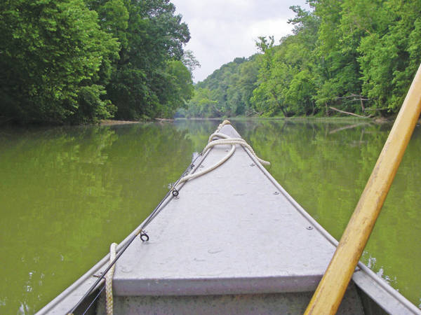
From Browning road, the stream continues to be fast moving with small ripples. Many places exist for the newer paddler to practice eddy turns and ferries, but again, be on the lookout for strainers. Shortly after the put in there is a small ledge which can provide beginners with surfing practice. After this ledge the gradient begins to pick up slightly and the scenery changes from low banks and pasture land to higher banks and eventually limestone cliffs. In the region of the 7 caves the cliffs are spectacular, rising sharply a hundred feet or more over the river. Most folks won't believe they are still in Ohio. Bring a camera.
There are a couple of minor rapids leading into and out of this section where the beginner paddler can practice surfing and other techniques, but the water through the most beautiful section is flat, allowing for maximum appreciation of the beauty.
After the 7 caves area, the cliff receed and the stream starts to return to pastoral scenery. Most new paddlers will take out on river right below the Rt 50 bridge. Again, be aware you are crossing private land! More experienced paddlers will continue on to the Confluence with Paint Creek a few hundred yards below, attempt the class II-III Paint Creek chutes and take out at the old primitive roadside rest area on Rt. 50. The rest area is now private property but permission has been attained to park on the creek side of the loop, do not park on the inside of the loop. For details about Paint Creek, see Paint Creek Information
Other Information Sources:
Rocky Fork State Park
Highlands Nature Conservancy
Seven Caves Hikers are allowed in the area but not within the caves. This is to allow restoration and prevent the spread of white nose disease in bats.
Rapids in this Run (3)
Hazards & Portages (2)
Caution: The following locations may require scouting or portaging. Always check current conditions.
Difficulty
Class II
Length
9.0 mi
Gradient
10 ft/mi
Rapids
3
2 Hazards
Access Points
Difficulty Classes
I Easy
II Novice
III Intermediate
IV Advanced
V Expert/Extreme
VI Unrunnable
Current Conditions
5-Day Forecast
Whitewater data from
American Whitewater
American Whitewater