Mount Hope Church to Louisa Chapel Road
No sufficiently local live gauge linked. 1 automated match was excluded because locality could not be verified. Difficulty and route details are not current water conditions.
Run Map
Run Time Estimate
Select put-in and take-out to estimate time.
Plan This Trip
See wind-adjusted speed maps, forecast planning, and detailed time estimates.
Sign in to generate an AI timing estimate for this run.
Whitewater timing varies with scouting, portages, and group pace. Use as a planning baseline.
Description
This is a short run consisting of only a coupe rock gardens and a 4ft dam that the town of Franklin gets it's water from. The dam has to be run, there's no sneak around it. Watch out for wood below the dam through the rock gardens.
Pretty fun for the locals and that's about it.
From the put-in below the bridge behind Mt Hope Church you will paddle over some small ledges (1-2ft). This is a really calm stretch good practice for beginners in eddy turning and peeling out. The stream meanders through roderdendren and residental areas before it gets to the Macon County Industrial Park.
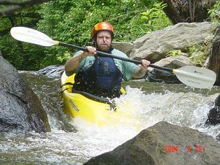
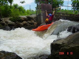
From here start to be on the look out for the Franklin Water Plant on the left and the 4ft dam. The dam as rocks put in place on the left side to divert all of the water over the dam. Get up some speed and go a little right of center where it's the deepest. There is concrete poured below that blows everything out so it's not like most dams. Below the dam there is a nice rock garden that begins under the Rock Quarry bridge. Don't flip though cause it's really shallow and the rocks are sharp. If you do flip you won't be able to roll up so just swim, much easier on your body.
There is another technical rock garden .25 miles above the take-out that's much the same as the one at the Rock Quarry. Don't swim!
As with all small streams be on the look out for wood. There was at least one tree that crossed the entire river, but at below 2.5ft you should be able to get under it, no problem. Also, the stream is very shallow, and mostly sand with a few rocks scattered about, so it's pretty user friendly for the beginner. Ie. push off the bottom if you're upside down and can't roll.
Rapids in this Run (2)
Waterfalls (1)
Playspots (1)
Difficulty
Class II(III)
Length
2.9 mi
Gradient
30 ft/mi
Rapids
2
Access Points
Difficulty Classes
I Easy
II Novice
III Intermediate
IV Advanced
V Expert/Extreme
VI Unrunnable
Current Conditions
5-Day Forecast
Whitewater data from
American Whitewater
American Whitewater