Near Ponderosa Way to Manton Road (A6)
Gauge Conditions
Runnable: ? – ? CFS
Approximate reading: This gauge is 6.7 miles away on Battle Creek. Use as a general reference only.
Data from American Whitewater & USGS
CDEC Flow Data California
Data from California Data Exchange Center (CDEC)
Run Map
Description
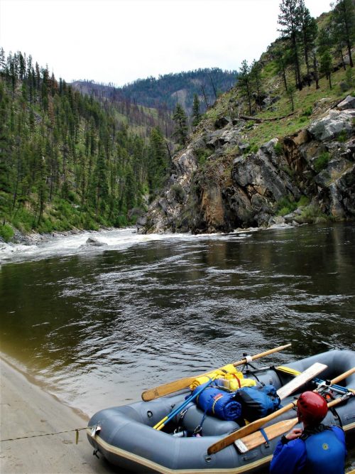
See the description in Bill Tuthill's excellent California Creekin, with pictures. Looks like a nice run, despite three dam portages.
Other Information Sources:
Battle Creek Watershed Conservancy
Battle Creek Alliance works to stop clearcut logging in this area.
Battle Creek Salmon and Steelhead Restoration Project.
Wikipedia - Battle Creek
Lassen Lodge Hydroelectric Project, FERC P-12496
This proposed Hydro project on the upper reaches of the South Fork of Battle Creek will have a 6' high by 94' wide diversion dam at elevation 4,304 feet. A 10' x 20' intake structure will be to the side of the dam. A 4' diameter pipe will extend downstream. Then a 3' high pressure line will drop another 1.4 miles to a powerhouse at elevation 3,350 feet. The powerhouse will have a maximum flow of 105 cfs, but optimal flow will be 95 cfs
P-12496-Exhibit A\_Project Description.PDF
To search further on the FERC website go to http://elibrary.ferc.gov/idmws/search/fercgensearch.asp and type in the project number: P-12496.
Rapids in this Run (1)
Hazards & Portages (1)
Caution: The following locations may require scouting or portaging. Always check current conditions.
Difficulty
Class V
Length
12.5 mi
Gradient
91 ft/mi
max 140
Rapids
1
1 Hazard
Access Points
Difficulty Classes
I Easy
II Novice
III Intermediate
IV Advanced
V Expert/Extreme
VI Unrunnable
Current Conditions
5-Day Forecast
Whitewater data from
American Whitewater
American Whitewater