New Bridge Road to Chattahoochee River
Gauge Conditions
Runnable: 2,500.0 – 15,000.0 CFS
Data from American Whitewater & USGS
Run Map
Description
Gauge Description:
Look for the ledges on the upstream side of the put-in to be well covered. If its looks like your boat would drag at all on the rocks at the put in, then there is not enough water.
If you see standing waves at the put-in, then Mossy is too high. Mossy is generally run when everything else is at flood. Look for the Chattooga to be 3 feet and rising, or the Upper Hooch to be 5 feet and going up.
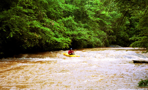
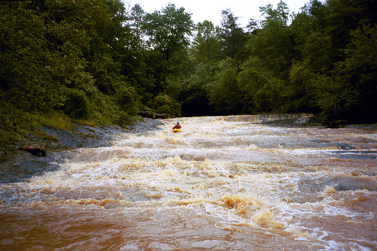
RIVER DESCRIPTION
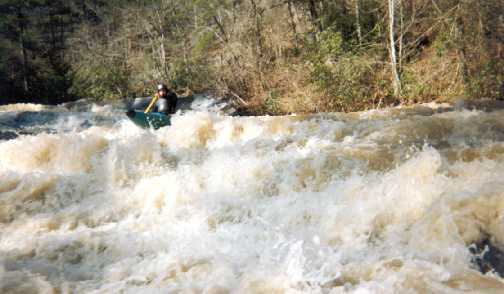
Mossy starts with about a mile of flatwater. The first rapid you come to is a small 4 foot tall riverwide ledge. Shortly after this is a small S-turn rapid with a variety of routes. This is followed by more flatwater. Then you come around a bend and see the mother of all horizon lines. Something not unlike being at the top of Oceana at Tallulah Gorge. This is the start of the slides.
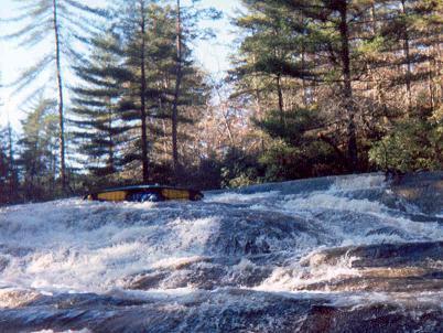
At low flows the first group features about 4 slides. At high flows those first four turn into one real big Class 5 slide/rapid thing. There will be a pretty grist mill off to the right below the first group of slides. At normal flows run the first one on the right. There is a decent sized pool between the first and second slide. The second and third slides are bisected by an island. After the first slide, the cleaner lines are on the left, so, run the next three slides on the left. After that theres a good sized pool beside the old mill.
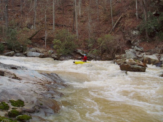
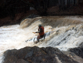
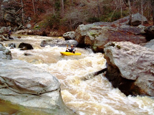
Then there is the ledge slide. This one has about a 9 foot vertical drop into another big slide. This one forms a strong hole on the top right at high flows. After that there are still 4 more big slides before you get to the really big one, "Over the Bars". Water levels will dictate the lines on all of these. Scout what you can't see. After the big one, there are two more smaller slides and two class 3/4 boulder drops before you hit the confluence with the Chattahoochee. There are two undercuts on the left in the last series of drops.
From the confluence to the take-out is about 5 miles of flatwater. Generally not a problem because the Hooch will be flooding and moving at a very rapid pace.
At low flows Mossy is a relatively forgiving run. Class 3/4 until the holes start to get big. The biggest danger would be running a slide inverted (Ouch!!!).
At low flows the paddle out on the Hooch can take forever.
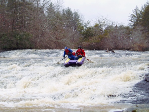
Mossy at high flows is no place for novices. The holes get big, the rapids are long and the pools get short. World class boaters have had bruising swims and have lost boats here.
Put-in: The put-in for Mossy is the bridge at New Bridge Road.
Take-out: The take-out is on Pea Ridge Road where Mud Creek confluences with the Chattahoochee. There is a parking area at the confluence, but 4 wheel drive may be required.
Confluence Take-out:
The short takeout: Take Newbridge Road from the put-in to Skitts mtn road. Take a left. Take a left on Skitts mtn drive. From intersection of Skitts Mountail Road and Skitts Mountain Drive (.2 miles south of hall/White County line), Homeplace Road is .6 miles east on Skitts Mountain Drive (past the intersection where Callus Mill Road goes left and Morrison Road goes right). Follow the dirt road down about a mile or two. It will sorta end in a cul-de-sac, but the road will continue on into an area Marked off by the Georgia DNR. At this point DNR has mostly blocked off the road on down to the mossy/hooch confluence. We left the truck here. From the confluence up to the truck was about a 10 or 15 minute carry. Using this take-out knocks about 15 miles off the shuttle each way, and about 5 miles of paddling off the hooch.
Rapids in this Run (6)
Waterfalls (3)
Hazards & Portages (5)
Caution: The following locations may require scouting or portaging. Always check current conditions.
Difficulty
Class III-IV
Length
6.6 mi
Gradient
120 ft/mi
max 250
Rapids
6
5 Hazards
Access Points
Difficulty Classes
I Easy
II Novice
III Intermediate
IV Advanced
V Expert/Extreme
VI Unrunnable
Current Conditions
5-Day Forecast
Whitewater data from
American Whitewater
American Whitewater