Pleasant Road to Hwy.147 (4 miles)
No sufficiently local live gauge linked. 1 automated match was excluded because the closest is 194.5 miles away. Difficulty and route details are not current water conditions.
Run Map
Description
Quick Facts:
Location: Maribel, midway NW of Two Rivers and SE of Green Bay.
Run Length: 1-mile access paddle, 0.6 miles of rapids on Devils River, plus up to 2.4 miles paddle-out on Neshota/West Twin.
Shuttle Length: 3.8 miles
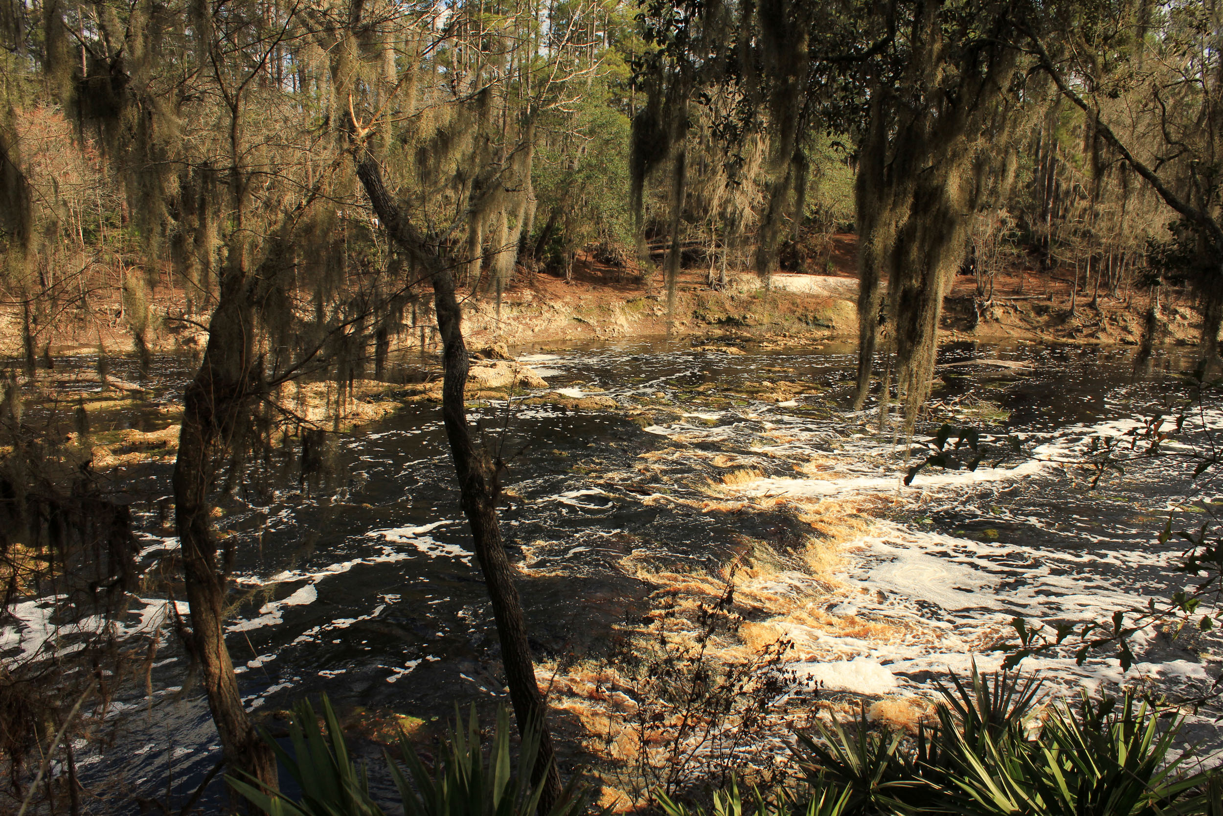
Character: A gentle stream meandering through America's Dairyland changes character after passing under the interstate. As the riverbed turns to bedrock, a falls (three quick ledges) and sloping bedrock make a busy half-mile.
Drainage area (at confluence with Neshota/West Twin): 36.3 square miles
Put-in is approximately 721' elevation.
Confluence (Devils/Neshota) is approximately 647' elevation.
Take-out is approximately 619' elevation.
Thus total elevation change is approximately 102'.
Gradient for just Devils River is approximately 46 FPM. The 'action' is **50' of drop in a half-mile, for an *effective gradient* of 100 FPM.
Gradient for the included portion of the run on Neshota/West Twin River is approximately 14 FPM.
Nearby ('companion') runs (with drainages, for comparison): Bower Creek (14.8 sq.mi.), Baird Creek (15.7 sq.mi.), School Creek (15 sq.mi.), Neshota/West Twin (43 sq.mi.).
(Since these are all small drainages and relatively similar size/nature, they are likely to all run at same time. Also, since they all short runs, it is very possible to do a 'daily double', triple, or quad!)
General Overview**
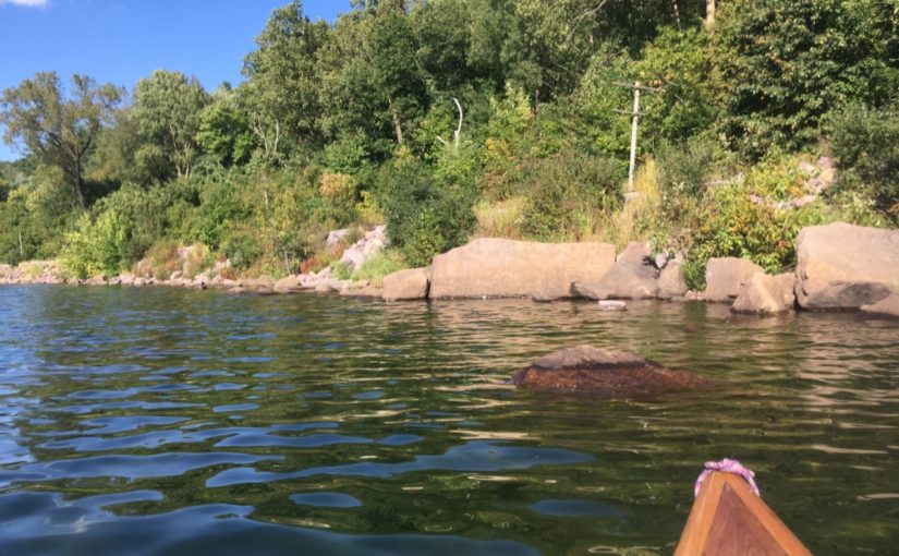
The 1-mile access paddle for this reach consists of flat but flowing water, with occasional riffles and rips. One should expect numerous snags which will require threading over, under, through, or around. After passing under Interstate 43 (and leaving the worst of the snags behind) you will see a trailer-campground river-right.
(I've never checked nor tried, but if you can find the proprietors at home, you *may* be able to gain access from the campground, thereby eliminating the access paddle. However, recently I have heard second-/third-hand info suggesting they are not boater-friendly, and are likely to protest your presence (due to liability and other concerns) to scout or portage. Thus, we generally urge keeping as low-profile a presence as possible when scouting/portaging this area -- do not linger! I have never had a problem (never been confronted) here, but, then, I have never attempted to boat this during summer, when campground is likely to be full and active.)
Gradient increases slightly to provide a tame rock-garden rapids, leading to a pool and a sharp left-hand turn. You will hear the falls downstream. Proceed cautiously, taking out on river-right before you come close to the horizon-line. The broken walls of a long-gone dam signal a drop which will catch any Midwest boater's attention. A couple ledges in quick succession (of approximately two feet height each) land on shallow bedrock. At high water, this will be a steep flume, dropping into a dynamic surging hole. A brief flowing pool leads to another short ledge which (at higher levels) will form a potentially sticky hole.
Immediately downstream, overhanging trees and shrubs add to the potential hazard as one begins the next 0.5 mile of mixed shallow sloping bedrock rapids and rubble field rapids, some of which could offer some play (were it not for the fact that water quality is generally terrible due to the multitude of cattle farms in the watershed). After passing under CTH.R, a few more good waves, short ledges, and rubble field rapids lead to the confluence of the Devils River with Neshota River, where together they form the West Twin River.
DON'T HEAD DOWNSTREAM YET! Ferry across to the east (river-left) bank and carry upstream about a hundred yards here. (Be very careful while walking through the woods-- there is old barbed wire low to the ground in a number of spots here.) A sweet series of ledge/waves on the Neshota River lie just upstream of the confluence, and can provide some sweet 'bigger water' action (not 'big water', just 'bigger' water than on Devils). At good flows, a couple of these wave/holes can be VERY sticky.
Heading downstream, you will encounter little more than swiftwater and a few riffles and rips. It is possible to take out at Maribel Caves County Park, eliminating about 1.5 miles of mostly flat-but-flowing water. This, however, necessitates an arduous climb up stairs at the bluff to get to the parking area. Therefore it is generally preferable to continue downstream to the listed take-out on Hwy.147. Whichever take-out is used, I highly recommend a hike in the park to explore the bluffs and caves and view the stone-wall ruins of the Maribel Hotel.
Note: You may notice (on topo maps and other sources) some marked 'falls' on the stretch of the West Twin (and nearby East Twin). Without exception, these are really just low-grade rapids, much more tame than the action on the Devils River! Each of the 'Twins' could make very pleasant canoe trips, and have reaches which would be floatable during most of the year. At lower water, many shoals would require dragging over, but most of the length of these streams are deep pools with sufficient beauty to merit a float trip.
Boaters who are hoping for a run on Devils River, but find it running too low to bother (remember, we list a 'virtual' gauge, which will occasionally give 'false reads' of boatability) may choose to partially salvage their trip to this area by just doing the run on the Neshota/West Twin. While it is not likely to be running high (under conditions when Devils River is too low to bother with), it should be boatable, and will give access to the Devils Meet Ledges, which should at least offer reasonable play (again, when the virtual gauge is giving a 'false read' of boatability on Devils River). Of course, boaters who were hoping for a run on Devils River may be (more likely to be) looking for more significant action than they'll find on Neshota/West Twin.
Rapids in this Run (2)
Waterfalls (1)
Difficulty
Class II-III(IV)
Length
3.7 mi
Gradient
26 ft/mi
max 65
Rapids
2
Access Points
Shuttle Info
**IF** permission can be obtained to access from the campground, shuttle (and run) can be shortened.
Difficulty Classes
I Easy
II Novice
III Intermediate
IV Advanced
V Expert/Extreme
VI Unrunnable
Current Conditions
5-Day Forecast
Whitewater data from
American Whitewater
American Whitewater