Rio Powerhouse to Delaware River
Gauge Conditions
Data from American Whitewater & USGS
Run Map
Run Time Estimate
Select put-in and take-out to estimate time.
Plan This Trip
See wind-adjusted speed maps, forecast planning, and detailed time estimates.
Sign in to generate an AI timing estimate for this run.
Whitewater timing varies with scouting, portages, and group pace. Use as a planning baseline.
Description
This regional gem has regularly scheduled recreational releases, and frequent power releases from Rio Dam. For the release schedule, see Eagle Creek's Release Schedule.
Releases are 1 tube or barrel (about 500 cfs) and 2 tube (~1000 cfs). 1 tube requires more maneuvering but has less push making it easier for the less experienced. 2 covers a lot more of the rocks but gives holes and drops more power. According to an Eagle Creek employee, standard 2 tube policy is to start 1 tube at 10 a.m. and leave 1 tube running till 4 p.m.
As you'd expect with paddlers, opinions vary as to which is best or even easiest.
Unscheduled Releases
Power releases occur frequently on the Rio Reach.
As of June 2020, Eagle Creek, the dam operators, started posting a day or 2 ahead generation forecast at Rio on the Mongaup at https://www.eaglecreekre.com/facilities/operating-facilities/mongaup-river-hydroelectric-system/mongaup-river-system-lake-levels-and-rio-operation-forecast.
During extremely wet years all the upstream reseviors get filled and flows get much higher. Around 2k water starts to flow thru trees with force, greatly increasing the consequences of swims.
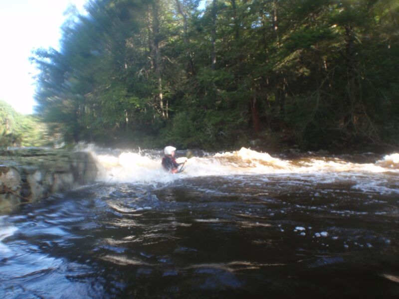
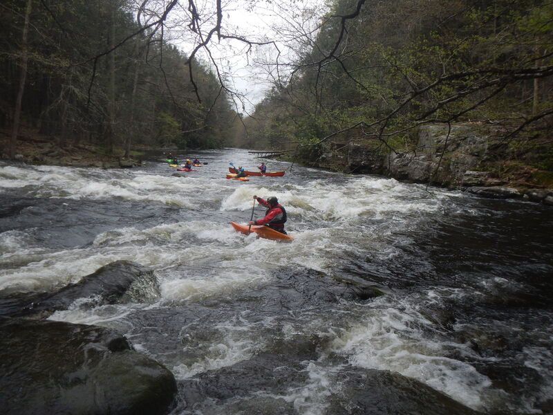
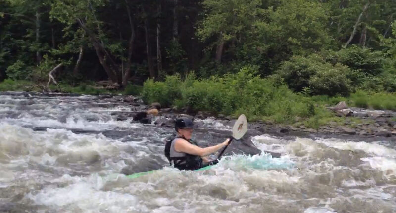
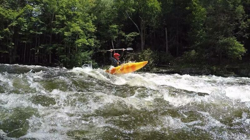
The only guidebook description is in Dennis Squires' 'New York Exposed: The Whitewater State, Volume 2,', which (on p 140) describes the rapids as 'pretty continuous class II and easy class III all the way down to the Delaware.' In general terms, while the gradient is fairly consistent on this reach, the rapids on the second half of the reach (below the lunch spot) are more sustained than on the upper portion. Save some energy for the rapids under the Route 97 bridge, which may be the most difficult on the river, and for the wave train at the confluence with the Delaware. Especially if the Delaware is high boat recovery after the wave train is a pain so think twice before letting beginners run it.
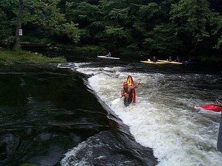
If you still have energy, the Mongaup Wave is a short distance down the Delaware on river right though it ain't what it used to be when enterprising locals might have been modifying the river bed.
There are several takeouts. The first one is on river right above the Route 97 Bridge, and avoids the Bridge Rapid and also avoids a significant carry as you can bring the car within 50 feet of the river. There is a good takeout along the Delaware above the confluence. To reach it, eddy out right at the confluence and head up the left (your right as you face upstream) bank of the Delaware. The takeout is a short distance up on your right. A path leads to the DEC Parking Lot. The takeout for the Mongaup Wave is a sandy beach on the left bank of the Delaware, visible from the wave.
This is not a beginner's run. First-time Mongaup paddlers would be well advised to hook up with friends who've done it before, or make contact with experienced local paddlers on the Lehigh Valley Canoe Club Forum or KCCNY both of which run trips for most releases.
Note that since 9/11, when the Homeland Security Threat Level is orange or red, the gate to the powerhouse/whitewater recreational facility will be locked. Boaters are permitted to carry down to the put-in, but at present there is no parking near the gate. According to Mirant, the previous licensee, 'When the threat level is raised to 'Orange' or 'Red,' the gate will be closed to vehicular access although access via foot is permitted.'
The Neighbors
Paddlers should remember that the speed limit on the dirt access road to the put-in is 10 MPH! We urge everyone to obey that limit and to respect the neighbors. We are only there a couple of days a month but they live there. Please show them respect and encourage others to do the same.
Upper Section
Above the powerhouse is about a mile of free flowing river. As part of the relicensing of the Rio Dam on the Mongaup, Eagle Creek released an additional 125 cfs (in addition to the 100 cfs min flow) below the dam on October 27th. The study was to tell us whether the bypassed reach is boatable at 250 cfs (the amount they can release with existing equipment). And we determined that though runnable it was too low to be much fun. Significant wood, general class 2 gradient. (As of April 2022 upper was completely clear).
If they ever get more water in this reach it would be nice if the Mongaup was a bit longer, but until then this stretch is only likely to run when the whole the east coast is flooding and you'll have little challenge then finding better rivers.
The Eagles
In order to protect Bald Eagle nesting habitat, kayaking and other activities on the Mongaup are illegal during the winter season. New York State Law prohibits 'entering onto the surface of the water or ice on the Mongaup River... or entering the upland surrounding those waters as designated by posted signs from December 1 through March 31'. Violation carries a $5,000 fine, and will endanger all boating on the river.
( https://www.dec.ny.gov/outdoor/68639.html).
Some phone numbers and web addresses:
Eagle Creek Renewable Energy
Eagle Creek Renewable Energy Phone: (855) 313-ECRE (call to check the status of releases, you may get an actual person).
Delaware River Basin Commission (DRBC)1-609-883-9500.
Google Map of New York Whitewater
New York Whitewater Paddlers Facebook Group
Rapids in this Run (6)
Playspots (2)
Difficulty
Class II+(III)
Length
3.0 mi
Gradient
53 ft/mi
max 60
Rapids
6
Access Points
Shuttle Info
Preferred parking is either the DEC Parkling Lot, on the left after the river, or the old takeout lot, on the right a short distance up Upper Mongaup Road. The lot just before the river on the right is a good place to meet up with boaters, check out the Bridge Rapid, or rack your boat if you're coming from the wave, but please try not to park there. It is only designed for 10 cars, and is supposed to be for fishermen. Do not park along Route 97. Please be careful crossing Route 97, as traffic moves very fast in the area.
There are only about a dozen spaces at the put-in, so use your judgement. The preferred option is to meet at the DEC Lot on Route 97, shuttle to the put-in, and then for the drivers there to arrange subsequent shuttles to reduce the number of vehicles in the put-in lot. REMEMBER: If you leave your vehicle at the put-in, you'll only have to find a way back up to get it at the end of the run.
DIRECTIONS: I'm still trying to master the mapping thing, but these narrative directions will get you to the put in. The present map directions will not.
Starting at the intersection of Route 97 and Route 31, just west of where the river crosses Route 97, head north on Route 31, also known as Upper Mongaup Road. You'll be heading uphill for about 2 miles.
Turn Right onto KNIGHT RD. Go a little more than 0.2 miles, and take your first right onto RIO DAM RD. It will sneak up on you if you're not paying attention, and sometimes the street sign is missing.
On RIO DAM RD, go about 0.3 Miles. There will be an intersection right where the road begins to go up a hill. There is a paved road to the right. Slow down and bear slightly right onto a dirt road. There will be a power company sign and a gate.
The dirt road is known as POWERHOUSE RD. The speed limit on this road is 10 MPH. The road is very narrow and people live along it. Local paddling groups have worked with the neighbors here on traffic issues and have arrived at an understanding. DO NOT EXCEED 10 MPH ON POWERHOUSE ROAD! This applies before, during, and after releases. Doing so will endanger access. Enough said.
POWERHOUSE RD. goes downhill and curves to the right. After the second gate, keep to the right. The put in parking is past the powerhouse.
Difficulty Classes
I Easy
II Novice
III Intermediate
IV Advanced
V Expert/Extreme
VI Unrunnable
Current Conditions
5-Day Forecast
Whitewater data from
American Whitewater
American Whitewater