Rooks Rd. to Bee Rock (6 miles)
Linked via: Nhdplus discovery 90% confidence Synced 6mo ago
Gauge Conditions
Runnable: 400.0 – 2,000.0 CFS
Likely too low (under 150 cfs.). (Must be confirmed by visual inspection.)
Runnable: 3,000.0 – 20,000.0 CFS
Data from American Whitewater & USGS
Run Map
Description
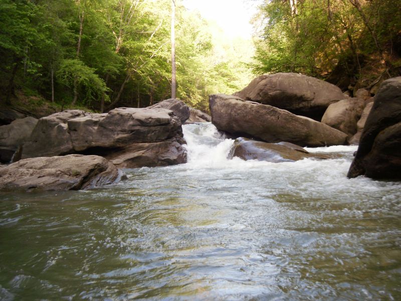
Cane Creek flows through the Cane Creek Wildlife Management Area as it makes it's way into the Rockcastle River one mile above Bee Rock in Laurel County. The 20 mi. sq. drainage area is largely undisturbed, the scenery is top-notch and the water quality seems to be thoroughly decent. The first three miles average about 25 fpm, with the last two miles averaging 60 fpm and containing all the good rapids. The final mile out on the Rockcastle is mostly flat, but has the potential to be big water. The rapids are pool / drop with undercuts and some sieves. Most of the rapids are in the class III spectrum with two or three class IVs. The streambed is tight, the eddies can be small, and wood is always a concern. Autofeed and Go Right both have notable hazards to be aware of.
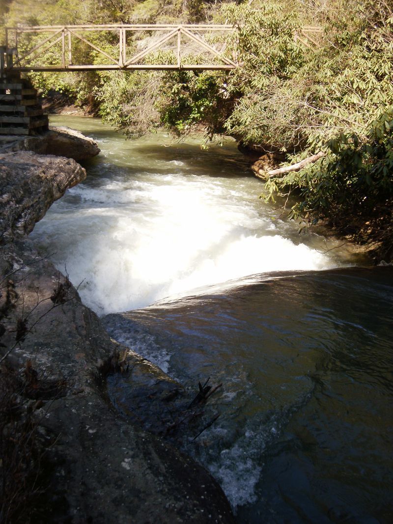
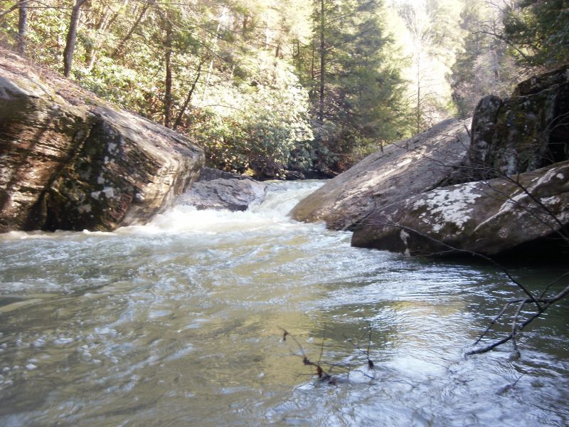
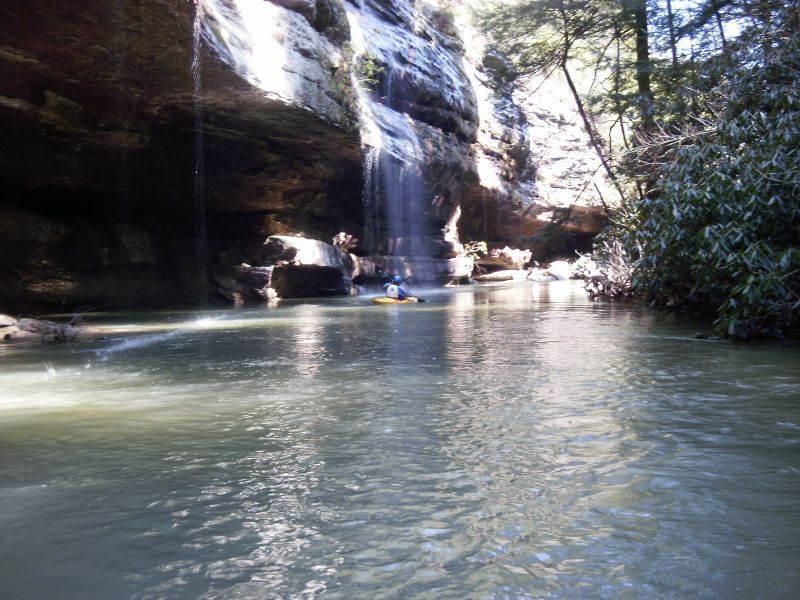
The beginning section winds through old growth hemlocks in a sandstone micro-canyon. Frequently, waterfalls cascade off landing directly in the creek. Be on the lookout for a footbridge over the creek. This is where the Sheltowee Trace hiking trail crosses and it signifies the beginning of the goods. Over the next mile several class III rapids work through a series of increasing sized boulders. This set finishes with a three part rapid to the right of a house sized block and then a brief interlude before the crux series.
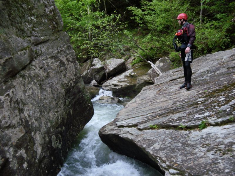
Autofeed is up next and is kind of hard to scout and has a notable pinning hazard on the left in the final drop. Eddy hop down the right over a few ledges toward a giant boulder with a sieve in front of it, then drive to the center eddy where you can ferry over to the left to scout the final drop. Here the creek pours into a box-type drop of about 4’ with most of the flow pushing into an ugly looking undercut on the left. Drive left to right with a good boof stroke at the lip to carry you away from the junk.
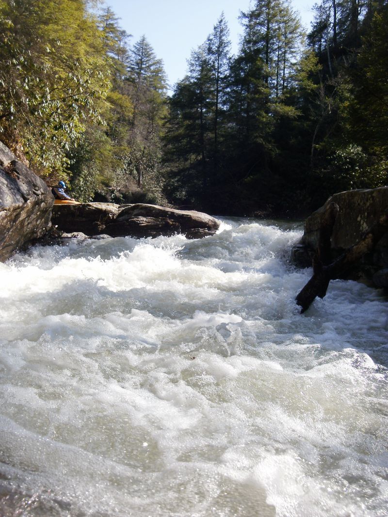
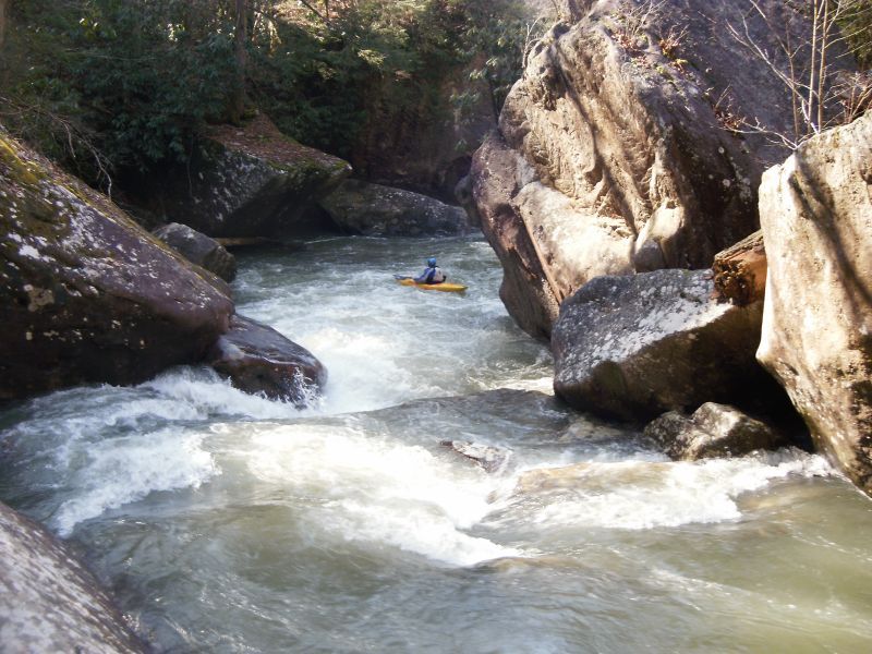
The next rapid, Go Right, comes up quickly and has a large sieve / tunnel on the left taking most of the flow. Be sure to go right of the large boulder in the middle of the creek. This one is not that hard as long as you know where you are.
When the Rockcastle is below about 6,000 cfs Cane Creek will have one more notable rapid that drops about 10 feet and is a lot of fun. After the confluence with the Rockcastle, the take out is about a mile downstream on river left at the boat ramp.
Directions:
To reach the take out at Bee Rock from I-75 take KY exit #38 and follow 192 West 18 miles to the Rockcastle River. Veer right on to the Bee Rock campground access road before going over the bridge. Follow the access road to the parking area and trailhead at the boat ramp.
Directions to the put in: If you are coming from Bee Rock, turn left (East) on 192 and go 8.2 miles, turn left on Rooks Rd. and drive 2.4 miles to the creek. If you are coming from the interstate, follow 192 West for 9.8 miles and turn right on Rooks Rd. Parking is limited so try to carpool and leave as many vehicles as you can at the boat ramp.
Rapids in this Run (4)
Waterfalls (1)
Hazards & Portages (2)
Caution: The following locations may require scouting or portaging. Always check current conditions.
Difficulty
Class IV
Length
6.2 mi
Gradient
40 ft/mi
max 60
Rapids
4
2 Hazards
Access Points
Difficulty Classes
I Easy
II Novice
III Intermediate
IV Advanced
V Expert/Extreme
VI Unrunnable
Current Conditions
5-Day Forecast
Whitewater data from
American Whitewater
American Whitewater