Route 259 to Saylor Park in Blacklick
Gauge Conditions
Runnable: 420.0 – 2,500.0 CFS
Data from American Whitewater & USGS
Run Map
Run Time Estimate
Select put-in and take-out to estimate time.
Plan This Trip
See wind-adjusted speed maps, forecast planning, and detailed time estimates.
Sign in to generate an AI timing estimate for this run.
Whitewater timing varies with scouting, portages, and group pace. Use as a planning baseline.
Description
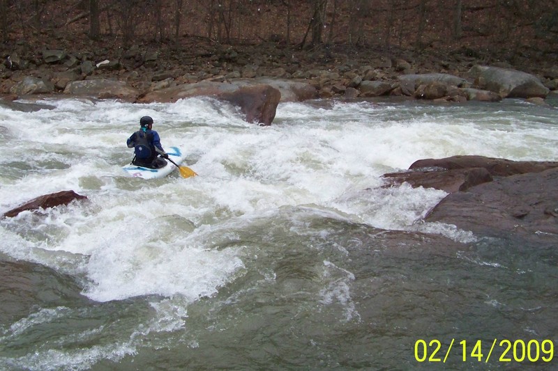
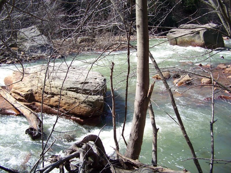
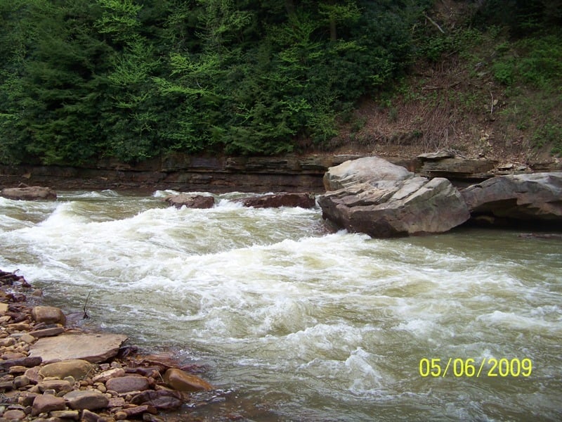
Blacklick Creek is located in southern Indiana County, Pennsylvania.It has been overlooked for years by many paddlers because of its bad reputation for acid polution and a devastated landscape, both the result of a coal mining past. Today, the Blacklick is a river in recovery. It has a way to go yet, but the upstream acid mine drainage has been significatly reduced . The conversion of the railroad bed to the Ghost Town multi-use trail included some clean up of the banks and hill sides. Trees have grown back and hide much of what remains of the boney piles and discarded mine equipment. The over-all impression the paddler now gets is one of beauty, mared only in spots. The white-water starts about a hundred yards above the Rt. 259 bridge in Heshbon. Put in from the Ghost Town Trail upstream of the bridge on the northern side. It is permissible to drive up to the gate to unload boats and equipment. Parking is back at the gravel lot by the road. The put-in is just beyond the gate on the right by a large rusting cable winch. You may also put-in on the down stream side of the North end of the bridge, but this is difficult and you miss some rapids. This section starts with the Heshbon Rapid, about 3/4 of a mile of ledges and boulder gardens that lead into Auld's Run Rapid (IV-). On your right you will pass Auld's Run, a small tributary. It is bright orange. Auld's Run Rapid is just below. Work your way over to the right and eddy out on the right just above the drop. You can scout the rapid from here(by boat or bank). The line is a diagonal one from right to left. You need to enter the rapid high from the top of the eddy, and get all the way over to the left near the leaning boulder to hit the clean line. The river maintains a busy class II-III pace for the next two and a half miles. With one last good class III just past the half way point called Diagonal Ledges. After this drop there are still a bunch of small ledges that provide good surfing opportunities. As the rapids and the scenery decline you are coming into the town of Blacklick. The take-out is at Saylor Park in Blacklick on river left (Josephine is on river right). Take out above or below Old Indiana rd. This is the first road bridge encountered below Heshbon. Above the bridge is a shorter portage to the parking lot, but the bank is steep. Below is a better place to beach but a longer walk.
Difficulty
Class II-III(IV)
Length
6.8 mi
Gradient
43 ft/mi
max 66
Rapids
0
Access Points
Shuttle Info
If you start your shuttle by dropping a vehicle at Saylor Park in the town of Blacklick go across the bridge from the park into Josephine, and then on out to rt.119. Turn right or North on rt.119 for about one mile to the first stop light at Coral and make a right onto the Luciusboro road (2019). After going about three miles turn right on to Auld's Run road (2014) This road is marked by a sign indicating the way to Bolivar. After a couple of miles on this road turn right when it hits rt. 259. Follow rt. 259 South to the put-in at Heshbon. Park on the left just after you cross the Ghost Town Trail and before the bridge. You may drive up to the vehicle gate on the trail to unload boats and equipment and then park back at the small lot by the road. This shuttle route is on lovely back roads across beautiful Pennsylvannia countryside. The alternate way to go, rt. 119 to rt. 22 to rt. 259 is viable now that the widening project is more or less done. If you are using the new rt. 119 Fish Commission access as a take out you can't get on South bound rt. 119 so...... rt. 22 is still a little problematic.
Difficulty Classes
I Easy
II Novice
III Intermediate
IV Advanced
V Expert/Extreme
VI Unrunnable
Current Conditions
5-Day Forecast
Whitewater data from
American Whitewater
American Whitewater