S.20th Street to S.5th Court (1.8 miles) *Access&Quality Issues*
Gauge Conditions
Runnable: 200.0 – 1,200.0 CFS
Too low for any reasonable whitewater.
Data from American Whitewater & USGS
Run Map
Run Time Estimate
Select put-in and take-out to estimate time.
Plan This Trip
See wind-adjusted speed maps, forecast planning, and detailed time estimates.
Sign in to generate an AI timing estimate for this run.
Whitewater timing varies with scouting, portages, and group pace. Use as a planning baseline.
Description
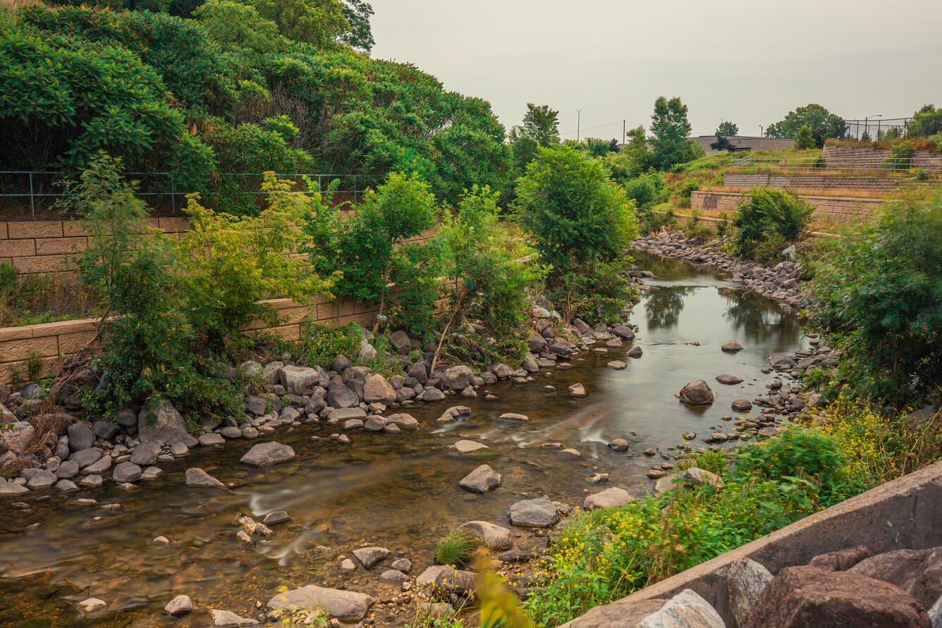
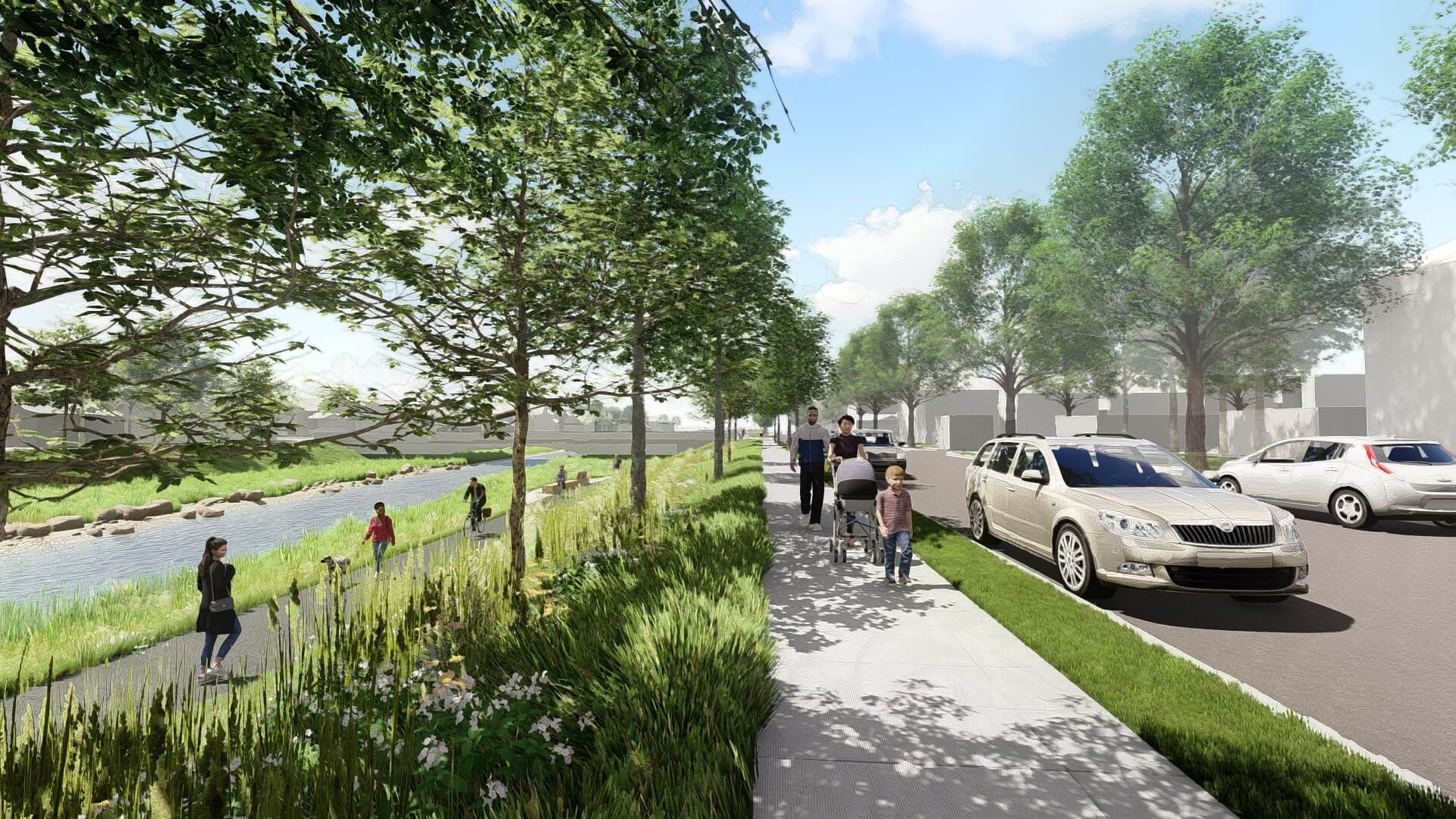
MMSD (Milwaukee Metropolitan Sewerage District) will be spending tens of millions of dollars, removing concrete, widening to re-create a floodplain, and meandering the channel (where possible) to alleviate flooding and improve fish and wildlife habitat.
From Cleveland Avenue to 16th Street (through Pulaski Park) was completed early 2020.Similar work is planned downstream, from 16th Street to 6th Street, which will eliminate two of the three 'jumps' detailed below. The timeframe for that phase has not been announced (as of 2023) but will keep our eyes and ears open to update this once this moves forward.
Click the following video link in which MMSD officials speak regarding plans for the lower stretch of this river. At 0:54 and 1:48 views (briefly) of the cement-ditch/river at high-water are shown.
https://youtu.be/bkqH\_tlDuMo
=======================================================================================================================================
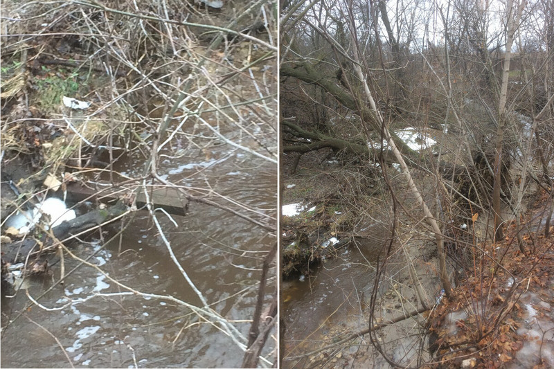
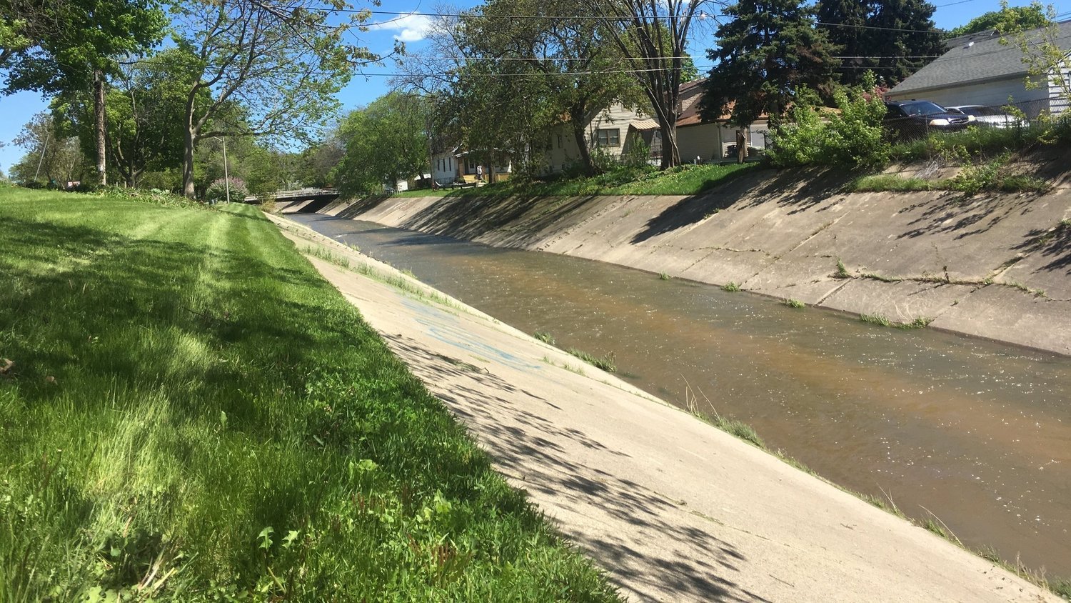
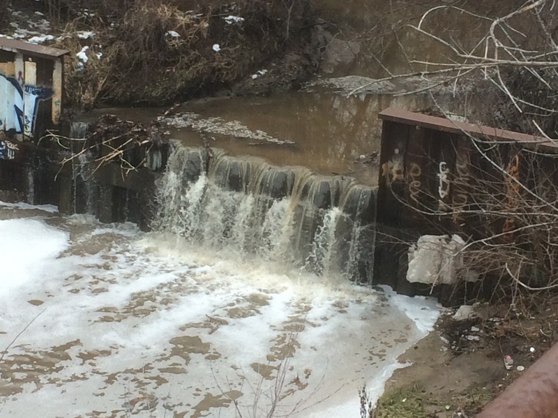
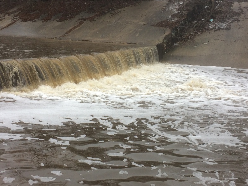
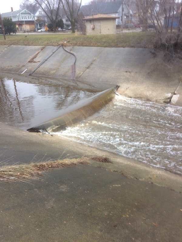
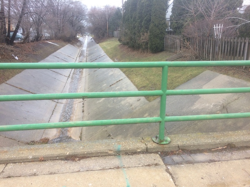
This description is being included to DISSUADE anyone from thinking they have discovered some unknown or unrun bit of whitewater. Much of this river has been altered (straightened, smooth-curved, and cemented) for the convenience of mankind, allowing roads and subdivisions to be laid out less hampered by the randomness of nature. At a few locations, 'hydraulic jumps' (cement ledge/drops) exist. With good flow, these may look like interesting whitewater, however, they will form wicked hydraulics at some flows!
You need to scout every drop prior to putting in (I.E., while you are setting shuttle). Once on the water, getting out to scout or portage may be difficult because there are virtually no eddies in this uniform cement ditch! Even more problematic, _flow changes extremely quickly during and immediately after rains, making it impossible to know precisely what conditions would prevail by the time you would set shuttle and arrive at each 'hydraulic jump' in your boat._
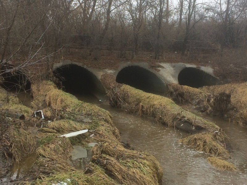
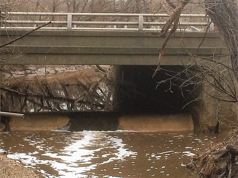
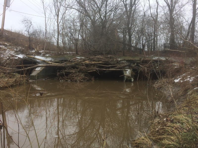
_Upstream of our 'theoretical put-in'_, virtually all areas of the river which are not straightened and cemented have heavily wooded shores, subject to major deadfall, blocking safe passage. In one area, the river passes through a box culvert ~295' (nearly one football field) in length. At another location, it passes through four large, oval, corrugated steel culverts ~656' in length (more than two football fields, about 1/8th mile). This one also has a bit of a bend in it, so besides being pitch dark, you will not see the light at the end of the tunnel until you are a fair way down it. (Strong water-resistant flashlight or headlamp would be a must!)
Side-slopes of the concrete sections are almost all quite steep, making it exceedingly difficult to exit the river, and nearly impossible to recover gear until slackwaters at or beyond our listed take-out!
Our recommendation is to drive and hike, look at the various locations and hypothesize runs . . . or better yet, don't bother! If there's enough water in the area to make this look interesting, there is enough water to have more fun in some safer, more scenic, and more playable river.
Rapids in this Run (11)
 Rapid
Rapid
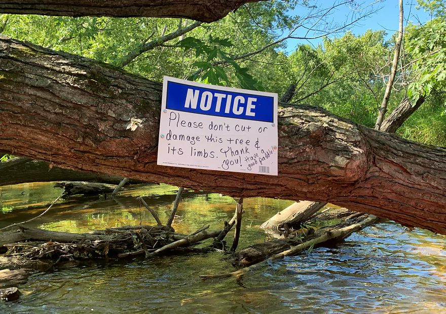
NOTICE!
 Rapid
Rapid
Exit from ~295' box culvert
 Rapid
Rapid
Parking
 Rapid
Rapid
Exit Quad-culvert
 Rapid
Rapid
Side-stream cascade (park pond outflow)
 Rapid
Rapid
Confluence: Wilson Creek (Combined drainage becomes 17.4 sq.mi.)
 Rapid
Rapid
2920 S.20th St
 Rapid
Rapid
Pulaski Park "Remediation"
 Rapid
Rapid
16th Street Cement Ditch
 Rapid
Rapid
6th Street
 Rapid
Rapid
Takeout
Waterfalls (4)
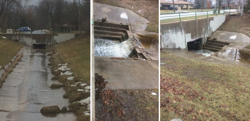
Hazards & Portages (5)
Caution: The following locations may require scouting or portaging. Always check current conditions.
Difficulty
Class II+(IV)
Length
1.7 mi
Rapids
11
5 Hazards
Access Points
Difficulty Classes
I Easy
II Novice
III Intermediate
IV Advanced
V Expert/Extreme
VI Unrunnable
Current Conditions
5-Day Forecast
Whitewater data from
American Whitewater
American Whitewater