Sam Anderson Road to CTH.U (0.33-6 miles)
Gauge Conditions
Runnable: 9.0 – 16.0 FT
Probably too low. (Likely less than 150 cfs.) We could use your input! Leave a comment or report!
Data from American Whitewater & USGS
Run Map
Run Time Estimate
Select put-in and take-out to estimate time.
Plan This Trip
See wind-adjusted speed maps, forecast planning, and detailed time estimates.
Sign in to generate an AI timing estimate for this run.
Whitewater timing varies with scouting, portages, and group pace. Use as a planning baseline.
Description
Approximate Mile-by-mile gradient: 33, 27, 50, 144, 38, 31 Approx.Ave.Gradient: 52 FPM, Approx.Max.Gradient: 140 FPM
The Amnicon is a beautiful stretch of river with features which will be interesting to intermediate as well as the advanced paddlers. We'll note up front that the flow ranges are likely quite different for the full run we list versus optimum flows for the sequence of falls within the state park. Moreover, those who are 'vertically addicted' may just do a park-and-huck of the sequence in Amnicon Falls State Park.
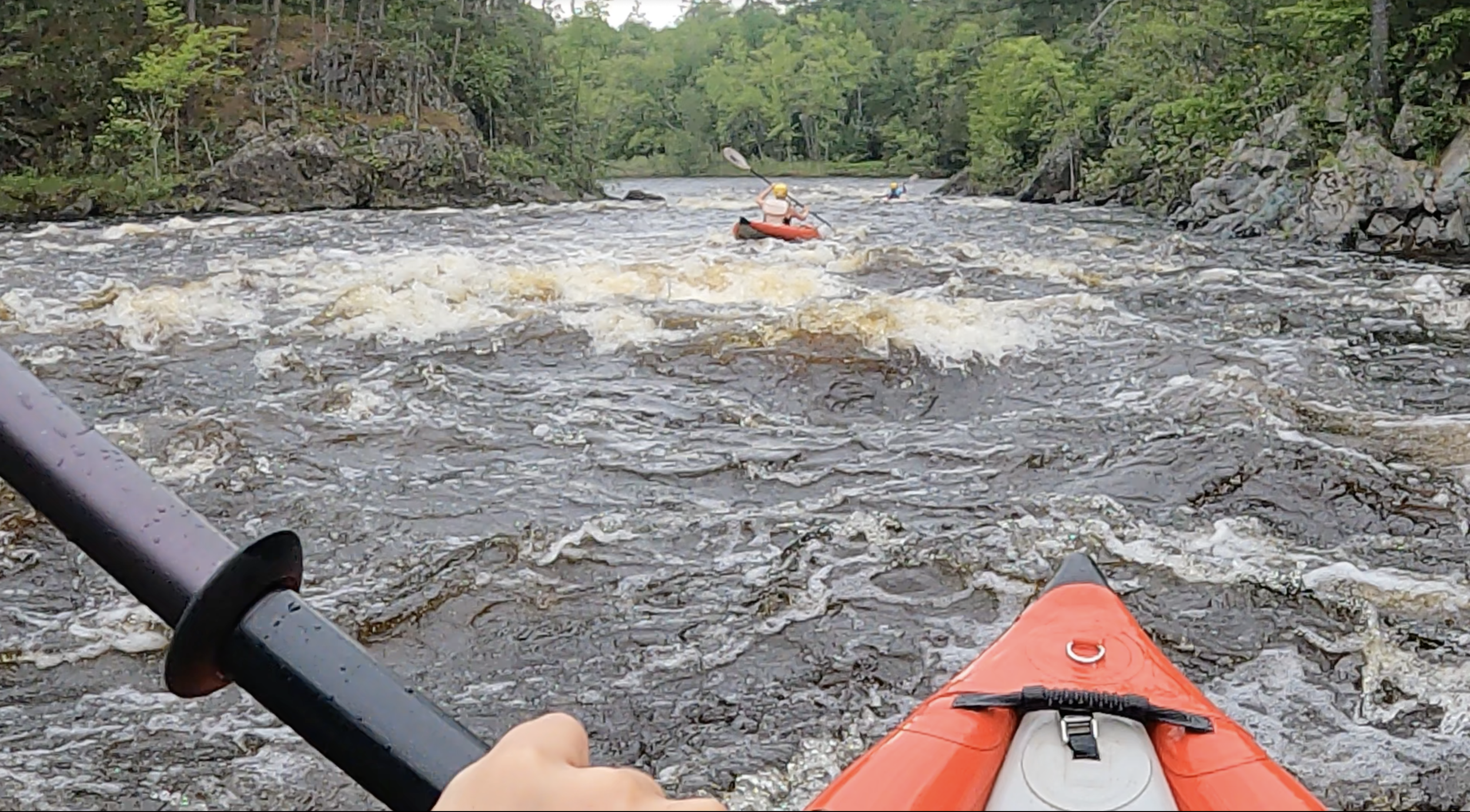
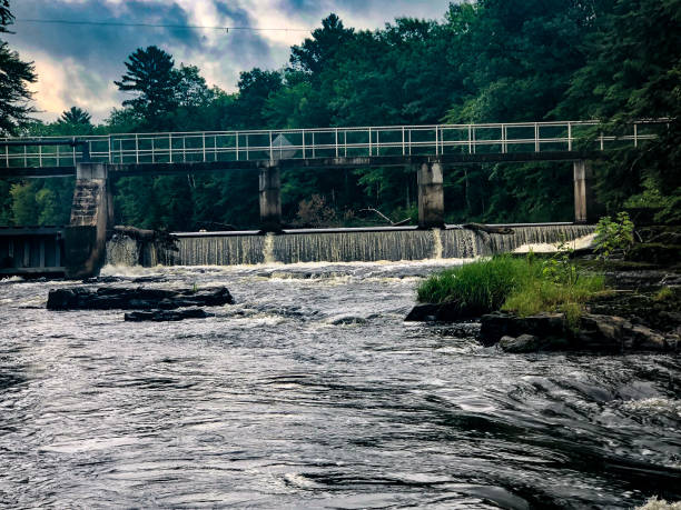
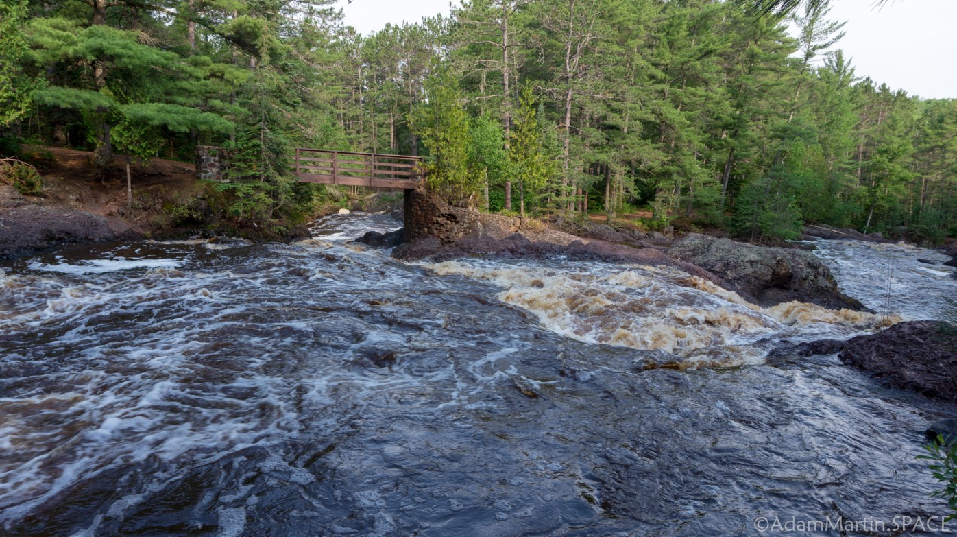
Put-in is possible from the Hwy 53 bridge, though (as listed here) we prefer a less-busy access ~1.7 miles upstream, at the start of the gradient. The early portions of the run will consist of class II-ish rockbed rapids with one larger drop (class III) about midway between Hwy.53 and Hwy.2. The pace picks up below the Hwy 2 bridge as the river enters Amnicon Falls State Park. Intermediate paddlers and those unfamiliar with the reach should get out to scout upon reaching the road bridge in the park. There are several hundred yards of class III-III+ before the falls sequence proper. A mistake here could quickly turn epic (not to mention dangerous).
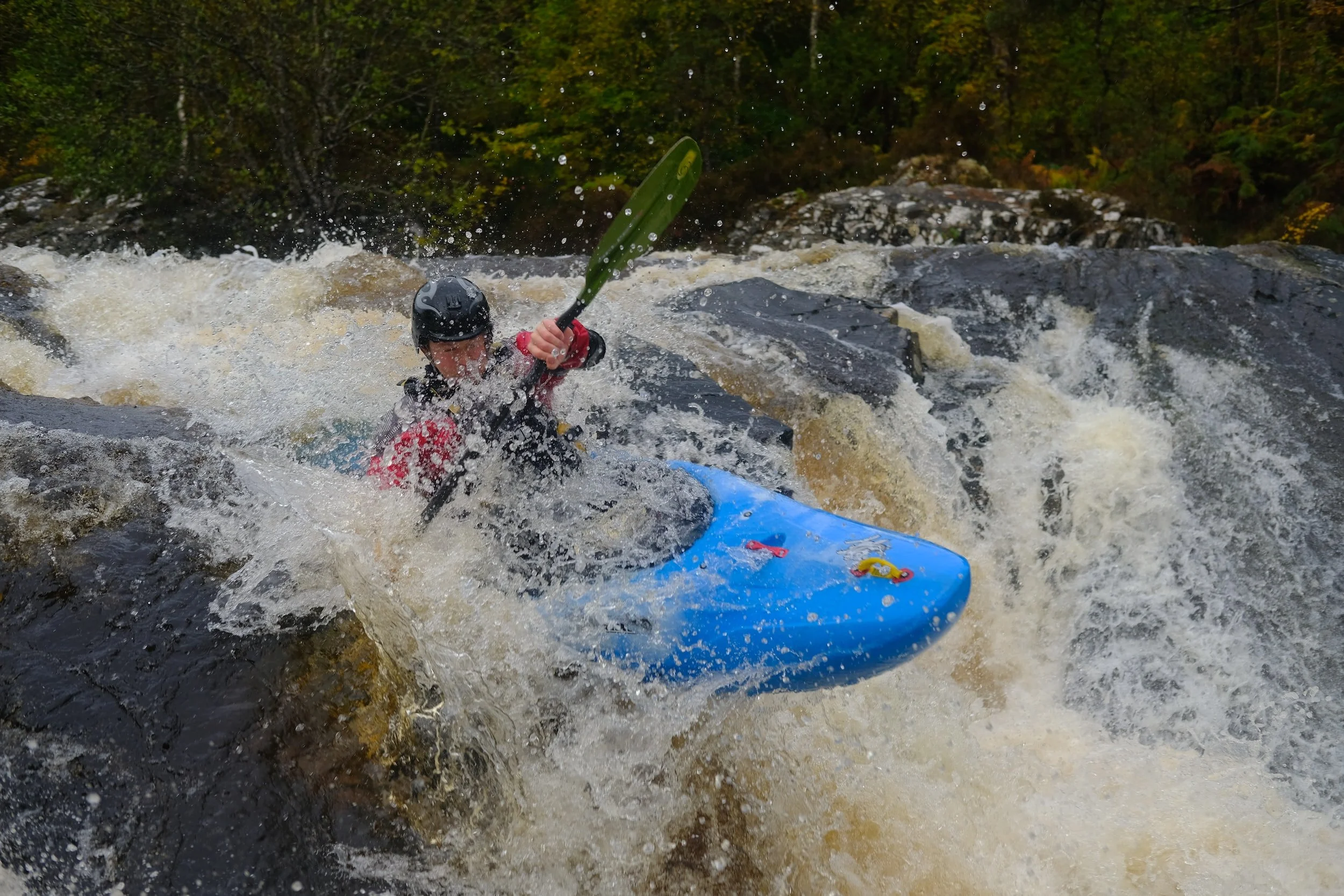
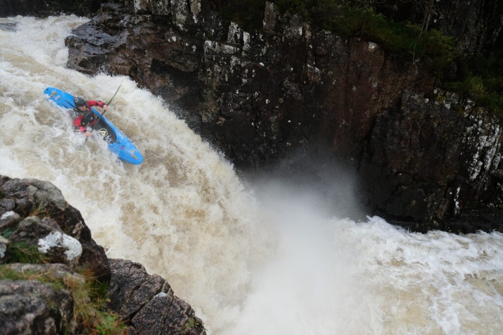
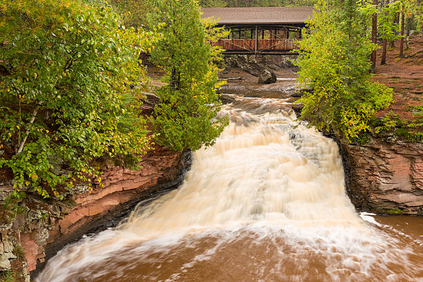
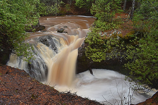
A footbridge and split channel mark the beginning of the falls sequence. Take-out above the footbridge to scout. The right channel carries the most water and is most commonly run. Below the bridge a steep drop of ~15' may generate an aggressive hydraulic at its base. A short distance downstream, the river twists and drops off a second falls of about 15'.
Note: there are splines of rock in the pool below, running parallel to the face of the drop and fairly close in. (These were no doubt formed as the falls, over time, has receded upstream, apparently in uneven 'chucks'. The resultant bottom contour is like the corrugated layer of a corrugated cardboard box.) These shallow splines generally preclude runs of this drop at low-to-moderate flows. You must be justifiably confident you can 'boof' the drop. Failure to do so will result in boat and/or bodily damage!
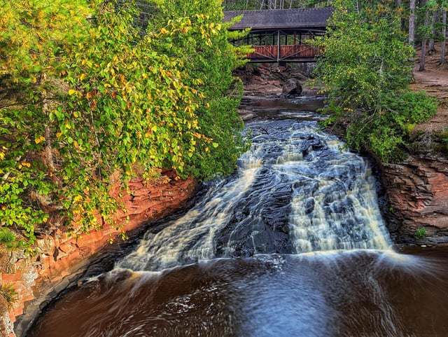
The third falls is a highly scenic photo op. After passing under the Horton covered bridge, the river drops over a medium-angle slide of perhaps 8'-10'. Watch the hydraulic here at elevated flows, though there's a big pool below for recovery if necessary. Below this point, the Amnicon resumes a pace very similar to that of above the falls sequence. The gradient gradually lessens until the CTH.U bridge is encountered.
There is actually more than one falls sequence in the park, as the river divides at the footbridge which marks the start of the serious gradient. The secondary (left) channel passes through a sequence of drops known as the "Snake Pit", which has been run with elevated flows. There is also a third channel that is not commonly viewed because of its location behind the pit toilets.
Through the years there had been confrontations from Park Rangers with boaters at Amnicon Falls State Park, including threats of fines up to $250 for running the falls and putting in/taking out in the park. In January of 2017, DNR officer Kevin Feind (the head official for Amnicon and Pattison State Parks) was contacted by an American Whitewater member and he confirmed that no one has the authority to fine a boater for kayaking the falls in Amnicon State park. He did stress his concern for the safety of boaters and the possibility of a boater hitting a swimmer below when coming off the falls. That being said, there likely won't be people swimming a the falls when the water is high enough to run them, but always keep in mind that it is a common swimming spot directly below some of the main waterfalls. Officer Kevin also made it known that a sign on the bridge that had read "No Kayaking Below Bridge" has been removed. Thus, boaters should no longer worry about getting fined for kayaking in Amnicon Falls State Park.
Rapids in this Run (10)
Difficulty
Class II-IV+
Length
5.8 mi
Gradient
52 ft/mi
max 140
Rapids
10
Access Points
Difficulty Classes
I Easy
II Novice
III Intermediate
IV Advanced
V Expert/Extreme
VI Unrunnable
Current Conditions
5-Day Forecast
Whitewater data from
American Whitewater
American Whitewater