Sand Hill Road to French Broad River
Gauge Conditions
Runnable: 2.7 – 5.0 FT
This is a new gage. At three feet I had a nice run and never scraped the bottom or hit any rocks. Please add runs at higher flows to comment section, as 5 feet
Data from American Whitewater & USGS
Run Map
Run Time Estimate
Select put-in and take-out to estimate time.
Plan This Trip
See wind-adjusted speed maps, forecast planning, and detailed time estimates.
Sign in to generate an AI timing estimate for this run.
Whitewater timing varies with scouting, portages, and group pace. Use as a planning baseline.
Description
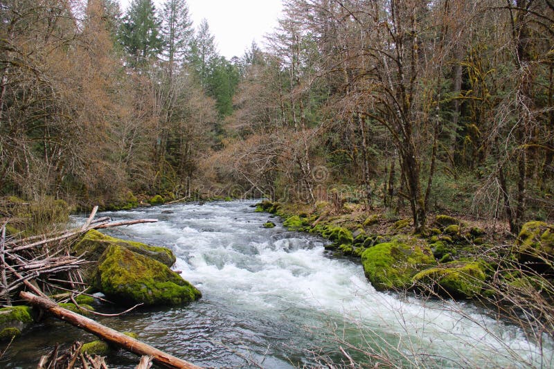
Hominy Creek is an overlooked urban river that winds through Asheville's malfunction junction, the intersection of interstates 26, 40, and 240. It passes under 12 bridges in the 7 miles between Sardis Road and it's confluence with the French Broad, but it's not all crumbling infrastructure and highway noise! Cattle graze the riverbank in unfenced pasture and (in places) mature forest thick with rhododendrons make you forget that you're touring the underbelly of southwest Asheville's light industrial zone.
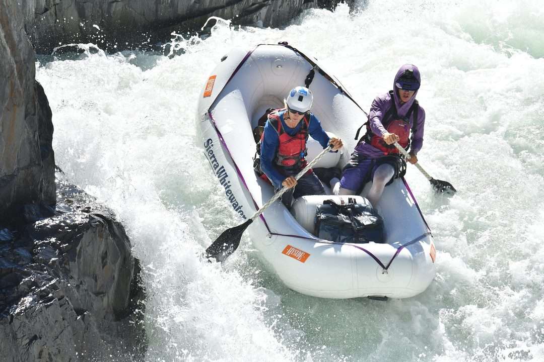
Hominy is a good run for a class II-III boater with a sense of adventure who is prepared to portage around a strainer or two, or a local boater looking for a low impact training run with a very easy 3 mile shuttle. The natural riverbed is deep and sandy, with some rapids the result of natural geography, but most are formed by the artificial constrictions of the bridges. The rapids tend to form wave trains with good eddies and powerful eddy lines at the run out.
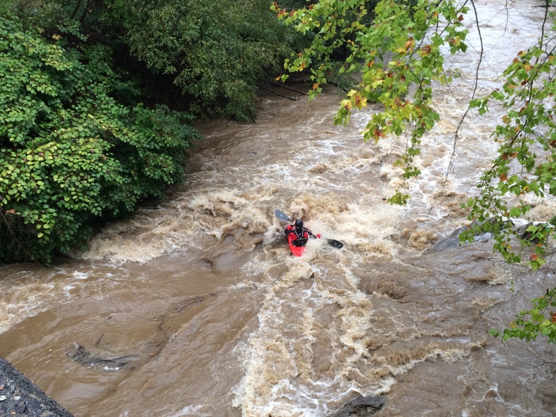
Free flowing Hominy Creek has a good sized water shed and runs often. The water quality is about what you'd expect from an agricultural, residential and mixed use watershed - bad. A 2021 flood may have moved some things around, so stay heads up.
Things to look out for:
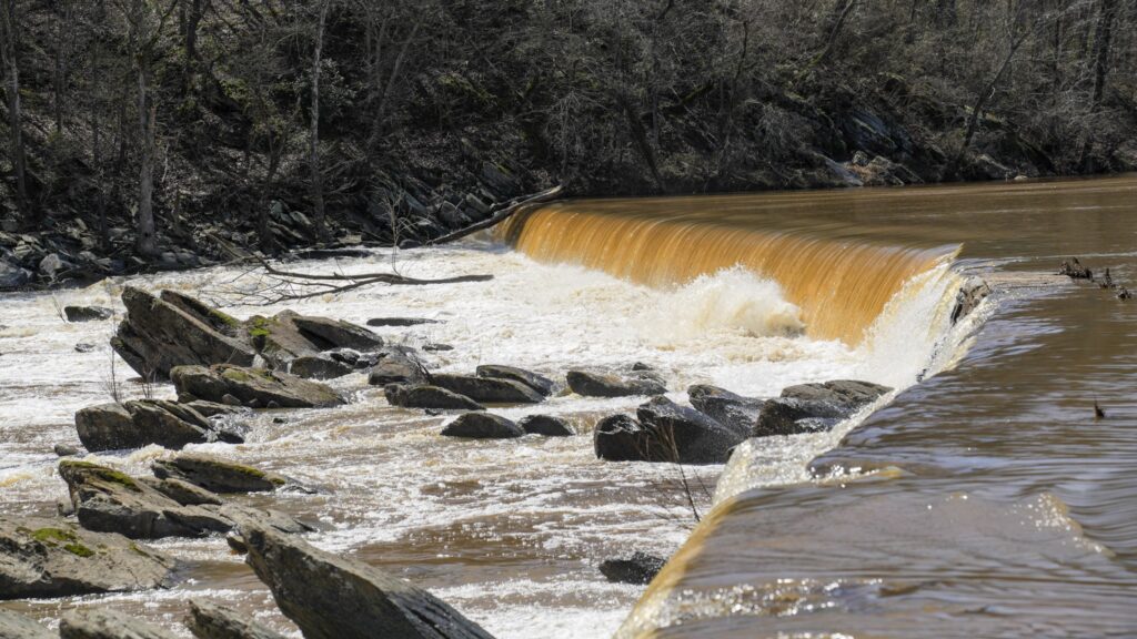
A sewer line follows the course of the river, in the first 3 miles it crosses the river 3 times. Half a mile down from the put-in you reach the first crossing. At high flows you can pass over the pipe, at low flow you can pass under only if you're willing to flip over, float under and roll up on the downstream side. At medium flows the pipe is right at river level becoming your first portage (recommended on river-right). The second sewer crossing you can float under at all but the highest flows. Be on the lookout for wood as the water moves fast here. The third crossing is only seen at lower flows when you can pass over the pipe. It forms a kind of play feature, but because it is a straight pipe forming a hole, there is no place that naturally releases your boat, so take care. Upstream of this section is a small dam and several sewer line crossings that require portage.
Rebar: At low flows in particular be wary of rebar and other metal debris poking out of the riverbed - not typically in rapids. In some cases this junk is covered in leaves so it might look like a rock or tree branch, but could be dangerous for boats and people.
Wood: Log jams and strainers come and go.
Rocks: Beware of sharp rocks that line the river banks at the bridges. These are not friendly Appalachian river rocks!
Rapids in this Run (3)
Hazards & Portages (1)
Caution: The following locations may require scouting or portaging. Always check current conditions.
Difficulty
Class II+
Length
6.8 mi
Gradient
20 ft/mi
Rapids
3
1 Hazard
Access Points
Shuttle Info
240 Brevard Rd. exit
Take out is at Hominy Creek Park at the end of Hominy Creek Rd. Paddle out to the French Broad and take out at the canoe launch, very civilized.
To reach the put in drive back up Hominy Creek Rd. take a left on Sherbourne.
\*If you are on a bike look for the Hominy Creek Greenway on your left, you can have a nice ride up the greenway and end up on Sand Hill Rd.
At the stop sign in about .5 mile take a hard left on Sand Hill Rd.
Follow Sand Hill for 2.2 miles to the put-in.
The put-in is a bridge over Hominy Creek, there is an unmaintained pull out on the far side of the bridge.
Difficulty Classes
I Easy
II Novice
III Intermediate
IV Advanced
V Expert/Extreme
VI Unrunnable
Current Conditions
5-Day Forecast
Whitewater data from
American Whitewater
American Whitewater